|
|
Sioux Falls Regional Airport
Joe Foss Field |
 |
| IATA: FSD – ICAO: KFSD – FAA LID: FSD |
| Summary |
| Airport type |
Public / Military |
| Serves |
Sioux Falls, South Dakota |
| Elevation AMSL |
1,429 ft / 436 m |
| Coordinates |
43°34′55″N 096°44′31″W / 43.58194°N 96.74194°W / 43.58194; -96.74194 |
| Runways |
| Direction |
Length |
Surface |
| ft |
m |
| 3/21 |
8,999 |
2,743 |
Concrete |
| 15/33 |
8,000 |
2,438 |
Concrete |
| 9/27 |
3,152 |
961 |
Concrete |
| Helipads |
| Number |
Length |
Surface |
| ft |
m |
| H1 |
50 |
15 |
Asphalt |
| Statistics (2008) |
| Aircraft operations |
86,107 |
| Based aircraft |
111 |
| Source: Federal Aviation Administration |
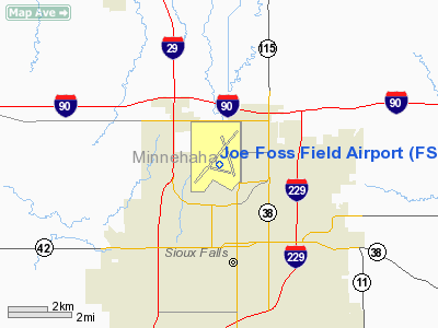
Runway layout at FSD Sioux Falls Regional Airport (IATA: FSD, ICAO: KFSD, FAA LID: FSD), also known as Joe Foss Field, is a joint civil and military use airport located three nautical miles (6 km) northwest of the central business district of Sioux Falls, a city in Minnehaha County, South Dakota, United States. Named in honor of aviator Joe Foss, it serves the greater Sioux Falls area, as well as communities throughout eastern South Dakota, southwestern Minnesota and northwestern Iowa.
Also located here is the Joe Foss Field Air National Guard Station, home to Headquarters, South Dakota Air National Guard and its 114th Fighter Wing (114 FW), an Air Combat Command gained unit known as the "Fighting Lobos" and operating F-16C/D aircraft.
Although the South Dakota Adjutant General is based in Camp Rapid in Rapid City, South Dakota, the South Dakota Air National Guard is effectively headquartered with the 114 FW.
FSD has public Wi-Fi available provided by Midcontinent Communications. History
Sioux Falls Regional Airport was originally the Sioux Falls Army Air Base constructed during World War II and closed permanently in the mid-1960s. The base was a logistical supply center and its grid of streets now make up a distinct industrial area in northwest Sioux Falls. The Air National Guard Base portion of the airport is located south and west of the commercial and general aviation areas, north of Russell Street, and has all the standard facilities of any small USAF installation except for family housing. The 114th's F-16C and F-16D aircraft are a frequent sight over the Sioux Falls area, conducting training flights and routine operations.
Facilities and aircraft
Joe Foss Field covers an area of 1,570 acres (635 ha) at an elevation of 1,429 feet (436 m) above mean sea level. It has three concrete paved runways 3/21 is 8,999 by 150 feet (2,743 x 46 m); 15/33 is 8,000 by 150 feet (2,438 x 46 m); 9/27 is 3,152 by 75 feet (961 x 23 m). It also one helipad designated H1 which is 50 by 50 feet (15 x 15 m) with an asphalt surface.
For the 12-month period ending December 31, 2008, the airport had 86,107 aircraft operations, an average of 235 per day: 54% general aviation, 31% air taxi, 10% scheduled commercial, and 5% military. At that time there were 111 aircraft based at this airport: 50% single-engine, 31% multi-engine, 4% jet and 16% military.
Airport renovation and expansion
Beginning in spring 2009, the Sioux Falls Regional Airport started expanding and remodeling the Costello Terminal. Tasks at hand included adding more windows, opening up more room in the check-in area, moving all TSA screening equipment behind the ticket counters, adding more electronic ticket kiosks, and expanding floor space on the entire main level. The estimated cost of the terminal renovation and expansion is approximately $7,000,000. The contract for this project was awarded in April 2009 to Hoogendorn Construction of Canton, South Dakota. Initially, a lawsuit was filed by several other local contractors that challenged the legitimacy of Hoogendorns' bid on the basis that the company did not have enough experience to undertake the project. In early July 2009, a judge dismissed the lawsuit against the airport authority allowing Hoogendorn Construction to begin work immediately. Groundbreaking took place in late July 2009 and the project is expected to take 18 months to complete. As of May 2010, the first phase of the terminal renovation was completed. The second phase of the renovation which will include a new gift shop should be completed by December 2010. The aging concourse is also undergoing a major renovation both inside and out with an estimated price tag of $5,500,000 that started in early July 2010. Among the improvements being made, two new jetbridges will be installed to help accommodate additional traffic, a new restaurant and lounge area are also being added, and new restrooms and waiting areas are being built to accommodate more travelers. The concourse renovations should be complete within 18 to 24 months. A runway repaving project was completed in mid-2009 and discussions are now underway to add a new cross-field taxiway and also to repair and repave the intersection where the two longest runways meet. The airport's parking operations will be updated beginning in late 2010-early 2011 at a cost of approximately $4,000,000; this will include repaving nearly all of the 3 parking lots, adding new parking spaces, and reconfiguring the entrances and exits to the parking lots.
Airlines and destinations
| Airlines |
Destinations |
| Allegiant Air |
Las Vegas, Los Angeles, Orlando-Sanford, Phoenix/Mesa |
| American Eagle |
Chicago-O'Hare, Dallas/Fort Worth |
| Delta Air Lines |
Minneapolis/St. Paul |
Delta Connection operated by
Atlantic Southeast Airlines |
Atlanta |
| Delta Connection operated by Comair |
Minneapolis/St. Paul |
| Delta Connection operated by Compass Airlines |
Minneapolis/St. Paul |
| Delta Connection operated by Mesaba Airlines |
Detroit, Minneapolis/St. Paul |
| Delta Connection operated by Pinnacle Airlines |
Detroit, Minneapolis/St. Paul |
| Delta Connection operated by SkyWest Airlines |
Minneapolis/St. Paul |
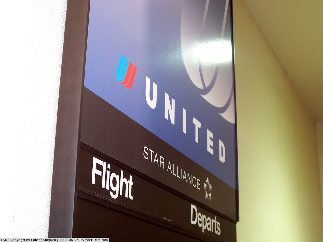
| United Airlines |
Denver |
| United Express operated by Express Jet |
Chicago-O'Hare |
| United Express operated by SkyWest Airlines |
Chicago-O'Hare, Denver |
Incidents
On December 20, 1983, Ozark Airlines Flight 650 struck a snow plow while landing killing the driver.
The above content comes from Wikipedia and is published under free licenses – click here to read more.
 |
(Click on the photo to enlarge) |
 |
(Click on the photo to enlarge) |
 |
(Click on the photo to enlarge) |
 |
(Click on the photo to enlarge) |
Location & QuickFacts
| FAA Information Effective: | 2008-09-25 |
| Airport Identifier: | FSD |
| Airport Status: | Operational |
| Longitude/Latitude: | 096-44-30.8890W/43-34-55.2480N
-96.741914/43.582013 (Estimated) |
| Elevation: | 1429 ft / 435.56 m (Surveyed) |
| Land: | 1570 acres |
| From nearest city: | 3 nautical miles NW of Sioux Falls, SD |
| Location: | Minnehaha County, SD |
| Magnetic Variation: | 05E (2000) |
Owner & Manager
| Ownership: | Publicly owned |
| Owner: | Sioux Falls Regnl Arpt Auth |
| Address: | 2801 Jaycee Lane
Sioux Falls, SD 57104 |
| Phone number: | 605-336-0762 |
| Manager: | Michael N Marnach |
| Address: | 2801 Jaycee Lane
Sioux Falls, SD 57104 |
| Phone number: | 605-336-0762 |
Airport Operations and Facilities
| Airport Use: | Open to public |
| Wind indicator: | Yes |
| Segmented Circle: | Yes |
| Control Tower: | Yes |
| Lighting Schedule: | DUSK-DAWN
HIRL RYS 03/21, 15/33, MIRL RY 09/27; MALSR RYS 03 & 21 PRESET ON LOW INTST 0000-0500. TO INCR INTST & ACTVT REIL RYS 15 & 33; MALSR RYS 03 & 21 - CTAF. FM 0000-0500 ACTVT HIRL RYS 03/21 & 15/33, MIRL RY 09/27 & REIL RYS 15 & 33; MALSR RYS 03 & 21- CTAF. VASI RY 21 & PAPI RYS 03; 15; 33 ON 24 HRS. |
| Beacon Color: | Clear-Green (lighted land airport) |
| Landing fee charge: | No |
| Sectional chart: | Omaha |
| Region: | AGL - Great Lakes |
| Boundary ARTCC: | ZMP - Minneapolis |
| Tie-in FSS: | HON - Huron |
| FSS on Airport: | No |
| FSS Toll Free: | 1-800-WX-BRIEF |
| NOTAMs Facility: | FSD (NOTAM-d service avaliable) |
| Certification type/date: | I B S 05/1973 |
| Federal Agreements: | NGPY |
Airport Communications
| CTAF: | 118.300 |
| Unicom: | 122.950 |
Airport Services
| Fuel available: | 100LLA |
| Airframe Repair: | MAJOR |
| Power Plant Repair: | MAJOR |
| Bottled Oxygen: | HIGH |
| Bulk Oxygen: | HIGH |
Runway Information
Runway 03/21
| Dimension: | 8999 x 150 ft / 2742.9 x 45.7 m |
| Surface: | CONC, Good Condition |
| Surface Treatment: | Wire Comb or Wire Tine |
| Weight Limit: | Single wheel: 200000 lbs.
Dual wheel: 200000 lbs.
Dual tandem wheel: 444000 lbs. |
| Edge Lights: | High |
| |
Runway 03 |
Runway 21 |
| Longitude: | 096-45-13.3010W | 096-44-03.3640W |
| Latitude: | 43-34-21.4280N | 43-35-34.3230N |
| Elevation: | 1423.00 ft | 1429.00 ft |
| Alignment: | 35 | 127 |
| ILS Type: | ILS
| ILS
|
| Traffic Pattern: | Left | Left |
| Markings: | Precision instrument, Good Condition | Precision instrument, Good Condition |
| Arresting: | BAK12 | BAK12 |
| Crossing Height: | 0.00 ft | 51.00 ft |
| VASI: | 4-light PAPI on left side | 4-box on left side |
| Visual Glide Angle: | 0.00° | 3.00° |
| RVR Equipment: | touchdown | touchdown |
| Approach lights: | MALSR | MALSR |
| Runway End Identifier: | No | No |
| Centerline Lights: | Yes | Yes |
| Touchdown Lights: | No | Yes |
| Obstruction: | 21 ft tree, 914.0 ft from runway, 523 ft left of centerline, 34:1 slope to clear | 23 ft rr, 1219.0 ft from runway, 645 ft left of centerline, 44:1 slope to clear |
|
Runway 09/27
| Dimension: | 3152 x 75 ft / 960.7 x 22.9 m |
| Surface: | CONC, Good Condition |
| Surface Treatment: | Wire Comb or Wire Tine |
| Weight Limit: | Single wheel: 30000 lbs. |
| Edge Lights: | Medium |
| |
Runway 09 |
Runway 27 |
| Longitude: | 096-44-51.1160W | 096-44-09.4320W |
| Latitude: | 43-34-40.6870N | 43-34-33.5910N |
| Elevation: | 1422.00 ft | 1421.00 ft |
| Alignment: | 103 | 127 |
| Traffic Pattern: | Left | Left |
| Markings: | Basic, Good Condition | Basic, Good Condition |
| Runway End Identifier: | No | No |
| Centerline Lights: | No | No |
| Touchdown Lights: | No | No |
| Obstruction: | , 50:1 slope to clear | 43 ft poles, 1256.0 ft from runway, 23 ft right of centerline, 24:1 slope to clear |
|
Runway 15/33
| Dimension: | 8000 x 150 ft / 2438.4 x 45.7 m |
| Surface: | ASPH-CONC, Good Condition |
| Surface Treatment: | Saw-cut or plastic Grooved |
| Weight Limit: | Single wheel: 150000 lbs.
Dual wheel: 175000 lbs.
Dual tandem wheel: 260000 lbs. |
| Edge Lights: | High |
| |
Runway 15 |
Runway 33 |
| Longitude: | 096-44-45.8300W | 096-43-59.7740W |
| Latitude: | 43-35-35.2600N | 43-34-23.6940N |
| Elevation: | 1428.00 ft | 1422.00 ft |
| Alignment: | 127 | 127 |
| Traffic Pattern: | Left | Left |
| Markings: | Non-precision instrument, Good Condition | Non-precision instrument, Good Condition |
| Arresting: | BAK12 | BAK12 |
| Crossing Height: | 46.00 ft | 42.00 ft |
| VASI: | 4-light PAPI on left side | 4-light PAPI on left side |
| Visual Glide Angle: | 3.00° | 3.00° |
| Runway End Identifier: | Yes | Yes |
| Centerline Lights: | No | No |
| Touchdown Lights: | No | No |
| Obstruction: | 4 ft fence, 310.0 ft from runway, 260 ft right of centerline, 27:1 slope to clear | 90 ft trees, 3136.0 ft from runway, 504 ft right of centerline, 32:1 slope to clear |
|
Helipad H1
| Dimension: | 50 x 50 ft / 15.2 x 15.2 m |
| Surface: | ASPH, |
| |
Runway H1 |
Runway |
| Traffic Pattern: | Left | Left |
|
Radio Navigation Aids
| ID |
Type |
Name |
Ch |
Freq |
Var |
Dist |
| FS | NDB | Rokky | | 245.00 | 06E | 6.5 nm |
| MDS | NDB | Wentworth | | 400.00 | 05E | 30.0 nm |
| SOY | NDB | Sioux Center | | 368.00 | 06E | 36.2 nm |
| ISB | NDB | Sibley | | 269.00 | 05E | 45.0 nm |
| SHL | NDB | Sheldon | | 338.00 | 05E | 45.4 nm |
| ORC | NDB | Orange City | | 521.00 | 05E | 46.4 nm |
| VMR | NDB | Vermillion | | 375.00 | 06E | 49.9 nm |
| PQN | NDB/DME | Pipestone | 028X | 284.00 | 06E | 31.0 nm |
| BKX | VOR/DME | Brookings | 025X | 108.80 | 06E | 43.5 nm |
| DDL | VOR/DME | Sheldon | 023X | 108.60 | 05E | 45.5 nm |
| YKN | VOR/DME | Yankton | 051X | 111.40 | 07E | 48.8 nm |
| FSD | VORTAC | Sioux Falls | 097X | 115.00 | 09E | 4.4 nm |
Remarks
- MIGRATORY BIRDS WITHIN 25 NM PRIMARILY BETWEEN MAR-NOV.
- GA RAMP RESTRICTED TO 60000 LBS.
- HELICOPTER LANDING OPERATIONS RESTRICTED TO HELIPAD ONLY.
- ATCT HAS LIMITED VIS ON TWYS HOTEL, GOLF AND JULIET BTN THE EAST CARGO RAMP AND TWY BRAVO.
- CAUTION: MARV SKIE-LINCOLN COUNTY AIRPORT (Y14) LOCATED 7.2 MILES SW OF FSD & 2 MILES EAST OF ROKKY HAS HEAVY VFR TRAFFIC.
- WATERFOWL, BIRDS & DEER ON & INVOF ARPT.
- RY 03 ACFT ARRESTING DEVICE BAK12 LCTD 1540 FT FM THLD.
- RY 21 ACFT ARRESTING DEVICE BAK12 LCTD 1500 FT FM THLD.
- RY 15 ACFT ARRESTING DEVICE BAK14 LCTD 1550 FT FM THLD.
- RY 33 ACFT ARRESTING DEVICE BAK14 LCTD 1500 FT FM THLD.
- FLT NOTIFICATION SVC (ADCUS) AVBL MON-FRI 0800-1600 CALL (605) 338-4384; AFT HRS CALL (605) 373-3523 PRIOR TO DEP.
- RY 9/27 AVBL FOR TAXI ONLY, SCHED ACR OPNS INVOLV ACFT DESIGNED FOR 10 OR MORE PSGR SEATS AND SCHED/UNSCHED ACR OPNS INVOLV ACFT DESIGNED FOR 31 OR MORE SEATS.
Images and information placed above are from
http://www.airport-data.com/airport/FSD/
We thank them for the data!
| General Info
|
| Country |
United States
|
| State |
SOUTH DAKOTA
|
| FAA ID |
FSD
|
| Latitude |
43-34-52.864N
|
| Longitude |
096-44-30.121W
|
| Elevation |
1429 feet
|
| Near City |
SIOUX FALLS
|
We don't guarantee the information is fresh and accurate. The data may
be wrong or outdated.
For more up-to-date information please refer to other sources.
|
|