 |
|
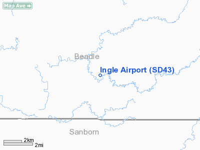
Location & QuickFacts
| FAA Information Effective: | 2008-09-25 |
| Airport Identifier: | SD43 |
| Airport Status: | Operational |
| Longitude/Latitude: | 098-02-59.0000W/44-14-23.0000N
-98.049722/44.239722 (Estimated) |
| Elevation: | 1305 ft / 397.76 m (Estimated) |
| Land: | 60 acres |
| From nearest city: | 8 nautical miles S of Cavour, SD |
| Location: | Beadle County, SD |
| Magnetic Variation: | 07E (1985) |
Owner & Manager
| Ownership: | Privately owned |
| Owner: | Robert R Ingle |
| Address: | 21697- 408th Avenue
Cavour, SD 57324 |
| Phone number: | 605-352-5933 |
| Manager: | Robert R. Ingle |
| Address: | 21697- 408th Avenue
Cavour, SD 57324 |
| Phone number: | 605-352-5933 |
Airport Operations and Facilities
| Airport Use: | Private |
| Wind indicator: | Yes |
| Segmented Circle: | No |
| Control Tower: | No |
| Landing fee charge: | No |
| Sectional chart: | Omaha |
| Region: | AGL - Great Lakes |
| Boundary ARTCC: | ZMP - Minneapolis |
| Tie-in FSS: | HON - Huron |
| FSS on Airport: | No |
| FSS Toll Free: | 1-800-WX-BRIEF |
Airport Services
| Fuel available: | 100LL
EMERGENCY ONLY |
| Airframe Repair: | MINOR |
| Power Plant Repair: | MINOR |
Runway Information
Runway 07/25
| Dimension: | 1800 x 100 ft / 548.6 x 30.5 m |
| Surface: | TURF, |
| |
Runway 07 |
Runway 25 |
| Traffic Pattern: | Left | Left |
| Obstruction: | 30 ft bins, 280.0 ft from runway | |
|
Runway 12/30
| Dimension: | 2000 x 100 ft / 609.6 x 30.5 m |
| Surface: | TURF, |
| |
Runway 12 |
Runway 30 |
| Traffic Pattern: | Left | Left |
|
Runway 17/35
| Dimension: | 1800 x 100 ft / 548.6 x 30.5 m |
| Surface: | TURF, |
| |
Runway 17 |
Runway 35 |
| Traffic Pattern: | Left | Left |
| Obstruction: | 50 ft trees hgrs, 100.0 ft from runway | |
|
Radio Navigation Aids
| ID |
Type |
Name |
Ch |
Freq |
Var |
Dist |
| MDS | NDB | Wentworth | | 400.00 | 05E | 43.6 nm |
| MHE | VOR/DME | Mitchell | 029X | 109.20 | 07E | 27.8 nm |
| HON | VORTAC | Huron | 123X | 117.60 | 10E | 16.5 nm |
Remarks
- REFLECTORS REMOVED EXCEPT ON ENDS; FACILITY IS FOR EMERGENCY USE, LAND AT OWN RISK. CALL AHEAD FOR RUNWAY CONDITIONS.
Images and information placed above are from
http://www.airport-data.com/airport/SD43/
We thank them for the data!
| General Info
|
| Country |
United States
|
| State |
SOUTH DAKOTA
|
| FAA ID |
SD43
|
| Latitude |
44-14-23.000N
|
| Longitude |
098-02-59.000W
|
| Elevation |
1305 feet
|
| Near City |
CAVOUR
|
We don't guarantee the information is fresh and accurate. The data may
be wrong or outdated.
For more up-to-date information please refer to other sources.
|
|


