|
|
| Huron Regional Airport |
 |
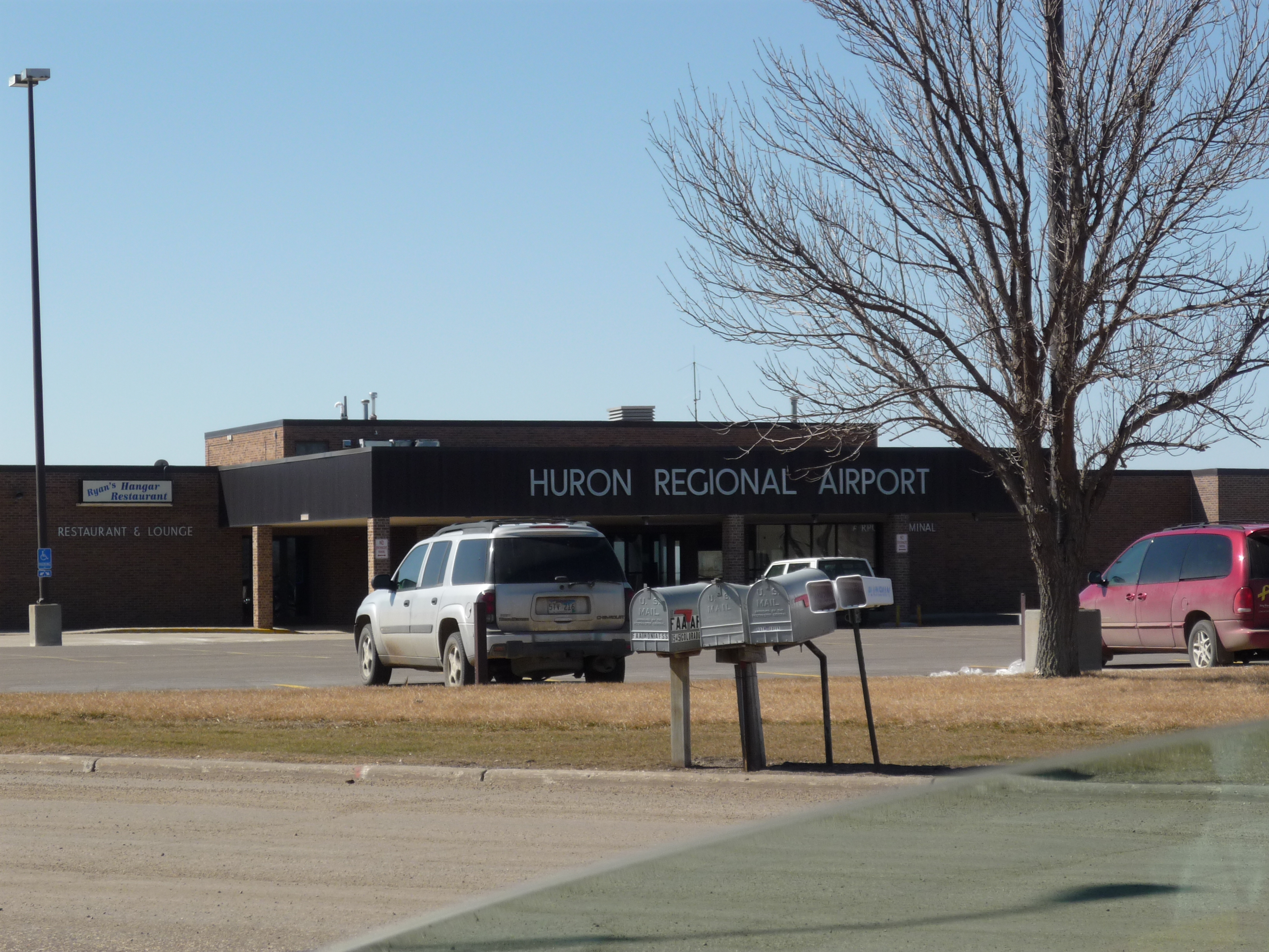
| The Terminal |
| IATA: HON – ICAO: KHON – FAA LID: HON |
| Summary |
| Airport type |
Public |
| Owner |
City of Huron |
| Operator |
City of Huron |
| Serves |
Huron and the surrounding area |
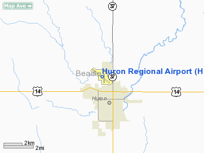
| Location |
Huron, South Dakota |
| Elevation AMSL |
1,289 ft / 392.9 m |
| Coordinates |
44°23′07″N 98°13′43″W / 44.38528°N 98.22861°W / 44.38528; -98.22861Coordinates: 44°23′07″N 98°13′43″W / 44.38528°N 98.22861°W / 44.38528; -98.22861 |
| Runways |
| Direction |
Length |
Surface |
| ft |
m |
| 12/30 |
7,201 |
2,195 |
Concrete |
| 17/35 |
5,000 |
1,524 |
Concrete |
Huron Regional Airport (IATA: HON, ICAO: KHON, FAA LID: HON) is a public airport located in the city of Huron in Beadle County, South Dakota, USA. The airport covers 1,235 acres (500 ha) and has two runways. It is served by one commercial airline, with service subsidized by the Essential Air Service program. History
The airport was originally known as the W. W. Howes Municipal Airport, named in honor of William Washington Howes, First Assistant Postmaster General under Franklin Roosevelt. Howes brought airmail service to the Midwest. The airport hangar pictured, below, was named the W. W. Howes hangar in 1998 as a result of the efforts of Howes' grandson, Dr. Whiting Wicker. (Source: Dr. Whiting Wicker)
 | |
The Airports Logo |
Airlines and destinations
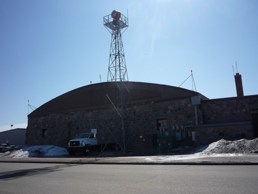 | |
The hangar |
| Airlines |
Destinations |
| Great Lakes Airlines |
Denver, McCook |
The above content comes from Wikipedia and is published under free licenses – click here to read more.
Location & QuickFacts
| FAA Information Effective: | 2008-09-25 |
| Airport Identifier: | HON |
| Airport Status: | Operational |
| Longitude/Latitude: | 098-13-42.8000W/44-23-06.7000N
-98.228556/44.385194 (Estimated) |
| Elevation: | 1289 ft / 392.89 m (Surveyed) |
| Land: | 1235 acres |
| From nearest city: | 0 nautical miles NW of Huron, SD |
| Location: | Beadle County, SD |
| Magnetic Variation: | 07E (1985) |
Owner & Manager
| Ownership: | Publicly owned |
| Owner: | City Of Huron |
| Address: |
Huron, SD 57350 |
| Phone number: | 605-353-8516 |
| Manager: | Larry Cooper |
| Address: | Po Box 1369
Huron, SD 57350 |
| Phone number: | 605-353-8516 |
Airport Operations and Facilities
| Airport Use: | Open to public |
| Wind indicator: | Yes |
| Segmented Circle: | Yes |
| Control Tower: | No |
| Lighting Schedule: | DUSK-DAWN
HIRL RY 12/30 PRESET ON LOW INTST SS-2200; TO INCR INTST & ACTVT MALSR RY 12; REIL RYS 17, 35 & 30 & MIRL RY 17/35 - 123.0. PAPI RYS 12, 17, 30 & 35 OPER SR-2200; OTHER TIMES ACTVT - 123.0. |
| Beacon Color: | Clear-Green (lighted land airport) |
| Landing fee charge: | No |
| Sectional chart: | Omaha |
| Region: | AGL - Great Lakes |
| Traffic Pattern Alt: | 812 ft |
| Boundary ARTCC: | ZMP - Minneapolis |
| Tie-in FSS: | HON - Huron
CTC HURON RADIO FOR AIRPORT ADVISORY SERVICE ON 123.6. |
| FSS on Airport: | No |
| FSS Toll Free: | 1-800-WX-BRIEF |
| NOTAMs Facility: | HON (NOTAM-d service avaliable) |
| Certification type/date: | II A S 05/197
SKED ACR OPS ACFT DESIGNED FOR 10+ PSGR SEATS AND SKED/UNSKED ACR OPS ACFT DESIGNED FOR 31+ PAX SEATS NOT AUZD UNDER PART 139 TO OPR IN EXCESS OF 15 MINS BEFORE OR AFTER SKED ARR/DEP TIMES. COORDINATE SKED CHANGES WITH AMGR TO ASSURE ARFF AVAIL. 605-353-8516. |
| Federal Agreements: | NGY |
Airport Communications
| CTAF: | 123.600 |
| Unicom: | 123.000 |
Airport Services
| Fuel available: | 100LLA |
| Airframe Repair: | MAJOR |
| Power Plant Repair: | MAJOR |
| Bottled Oxygen: | LOW |
| Bulk Oxygen: | NONE |
Runway Information
Runway 12/30
| Dimension: | 7201 x 100 ft / 2194.9 x 30.5 m |
| Surface: | CONC, Fair Condition |
| Surface Treatment: | Saw-cut or plastic Grooved |
| Weight Limit: | Single wheel: 75000 lbs.
Dual wheel: 150000 lbs.
Dual tandem wheel: 280000 lbs.
Dual dual tandem wheel: 395000 lbs. |
| Edge Lights: | High |
| |
Runway 12 |
Runway 30 |
| Longitude: | 098-14-29.1241W | 098-13-11.0706W |
| Latitude: | 44-23-32.6807N | 44-22-48.8318N |
| Elevation: | 1289.00 ft | 1283.00 ft |
| Alignment: | 127 | 127 |
| ILS Type: | ILS/DME
| |
| Traffic Pattern: | Left | Left |
| Markings: | Precision instrument, Fair Condition | Precision instrument, Fair Condition |
| Crossing Height: | 50.00 ft | 50.00 ft |
| VASI: | 4-light PAPI on left side | 4-light PAPI on left side |
| Visual Glide Angle: | 3.00° | 3.00° |
| Approach lights: | MALSR | |
| Runway End Identifier: | | Yes |
| Centerline Lights: | No | No |
| Touchdown Lights: | No | No |
| Obstruction: | , 50:1 slope to clear | 23 ft ant, 850.0 ft from runway, 500 ft right of centerline, 28:1 slope to clear |
|
Runway 17/35
| Dimension: | 5000 x 75 ft / 1524.0 x 22.9 m |
| Surface: | CONC, Fair Condition |
| Weight Limit: | Single wheel: 40000 lbs.
Dual wheel: 55000 lbs. |
| Edge Lights: | Medium |
| |
Runway 17 |
Runway 35 |
| Longitude: | 098-13-32.3768W | 098-13-31.9863W |
| Latitude: | 44-23-25.6041N | 44-22-36.2308N |
| Elevation: | 1283.00 ft | 1285.00 ft |
| Alignment: | 127 | 127 |
| Traffic Pattern: | Left | Left |
| Markings: | Basic, Fair Condition | Basic, Fair Condition |
| Crossing Height: | 27.00 ft | 23.00 ft |
| VASI: | 4-light PAPI on left side | 4-light PAPI on left side |
| Visual Glide Angle: | 3.00° | 3.00° |
| Runway End Identifier: | Yes | Yes |
| Centerline Lights: | No | No |
| Touchdown Lights: | No | No |
|
Radio Navigation Aids
| ID |
Type |
Name |
Ch |
Freq |
Var |
Dist |
| MHE | VOR/DME | Mitchell | 029X | 109.20 | 07E | 37.5 nm |
| HON | VORTAC | Huron | 123X | 117.60 | 10E | 4.8 nm |
Remarks
- DEER AND GAME BIRDS ON AND INVOF ARPT.
- AGRICULTURAL ACFT SPRAYING INVOF ARPT APR-AUG.
- SNOW REMOVAL IN PROGRESS VARIOUS TIMES NOV-APR.
- SKED ACR OPNS INVOLV ACFT DESIGNED FOR 10-30 PAX SEATS AND UNSKED ACR OPNS INVOLV ACFT DESIGNED FOR 31+ PAX SEATS ARE NOT AUTHORIZED UNDER PART 139 TO OPERATE AT HON IN EXCESS OF 15 MINS BEFORE OR AFTER SKED ARR/DEP TIMES. COORD SKED CHANGES WITH AMGR TO ASSURE ARFF AVBL CALL 605-353-8516.
Images and information placed above are from
http://www.airport-data.com/airport/HON/
We thank them for the data!
| General Info
|
| Country |
United States
|
| State |
SOUTH DAKOTA
|
| FAA ID |
HON
|
| Latitude |
44-23-06.722N
|
| Longitude |
098-13-42.753W
|
| Elevation |
1289 feet
|
| Near City |
HURON
|
We don't guarantee the information is fresh and accurate. The data may
be wrong or outdated.
For more up-to-date information please refer to other sources.
|
|