 |
|
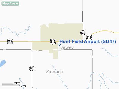
Location & QuickFacts
| FAA Information Effective: | 2008-09-25 |
| Airport Identifier: | SD47 |
| Airport Status: | Operational |
| Longitude/Latitude: | 101-12-47.5440W/45-00-09.9290N
-101.213207/45.002758 (Estimated) |
| Elevation: | 2440 ft / 743.71 m (Estimated) |
| Land: | 0 acres |
| From nearest city: | 1 nautical miles NE of Eagle Butte, SD |
| Location: | Dewey County, SD |
| Magnetic Variation: | 09E (1995) |
Owner & Manager
| Ownership: | Privately owned |
| Owner: | Dorothy Hunt |
| Address: | Box 600
Eagle Butte, SD 57625 |
| Phone number: | 605-964-3881 |
| Address: |
|
Airport Operations and Facilities
| Airport Use: | Private |
| Wind indicator: | Yes |
| Segmented Circle: | No |
| Control Tower: | No |
| Landing fee charge: | No |
| Sectional chart: | Billings |
| Region: | AGL - Great Lakes |
| Boundary ARTCC: | ZMP - Minneapolis |
| Tie-in FSS: | HON - Huron |
| FSS on Airport: | No |
| FSS Toll Free: | 1-800-WX-BRIEF |
Airport Services
| Airframe Repair: | NONE |
| Power Plant Repair: | NONE |
Runway Information
Runway NW/SE
| Dimension: | 2000 x 125 ft / 609.6 x 38.1 m |
| Surface: | TURF, |
| |
Runway NW |
Runway SE |
| Traffic Pattern: | Left | Left |
|
Radio Navigation Aids
| ID |
Type |
Name |
Ch |
Freq |
Var |
Dist |
| RVB | NDB | Riverbend | | 407.00 | 09E | 47.3 nm |
| DPR | VORTAC | Dupree | 115X | 116.80 | 10E | 21.8 nm |
Images and information placed above are from
http://www.airport-data.com/airport/SD47/
We thank them for the data!
| General Info
|
| Country |
United States
|
| State |
SOUTH DAKOTA
|
| FAA ID |
SD47
|
| Latitude |
45-00-09.929N
|
| Longitude |
101-12-47.544W
|
| Elevation |
2440 feet
|
| Near City |
EAGLE BUTTE
|
We don't guarantee the information is fresh and accurate. The data may
be wrong or outdated.
For more up-to-date information please refer to other sources.
|
|


