 |
|
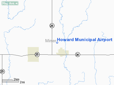
Location & QuickFacts
| FAA Information Effective: | 2008-09-25 |
| Airport Identifier: | 8D9 |
| Airport Status: | Operational |
| Longitude/Latitude: | 097-32-16.2520W/44-01-44.9060N
-97.537848/44.029141 (Estimated) |
| Elevation: | 1582 ft / 482.19 m (Surveyed) |
| Land: | 160 acres |
| From nearest city: | 1 nautical miles N of Howard, SD |
| Location: | Miner County, SD |
| Magnetic Variation: | 07E (1985) |
Owner & Manager
| Ownership: | Publicly owned |
| Owner: | City Of Howard |
| Address: | Box 705
Howard, SD 57349 |
| Phone number: | 605-772-4391 |
| Manager: | Tim Clarke |
| Address: | Box 145
Howard, SD 57349 |
| Phone number: | 605-772-5731 |
Airport Operations and Facilities
| Airport Use: | Open to public |
| Wind indicator: | Yes |
| Segmented Circle: | No |
| Control Tower: | No |
| Lighting Schedule: | DUSK-DAWN
ACTVT LIRL RY 13/31 - CTAF. |
| Beacon Color: | Clear-Green (lighted land airport) |
| Landing fee charge: | No |
| Sectional chart: | Omaha |
| Region: | AGL - Great Lakes |
| Boundary ARTCC: | ZMP - Minneapolis |
| Tie-in FSS: | HON - Huron |
| FSS on Airport: | No |
| FSS Toll Free: | 1-800-WX-BRIEF |
| NOTAMs Facility: | HON (NOTAM-d service avaliable) |
| Federal Agreements: | N |
Airport Communications
Airport Services
| Airframe Repair: | NONE |
| Power Plant Repair: | NONE |
| Bottled Oxygen: | NONE |
| Bulk Oxygen: | NONE |
Runway Information
Runway 13/31
| Dimension: | 2672 x 150 ft / 814.4 x 45.7 m |
| Surface: | TURF, Good Condition |
| Edge Lights: | Low |
| |
Runway 13 |
Runway 31 |
| Longitude: | 097-32-17.7600W | 097-31-54.1300W |
| Latitude: | 44-02-10.3800N | 44-01-50.2600N |
| Elevation: | 1563.00 ft | 1582.00 ft |
| Traffic Pattern: | Left | Left |
| Obstruction: | 14 ft road, 300.0 ft from runway, 21:1 slope to clear | , 50:1 slope to clear |
|
Runway 18/36
| Dimension: | 1932 x 150 ft / 588.9 x 45.7 m |
| Surface: | TURF, Good Condition |
| |
Runway 18 |
Runway 36 |
| Longitude: | 097-31-53.2500W | 097-31-56.2800W |
| Latitude: | 44-02-08.9100N | 44-01-47.6900N |
| Elevation: | 1583.00 ft | 1581.00 ft |
| Traffic Pattern: | Left | Left |
| Obstruction: | 28 ft pline, 737.0 ft from runway, 26:1 slope to clear | 4 ft fence, 80.0 ft from runway, 20:1 slope to clear |
|
Radio Navigation Aids
| ID |
Type |
Name |
Ch |
Freq |
Var |
Dist |
| MDS | NDB | Wentworth | | 400.00 | 05E | 19.4 nm |
| FS | NDB | Rokky | | 245.00 | 06E | 44.5 nm |
| MHE | VOR/DME | Mitchell | 029X | 109.20 | 07E | 26.4 nm |
| BKX | VOR/DME | Brookings | 025X | 108.80 | 06E | 35.2 nm |
| FSD | VORTAC | Sioux Falls | 097X | 115.00 | 09E | 40.0 nm |
| HON | VORTAC | Huron | 123X | 117.60 | 10E | 41.5 nm |
Remarks
- RY 13 - 4+ FT FENCE 45 FT R 300 FT FM THR & 125 FT R 240 FT FM THR.
- WILDLIFE ON AND INVOF ARPT.
Images and information placed above are from
http://www.airport-data.com/airport/8D9/
We thank them for the data!
| General Info
|
| Country |
United States
|
| State |
SOUTH DAKOTA
|
| FAA ID |
8D9
|
| Latitude |
44-01-44.906N
|
| Longitude |
097-32-16.252W
|
| Elevation |
1582 feet
|
| Near City |
HOWARD
|
We don't guarantee the information is fresh and accurate. The data may
be wrong or outdated.
For more up-to-date information please refer to other sources.
|
|


