 |
|
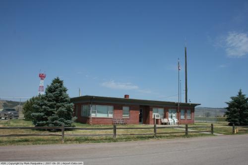 |
(Click on the photo to enlarge) |
Location & QuickFacts
| FAA Information Effective: | 2008-09-25 |
| Airport Identifier: | HSR |
| Airport Status: | Operational |
| Longitude/Latitude: | 103-23-17.2960W/43-22-05.6830N
-103.388138/43.368245 (Estimated) |
| Elevation: | 3148 ft / 959.51 m (Surveyed) |
| Land: | 518 acres |
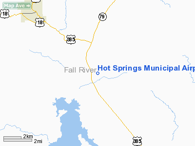
| From nearest city: | 5 nautical miles SE of Hot Springs, SD |
| Location: | Fall River County, SD |
| Magnetic Variation: | 10E (2000) |
Owner & Manager
| Ownership: | Publicly owned |
| Owner: | City Of Hot Springs |
| Address: | Box 391
Hot Springs, SD 57747 |
| Phone number: | 605-745-3135 |
| Manager: | Keith Miller |
| Address: | Hc 52 Box 123
Hot Springs, SD 57747 |
| Phone number: | 605-745-3555 |
Airport Operations and Facilities
| Airport Use: | Open to public |
| Wind indicator: | Yes |
| Segmented Circle: | Yes |
| Control Tower: | No |
| Lighting Schedule: | DUSK-DAWN
ACTVT MIRL RY 01/19 & PAPI RYS 01 & 19 - CTAF. |
| Beacon Color: | Clear-Green (lighted land airport) |
| Landing fee charge: | No |
| Sectional chart: | Cheyenne |
| Region: | AGL - Great Lakes |
| Boundary ARTCC: | ZDV - Denver |
| Tie-in FSS: | HON - Huron |
| FSS on Airport: | No |
| FSS Toll Free: | 1-800-WX-BRIEF |
| NOTAMs Facility: | HON (NOTAM-d service avaliable) |
| Federal Agreements: | NGY |
Airport Communications
| CTAF: | 122.800 |
| Unicom: | 122.800 |
Airport Services
| Fuel available: | 100LL
FUEL AVBL 24 HRS WITH CREDIT CARD. |
| Airframe Repair: | NONE |
| Power Plant Repair: | NONE |
| Bottled Oxygen: | NONE |
| Bulk Oxygen: | NONE |
Runway Information
Runway 01/19
| Dimension: | 4505 x 100 ft / 1373.1 x 30.5 m |
| Surface: | ASPH, Good Condition |
| Weight Limit: | Single wheel: 7000 lbs. |
| Edge Lights: | Medium |
| |
Runway 01 |
Runway 19 |
| Longitude: | 103-23-32.5090W | 103-23-10.0340W |
| Latitude: | 43-21-48.2860N | 43-22-29.6390N |
| Elevation: | 3148.00 ft | 3140.00 ft |
| Alignment: | 22 | 127 |
| Traffic Pattern: | Left | Left |
| Markings: | Non-precision instrument, Good Condition | Non-precision instrument, Good Condition |
| Crossing Height: | 29.00 ft | 31.00 ft |
| VASI: | 2-light PAPI on left side | 2-light PAPI on left side |
| Visual Glide Angle: | 3.00° | 3.00° |
| Runway End Identifier: | No | No |
| Centerline Lights: | No | No |
| Touchdown Lights: | No | No |
| Obstruction: | 114 ft trees, 3400.0 ft from runway, 28:1 slope to clear | 21 ft tree, 470.0 ft from runway, 260 ft left of centerline, 12:1 slope to clear |
|
Runway 06/24
| Dimension: | 3950 x 250 ft / 1204.0 x 76.2 m |
| Surface: | TURF, Good Condition |
| |
Runway 06 |
Runway 24 |
| Longitude: | 103-23-38.7090W | 103-22-46.8190W |
| Latitude: | 43-21-57.2230N | 43-22-06.6590N |
| Elevation: | 3145.00 ft | 3141.00 ft |
| Alignment: | 76 | 127 |
| Traffic Pattern: | Left | Left |
| Markings: | Basic, Good Condition | Basic, Good Condition |
| Runway End Identifier: | No | No |
| Centerline Lights: | No | No |
| Touchdown Lights: | No | No |
| Obstruction: | 20 ft , 800.0 ft from runway, 40:1 slope to clear | , 50:1 slope to clear |
|
Radio Navigation Aids
| ID |
Type |
Name |
Ch |
Freq |
Var |
Dist |
| HIN | NDB | Whitney | | 275.00 | 11E | 34.9 nm |
| RA | NDB | Ranch | | 254.00 | 11E | 39.7 nm |
| RCA | TACAN | Ellsworth | 025X | | 11E | 48.0 nm |
| CDR | VOR/DME | Chadron | 081X | 113.40 | 13E | 48.8 nm |
| RAP | VORTAC | Rapid City | 070X | 112.30 | 13E | 40.0 nm |
Remarks
- RY 01 +21 FT PLINE 680 FT FM THR.
- BIRDS ON & INVOF ARPT.
- RY 06/24 MARKED WITH BLACK AND WHITE CONES.
- GLIDER OPS ON & INVOF ARPT.
Images and information placed above are from
http://www.airport-data.com/airport/HSR/
We thank them for the data!
| General Info
|
| Country |
United States
|
| State |
SOUTH DAKOTA
|
| FAA ID |
HSR
|
| Latitude |
43-22-05.683N
|
| Longitude |
103-23-17.296W
|
| Elevation |
3148 feet
|
| Near City |
HOT SPRINGS
|
We don't guarantee the information is fresh and accurate. The data may
be wrong or outdated.
For more up-to-date information please refer to other sources.
|
|


