 |
|
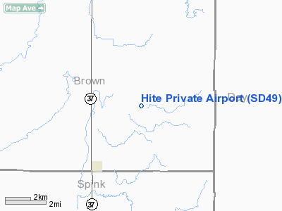
Location & QuickFacts
| FAA Information Effective: | 2008-09-25 |
| Airport Identifier: | SD49 |
| Airport Status: | Operational |
| Longitude/Latitude: | 098-03-15.3410W/45-17-13.8500N
-98.054261/45.287181 (Estimated) |
| Elevation: | 1320 ft / 402.34 m (Estimated) |
| Land: | 0 acres |
| From nearest city: | 3 nautical miles SE of Ferney, SD |
| Location: | Brown County, SD |
| Magnetic Variation: | 07E (1985) |
Owner & Manager
| Ownership: | Privately owned |
| Owner: | Hite Farms |
| Address: | 40861 145th St
Conde, SD 57434 |
| Phone number: | 972-562-8027 |
| Manager: | Donald Hite |
| Address: | 10030 N. American Lane
Mckinney, TX 75071 |
| Phone number: | 972-834-5922 |
Airport Operations and Facilities
| Airport Use: | Private |
| Wind indicator: | Yes |
| Segmented Circle: | No |
| Control Tower: | No |
| Landing fee charge: | No |
| Sectional chart: | Twin Cities |
| Region: | AGL - Great Lakes |
| Boundary ARTCC: | ZMP - Minneapolis |
| Tie-in FSS: | HON - Huron |
| FSS on Airport: | No |
| FSS Toll Free: | 1-800-WX-BRIEF |
Airport Services
| Airframe Repair: | NONE |
| Power Plant Repair: | NONE |
Runway Information
Runway 17/35
| Dimension: | 2100 x 60 ft / 640.1 x 18.3 m |
| Surface: | TURF, |
| |
Runway 17 |
Runway 35 |
| Traffic Pattern: | Left | Left |
|
Radio Navigation Aids
| ID |
Type |
Name |
Ch |
Freq |
Var |
Dist |
| BTN | NDB | Britton | | 386.00 | 06E | 34.5 nm |
| ABR | VOR/DME | Aberdeen | 077X | 113.00 | 07E | 15.4 nm |
| ATY | VORTAC | Watertown | 113X | 116.60 | 09E | 42.9 nm |
Images and information placed above are from
http://www.airport-data.com/airport/SD49/
We thank them for the data!
| General Info
|
| Country |
United States
|
| State |
SOUTH DAKOTA
|
| FAA ID |
SD49
|
| Latitude |
45-17-13.850N
|
| Longitude |
098-03-15.341W
|
| Elevation |
1320 feet
|
| Near City |
FERNEY
|
We don't guarantee the information is fresh and accurate. The data may
be wrong or outdated.
For more up-to-date information please refer to other sources.
|
|


