 |
|
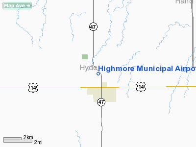
Location & QuickFacts
| FAA Information Effective: | 2008-09-25 |
| Airport Identifier: | 9D0 |
| Airport Status: | Operational |
| Longitude/Latitude: | 099-26-46.4030W/44-32-29.9420N
-99.446223/44.541651 (Estimated) |
| Elevation: | 1854 ft / 565.10 m (Surveyed) |
| Land: | 149 acres |
| From nearest city: | 1 nautical miles N of Highmore, SD |
| Location: | Hyde County, SD |
| Magnetic Variation: | 08E (1985) |
Owner & Manager
| Ownership: | Publicly owned |
| Owner: | City Of Highmore |
| Address: | Po Box 299
Highmore, SD 57345 |
| Phone number: | 605-852-2716 |
| Manager: | Pam Huber-finance Officer |
| Address: | Po Box 299
Highmore, SD 57345 |
| Phone number: | 605-852-2716 |
Airport Operations and Facilities
| Airport Use: | Open to public |
| Wind indicator: | Yes |
| Segmented Circle: | No |
| Control Tower: | No |
| Lighting Schedule: | DUSK-DAWN
ACTVT LIRL RY 12/30 - CTAF. |
| Beacon Color: | Clear-Green (lighted land airport) |
| Landing fee charge: | No |
| Sectional chart: | Twin Cities |
| Region: | AGL - Great Lakes |
| Boundary ARTCC: | ZMP - Minneapolis |
| Tie-in FSS: | HON - Huron |
| FSS on Airport: | No |
| FSS Toll Free: | 1-800-WX-BRIEF |
| NOTAMs Facility: | HON (NOTAM-d service avaliable) |
| Federal Agreements: | N1 |
Airport Communications
Airport Services
| Airframe Repair: | MINOR |
| Power Plant Repair: | MINOR |
| Bottled Oxygen: | NONE |
| Bulk Oxygen: | NONE |
Runway Information
Runway 12/30
| Dimension: | 3700 x 60 ft / 1127.8 x 18.3 m |
| Surface: | ASPH, |
| Edge Lights: | Low |
| |
Runway 12 |
Runway 30 |
| Longitude: | 099-27-21.5200W | 099-26-45.2500W |
| Latitude: | 44-32-39.4400N | 44-32-13.7100N |
| Elevation: | 1841.00 ft | 1854.00 ft |
| Traffic Pattern: | Left | Left |
| Markings: | Basic, Good Condition | Basic, Good Condition |
| Runway End Identifier: | No | No |
| Centerline Lights: | No | No |
| Touchdown Lights: | No | No |
| Obstruction: | 5 ft fence, 150.0 ft from runway, 30:1 slope to clear | 18 ft road, 460.0 ft from runway, 25:1 slope to clear |
|
Radio Navigation Aids
| ID |
Type |
Name |
Ch |
Freq |
Var |
Dist |
| PIR | VORTAC | Pierre | 072X | 112.50 | 11E | 32.0 nm |
| HON | VORTAC | Huron | 123X | 117.60 | 10E | 49.1 nm |
Images and information placed above are from
http://www.airport-data.com/airport/9D0/
We thank them for the data!
| General Info
|
| Country |
United States
|
| State |
SOUTH DAKOTA
|
| FAA ID |
9D0
|
| Latitude |
44-32-29.942N
|
| Longitude |
099-26-46.403W
|
| Elevation |
1851 feet
|
| Near City |
HIGHMORE
|
We don't guarantee the information is fresh and accurate. The data may
be wrong or outdated.
For more up-to-date information please refer to other sources.
|
|


