 |
|
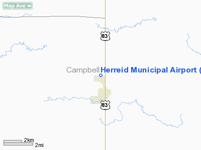
Location & QuickFacts
| FAA Information Effective: | 2008-09-25 |
| Airport Identifier: | 5T4 |
| Airport Status: | Operational |
| Longitude/Latitude: | 100-04-31.4230W/45-51-14.9680N
-100.075395/45.854158 (Estimated) |
| Elevation: | 1725 ft / 525.78 m (Estimated) |
| Land: | 93 acres |
| From nearest city: | 1 nautical miles N of Herreid, SD |
| Location: | Campbell County, SD |
| Magnetic Variation: | 09E (1985) |
Owner & Manager
| Ownership: | Publicly owned |
| Owner: | City Of Herreid |
| Address: | Po Box 676
Herreid, SD 57632 |
| Phone number: | 605-437-2302 |
| Manager: | Gordon Quaschnick |
| Address: | C/o City Of Herreid, Po Box 767
Herreid, SD 57632 |
| Phone number: | 605-437-2444 |
Airport Operations and Facilities
| Airport Use: | Open to public |
| Wind indicator: | Yes |
| Segmented Circle: | Yes |
| Control Tower: | No |
| Landing fee charge: | No |
| Sectional chart: | Twin Cities |
| Region: | AGL - Great Lakes |
| Boundary ARTCC: | ZMP - Minneapolis |
| Tie-in FSS: | HON - Huron |
| FSS on Airport: | No |
| FSS Toll Free: | 1-800-WX-BRIEF |
| NOTAMs Facility: | HON (NOTAM-d service avaliable) |
| Federal Agreements: | 1 |
Airport Communications
Airport Services
| Airframe Repair: | NONE |
| Power Plant Repair: | NONE |
| Bottled Oxygen: | NONE |
| Bulk Oxygen: | NONE |
Runway Information
Runway 12/30
| Dimension: | 2230 x 200 ft / 679.7 x 61.0 m |
| Surface: | ASPH-TURF,
CENTER 30' OF ASPHALT IN POOR CONDITION. |
| |
Runway 12 |
Runway 30 |
| Longitude: | 100-04-37.9000W | 100-04-13.4200W |
| Latitude: | 45-51-00.3200N | 45-50-46.4700N |
| Elevation: | 1718.00 ft | 1719.00 ft |
| Traffic Pattern: | Left | Left |
| Runway End Identifier: | No | No |
| Touchdown Lights: | No | No |
| Obstruction: | , 50:1 slope to clear | 19 ft road, 314.0 ft from runway, 16:1 slope to clear |
|
Radio Navigation Aids
| ID |
Type |
Name |
Ch |
Freq |
Var |
Dist |
| RVB | NDB | Riverbend | | 407.00 | 09E | 23.1 nm |
Remarks
- RY 12 CULTIVATION 80' FM THR.
- WILDLIFE ON AND INVOF ARPT.
- PRIOR TO 1959.
Images and information placed above are from
http://www.airport-data.com/airport/5T4/
We thank them for the data!
| General Info
|
| Country |
United States
|
| State |
SOUTH DAKOTA
|
| FAA ID |
5T4
|
| Latitude |
45-51-14.968N
|
| Longitude |
100-04-31.423W
|
| Elevation |
1725 feet
|
| Near City |
HERREID
|
We don't guarantee the information is fresh and accurate. The data may
be wrong or outdated.
For more up-to-date information please refer to other sources.
|
|


