 |
|
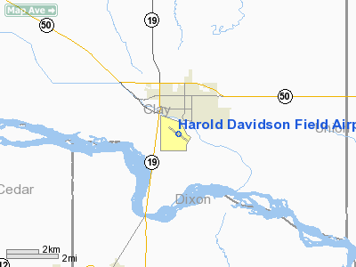
Harold Davidson Field Airport |
Location & QuickFacts
| FAA Information Effective: | 2008-09-25 |
| Airport Identifier: | VMR |
| Airport Status: | Operational |
| Longitude/Latitude: | 096-56-03.3170W/42-45-55.0410N
-96.934255/42.765289 (Estimated) |
| Elevation: | 1147 ft / 349.61 m (Surveyed) |
| Land: | 140 acres |
| From nearest city: | 1 nautical miles S of Vermillion, SD |
| Location: | Clay County, SD |
| Magnetic Variation: | 06E (1995) |
Owner & Manager
| Ownership: | Publicly owned |
| Owner: | City Of Vermillion |
| Address: | 25 Center St
Vermillion, SD 57069 |
| Phone number: | 605-624-7050 |
| Manager: | Bill Welk |
| Address: | 25 Center
Vermillion, SD 57069 |
| Phone number: | 605-677-7083 |
Airport Operations and Facilities
| Airport Use: | Open to public |
| Wind indicator: | Yes |
| Segmented Circle: | No |
| Control Tower: | No |
| Lighting Schedule: | DUSK-DAWN
ACTIVATE MIRL RY 12/30, PAPI RY 12 AND RY 30 - CTAF. |
| Beacon Color: | Clear-Green (lighted land airport) |
| Landing fee charge: | No |
| Sectional chart: | Omaha |
| Region: | AGL - Great Lakes |
| Boundary ARTCC: | ZMP - Minneapolis |
| Tie-in FSS: | HON - Huron |
| FSS on Airport: | No |
| FSS Toll Free: | 1-800-WX-BRIEF |
| NOTAMs Facility: | HON (NOTAM-d service avaliable) |
| Federal Agreements: | NGY |
Airport Communications
| CTAF: | 122.800 |
| Unicom: | 122.800 |
Airport Services
| Fuel available: | 100LL
FUEL AVBL 24 HRS WITH CREDIT CARD. |
| Airframe Repair: | MINOR |
| Power Plant Repair: | MINOR |
| Bottled Oxygen: | NONE |
| Bulk Oxygen: | NONE |
Runway Information
Runway 12/30
| Dimension: | 4105 x 75 ft / 1251.2 x 22.9 m |
| Surface: | ASPH, Fair Condition |
| Weight Limit: | Single wheel: 12000 lbs. |
| Edge Lights: | Medium |
| |
Runway 12 |
Runway 30 |
| Longitude: | 096-56-25.5730W | 096-55-41.0640W |
| Latitude: | 42-46-06.9610N | 42-45-43.1200N |
| Elevation: | 1145.00 ft | 1145.00 ft |
| Alignment: | 126 | 127 |
| Traffic Pattern: | Right | Left |
| Markings: | Non-precision instrument, Fair Condition | Non-precision instrument, Fair Condition |
| Crossing Height: | 38.00 ft | 38.00 ft |
| VASI: | 4-light PAPI on left side | 4-light PAPI on left side |
| Visual Glide Angle: | 3.00° | 3.00° |
| Runway End Identifier: | No | No |
| Centerline Lights: | No | No |
| Touchdown Lights: | No | No |
| Obstruction: | , 50:1 slope to clear | 68 ft trees, 1900.0 ft from runway, 25:1 slope to clear |
|
Radio Navigation Aids
| ID |
Type |
Name |
Ch |
Freq |
Var |
Dist |
| VMR | NDB | Vermillion | | 375.00 | 06E | 0.1 nm |
| OI | NDB | Tommi | | 305.00 | 07E | 27.8 nm |
| LCG | NDB | Wayne | | 389.00 | 06E | 31.5 nm |
| GAK | NDB | Sioux Gateway | | 233.00 | 06E | 32.4 nm |
| SU | NDB | Salix | | 414.00 | 07E | 38.8 nm |
| SOY | NDB | Sioux Center | | 368.00 | 06E | 39.5 nm |
| ORC | NDB | Orange City | | 521.00 | 05E | 40.8 nm |
| FS | NDB | Rokky | | 245.00 | 06E | 44.1 nm |
| YKN | VOR/DME | Yankton | 051X | 111.40 | 07E | 21.9 nm |
| SUX | VORTAC | Sioux City | 112X | 116.50 | 09E | 37.0 nm |
Images and information placed above are from
http://www.airport-data.com/airport/VMR/
We thank them for the data!
| General Info
|
| Country |
United States
|
| State |
SOUTH DAKOTA
|
| FAA ID |
VMR
|
| Latitude |
42-45-55.041N
|
| Longitude |
096-56-03.317W
|
| Elevation |
1147 feet
|
| Near City |
VERMILLION
|
We don't guarantee the information is fresh and accurate. The data may
be wrong or outdated.
For more up-to-date information please refer to other sources.
|
|


