 |
|
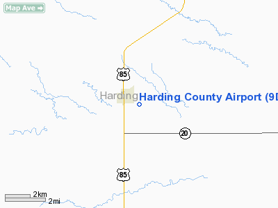
Location & QuickFacts
| FAA Information Effective: | 2008-09-25 |
| Airport Identifier: | 9D2 |
| Airport Status: | Operational |
| Longitude/Latitude: | 103-31-46.6880W/45-34-49.9880N
-103.529636/45.580552 (Estimated) |
| Elevation: | 2889 ft / 880.57 m (Surveyed) |
| Land: | 120 acres |
| From nearest city: | 1 nautical miles SE of Buffalo, SD |
| Location: | Harding County, SD |
| Magnetic Variation: | 11E (1985) |
Owner & Manager
| Ownership: | Publicly owned |
| Owner: | Harding County |
| Address: | P O Box 26
Buffalo, SD 57720 |
| Phone number: | 605-375-3130 |
| Manager: | Will Henderson |
| Address: | Box 165
Buffalo, SD 57720 |
| Phone number: | 605-375-3564 |
Airport Operations and Facilities
| Airport Use: | Open to public |
| Wind indicator: | Yes |
| Segmented Circle: | No |
| Control Tower: | No |
| Lighting Schedule: | DUSK-DAWN |
| Beacon Color: | Clear-Green (lighted land airport) |
| Landing fee charge: | No |
| Sectional chart: | Billings |
| Region: | AGL - Great Lakes |
| Boundary ARTCC: | ZLC - Salt Lake City |
| Tie-in FSS: | HON - Huron |
| FSS on Airport: | No |
| FSS Toll Free: | 1-800-WX-BRIEF |
| NOTAMs Facility: | HON (NOTAM-d service avaliable) |
| Federal Agreements: | NGY |
Airport Communications
Airport Services
| Fuel available: | 100LL
FOR FUEL CALL 605-375-3254/3255 |
| Airframe Repair: | NONE |
| Power Plant Repair: | NONE |
| Bottled Oxygen: | NONE |
| Bulk Oxygen: | NONE |
Runway Information
Runway 08/26
| Dimension: | 2250 x 100 ft / 685.8 x 30.5 m |
| Surface: | TURF, Good Condition |
| |
Runway 08 |
Runway 26 |
| Longitude: | 103-32-01.5200W | 103-31-30.0400W |
| Latitude: | 45-34-47.4500N | 45-34-45.2500N |
| Elevation: | 2874.00 ft | 2865.00 ft |
| Traffic Pattern: | Left | Left |
| Runway End Identifier: | No | No |
| Touchdown Lights: | No | No |
| Obstruction: | 17 ft road, 340.0 ft from runway, 20:1 slope to clear | 7 ft fence, 145.0 ft from runway, 20:1 slope to clear |
|
Runway 12/30
| Dimension: | 3900 x 60 ft / 1188.7 x 18.3 m |
| Surface: | ASPH, Fair Condition |
| Weight Limit: | Single wheel: 12500 lbs. |
| Edge Lights: | Low |
| |
Runway 12 |
Runway 30 |
| Longitude: | 103-32-02.1900W | 103-31-17.5000W |
| Latitude: | 45-34-59.4900N | 45-34-29.4500N |
| Elevation: | 2889.00 ft | 2848.00 ft |
| Traffic Pattern: | Left | Left |
| Markings: | Basic, Fair Condition | Basic, Fair Condition |
| Runway End Identifier: | No | No |
| Touchdown Lights: | No | No |
| Obstruction: | 4 ft fence, 366.0 ft from runway, 142 ft right of centerline, 41:1 slope to clear | , 50:1 slope to clear |
|
Radio Navigation Aids
| ID |
Type |
Name |
Ch |
Freq |
Var |
Dist |
| BOD | NDB | Bowman | | 374.00 | 10E | 36.6 nm |
| HEI | NDB | Hettinger | | 392.00 | 12E | 45.3 nm |
| BUA | VOR/DME | Buffalo | 031X | 109.40 | 13E | 3.5 nm |
Remarks
- WILDLIFE ON AND INVOF ARPT.
Images and information placed above are from
http://www.airport-data.com/airport/9D2/
We thank them for the data!
| General Info
|
| Country |
United States
|
| State |
SOUTH DAKOTA
|
| FAA ID |
9D2
|
| Latitude |
45-34-49.988N
|
| Longitude |
103-31-46.688W
|
| Elevation |
2889 feet
|
| Near City |
BUFFALO
|
We don't guarantee the information is fresh and accurate. The data may
be wrong or outdated.
For more up-to-date information please refer to other sources.
|
|


