 |
|
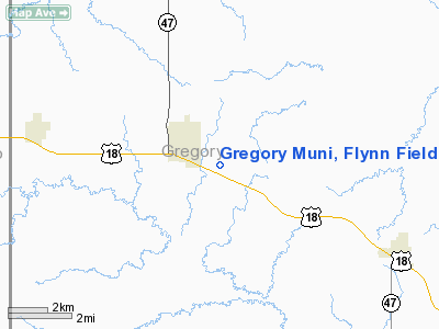
Gregory Muni, Flynn Field Airport |
Location & QuickFacts
| FAA Information Effective: | 2008-09-25 |
| Airport Identifier: | 9D1 |
| Airport Status: | Operational |
| Longitude/Latitude: | 099-24-11.8800W/43-13-18.2900N
-99.403300/43.221747 (Estimated) |
| Elevation: | 2168 ft / 660.81 m (Surveyed) |
| Land: | 214 acres |
| From nearest city: | 1 nautical miles SE of Gregory, SD |
| Location: | Gregory County, SD |
| Magnetic Variation: | 07E (2000) |
Owner & Manager
| Ownership: | Publicly owned |
| Owner: | City Of Gregory |
| Address: | Po Box 436
Gregory, SD 57533 |
| Phone number: | 605-835-8270 |
| Manager: | Ken Adams |
| Address: | Box 85
Gregory, SD 57533 |
| Phone number: | 605-835-9978 |
Airport Operations and Facilities
| Airport Use: | Open to public |
| Wind indicator: | Yes |
| Segmented Circle: | No |
| Control Tower: | No |
| Lighting Schedule: | DUSK-DAWN
ACTVT MIRL RY 13/31 & PAPI RYS 13 & 31 - CTAF. |
| Beacon Color: | Clear-Green (lighted land airport) |
| Landing fee charge: | No |
| Sectional chart: | Omaha |
| Region: | AGL - Great Lakes |
| Boundary ARTCC: | ZMP - Minneapolis |
| Tie-in FSS: | HON - Huron |
| FSS on Airport: | No |
| FSS Toll Free: | 1-800-WX-BRIEF |
| NOTAMs Facility: | HON (NOTAM-d service avaliable) |
| Federal Agreements: | NGY |
Airport Communications
| CTAF: | 122.800 |
| Unicom: | 122.800 |
Airport Services
| Fuel available: | 100LLA |
| Airframe Repair: | MINOR |
| Power Plant Repair: | MINOR |
| Bottled Oxygen: | NONE |
| Bulk Oxygen: | NONE |
Runway Information
Runway 13/31
| Dimension: | 3800 x 60 ft / 1158.2 x 18.3 m |
| Surface: | ASPH, |
| Weight Limit: | Single wheel: 12500 lbs. |
| Edge Lights: | Medium |
| |
Runway 13 |
Runway 31 |
| Longitude: | 099-24-30.1700W | 099-23-53.5900W |
| Latitude: | 43-13-31.4500N | 43-13-05.1300N |
| Elevation: | 2168.00 ft | 2160.00 ft |
| Alignment: | 127 | 127 |
| Traffic Pattern: | Left | Left |
| Markings: | Basic, Good Condition | Non-precision instrument, Good Condition |
| Crossing Height: | 31.00 ft | 32.00 ft |
| VASI: | 2-light PAPI on left side | 2-light PAPI on left side |
| Visual Glide Angle: | 3.00° | 3.00° |
| Runway End Identifier: | No | No |
| Centerline Lights: | No | No |
| Touchdown Lights: | No | No |
| Obstruction: | 32 ft trees, 1131.0 ft from runway, 29:1 slope to clear | , 50:1 slope to clear |
|
Radio Navigation Aids
| ID |
Type |
Name |
Ch |
Freq |
Var |
Dist |
| RBE | NDB | Rock County | | 341.00 | 08E | 39.7 nm |
| AGZ | NDB | Wagner | | 392.00 | 08E | 49.7 nm |
| ISD | VOR | Winner | | 112.80 | 08E | 22.4 nm |
| ANW | VOR/DME | Ainsworth | 074X | 112.70 | 09E | 47.0 nm |
Remarks
- TELEPHONE AVBL.
- WILDLIFE ON & INVOF ARPT.
Images and information placed above are from
http://www.airport-data.com/airport/9D1/
We thank them for the data!
| General Info
|
| Country |
United States
|
| State |
SOUTH DAKOTA
|
| FAA ID |
9D1
|
| Latitude |
43-13-18.290N
|
| Longitude |
099-24-11.880W
|
| Elevation |
2168 feet
|
| Near City |
GREGORY
|
We don't guarantee the information is fresh and accurate. The data may
be wrong or outdated.
For more up-to-date information please refer to other sources.
|
|


