 |
|
Location & QuickFacts
| FAA Information Effective: | 2008-09-25 |
| Airport Identifier: | SD99 |
| Airport Status: | Operational |
| Longitude/Latitude: | 096-45-01.1830W/43-37-29.9090N
-96.750329/43.624975 (Estimated) |
| Elevation: | 1495 ft / 455.68 m (Estimated) |
| Land: | 0 acres |
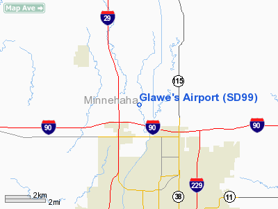
| From nearest city: | 3 nautical miles NW of Sioux Falls, SD |
| Location: | Minnehaha County, SD |
| Magnetic Variation: | 06E (1985) |
Owner & Manager
| Ownership: | Privately owned |
| Owner: | R E Glawe |
| Address: | Rr 4, Box 74a
Sioux Falls, SD 57101 |
| Manager: | R E Glawe |
| Address: | Rr 4, Box 74a
Sioux Falls, SD 57101 |
| Phone number: | 605-338-8540 |
Airport Operations and Facilities
| Airport Use: | Private |
| Wind indicator: | Yes |
| Segmented Circle: | No |
| Control Tower: | No |
| Landing fee charge: | No |
| Sectional chart: | Omaha |
| Region: | AGL - Great Lakes |
| Boundary ARTCC: | ZMP - Minneapolis |
| Tie-in FSS: | HON - Huron |
| FSS on Airport: | No |
| FSS Toll Free: | 1-800-WX-BRIEF |
Runway Information
Runway 13/31
| Dimension: | 1550 x 100 ft / 472.4 x 30.5 m |
| Surface: | TURF, |
| |
Runway 13 |
Runway 31 |
| Traffic Pattern: | Left | Left |
|
Radio Navigation Aids
| ID |
Type |
Name |
Ch |
Freq |
Var |
Dist |
| FS | NDB | Rokky | | 245.00 | 06E | 8.6 nm |
| MDS | NDB | Wentworth | | 400.00 | 05E | 27.6 nm |
| SOY | NDB | Sioux Center | | 368.00 | 06E | 38.4 nm |
| ISB | NDB | Sibley | | 269.00 | 05E | 46.2 nm |
| SHL | NDB | Sheldon | | 338.00 | 05E | 47.0 nm |
| ORC | NDB | Orange City | | 521.00 | 05E | 48.6 nm |
| PQN | NDB/DME | Pipestone | 028X | 284.00 | 06E | 29.3 nm |
| BKX | VOR/DME | Brookings | 025X | 108.80 | 06E | 40.9 nm |
| DDL | VOR/DME | Sheldon | 023X | 108.60 | 05E | 47.1 nm |
| FSD | VORTAC | Sioux Falls | 097X | 115.00 | 09E | 2.0 nm |
Remarks
- E111 PRVDD ALL TFC PAT OPNS ARE CONDUCTED SW OF RWY 33. E111 PRVDD AN ACPTBL LTR OF AGRMT BE ESTABD BTN OWNER OF PROPOSED R. E. GLAWE ARPT & CHIEF OF SIOUX FALLS ATCT PRIOR TO ACTVTN OF GLAWE ARPT.
Images and information placed above are from
http://www.airport-data.com/airport/SD99/
We thank them for the data!
| General Info
|
| Country |
United States
|
| State |
SOUTH DAKOTA
|
| FAA ID |
SD99
|
| Latitude |
43-37-29.909N
|
| Longitude |
096-45-01.183W
|
| Elevation |
1495 feet
|
| Near City |
SIOUX FALLS
|
We don't guarantee the information is fresh and accurate. The data may
be wrong or outdated.
For more up-to-date information please refer to other sources.
|
|


