 |
|
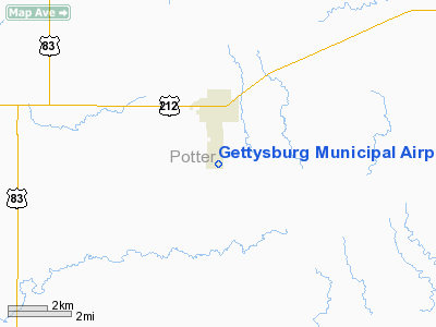
Location & QuickFacts
| FAA Information Effective: | 2008-09-25 |
| Airport Identifier: | 0D8 |
| Airport Status: | Operational |
| Longitude/Latitude: | 099-57-10.1993W/44-59-12.1674N
-99.952833/44.986713 (Estimated) |
| Elevation: | 2061 ft / 628.19 m (Surveyed) |
| Land: | 167 acres |
| From nearest city: | 1 nautical miles S of Gettysburg, SD |
| Location: | Potter County, SD |
| Magnetic Variation: | 08E (1995) |
Owner & Manager
| Ownership: | Publicly owned |
| Owner: | City Of Gettysburg |
| Address: | 110 E Commercial
Gettysburg, SD 57442 |
| Phone number: | 605-765-2733 |
| Manager: | Bill Eliason |
| Address: | 404 E Garfield
Gettysburg, SD 57442 |
| Phone number: | 605-765-2207
BACKUP NUMBER 605-765-2207. |
Airport Operations and Facilities
| Airport Use: | Open to public |
| Wind indicator: | Yes |
| Segmented Circle: | Yes |
| Control Tower: | No |
| Lighting Schedule: | DUSK-DAWN
ACTVT MIRL RY 13/31 - CTAF. |
| Beacon Color: | Clear-Green (lighted land airport) |
| Landing fee charge: | No |
| Sectional chart: | Twin Cities |
| Region: | AGL - Great Lakes |
| Boundary ARTCC: | ZMP - Minneapolis |
| Tie-in FSS: | HON - Huron |
| FSS on Airport: | No |
| FSS Toll Free: | 1-800-WX-BRIEF |
| NOTAMs Facility: | HON (NOTAM-d service avaliable) |
| Federal Agreements: | NGY |
Airport Communications
| CTAF: | 122.800 |
| Unicom: | 122.800 |
Airport Services
| Fuel available: | 100LLA
FOR FUEL CALL 605-765-9197/9782. |
| Airframe Repair: | MAJOR |
| Power Plant Repair: | MAJOR |
| Bottled Oxygen: | NONE |
| Bulk Oxygen: | NONE |
Runway Information
Runway 04/22
| Dimension: | 2700 x 150 ft / 823.0 x 45.7 m |
| Surface: | TURF, Good Condition |
| |
Runway 04 |
Runway 22 |
| Longitude: | 099-57-32.4400W | 099-57-02.3800W |
| Latitude: | 44-59-07.9700N | 44-59-23.9600N |
| Elevation: | 2048.00 ft | 2061.00 ft |
| Alignment: | 53 | 127 |
| Traffic Pattern: | Left | Left |
| Runway End Identifier: | No | No |
| Touchdown Lights: | No | No |
|
Runway 13/31
| Dimension: | 4400 x 75 ft / 1341.1 x 22.9 m |
| Surface: | ASPH, |
| Weight Limit: | Single wheel: 12500 lbs. |
| Edge Lights: | Medium |
| |
Runway 13 |
Runway 31 |
| Longitude: | 099-57-24.0430W | 099-56-47.5060W |
| Latitude: | 44-59-27.2640N | 44-58-52.4100N |
| Elevation: | 2059.00 ft | 2055.00 ft |
| Alignment: | 127 | 127 |
| Traffic Pattern: | Left | Left |
| Markings: | Non-precision instrument, Good Condition | Non-precision instrument, Good Condition |
| Crossing Height: | 30.00 ft | 29.00 ft |
| VASI: | 2-light PAPI on left side | 2-light PAPI on left side |
| Visual Glide Angle: | 3.00° | 3.00° |
| Runway End Identifier: | No | No |
| Centerline Lights: | No | No |
| Touchdown Lights: | No | No |
| Obstruction: | 32 ft pole, 1339.0 ft from runway, 35:1 slope to clear | , 50:1 slope to clear |
|
Radio Navigation Aids
| ID |
Type |
Name |
Ch |
Freq |
Var |
Dist |
| RVB | NDB | Riverbend | | 407.00 | 09E | 39.0 nm |
| PIR | VORTAC | Pierre | 072X | 112.50 | 11E | 36.7 nm |
Remarks
- WILDLIFE ON AND INVOF ARPT.
Images and information placed above are from
http://www.airport-data.com/airport/0D8/
We thank them for the data!
| General Info
|
| Country |
United States
|
| State |
SOUTH DAKOTA
|
| FAA ID |
0D8
|
| Latitude |
44-59-14.300N
|
| Longitude |
099-57-12.600W
|
| Elevation |
2061 feet
|
| Near City |
GETTYSBURG
|
We don't guarantee the information is fresh and accurate. The data may
be wrong or outdated.
For more up-to-date information please refer to other sources.
|
|


