 |
|
Location & QuickFacts
| FAA Information Effective: | 2008-09-25 |
| Airport Identifier: | SD93 |
| Airport Status: | Operational |
| Longitude/Latitude: | 099-36-35.5800W/44-52-05.2800N
-99.609883/44.868133 (Estimated) |
| Elevation: | 1930 ft / 588.26 m (Estimated) |
| Land: | 0 acres |
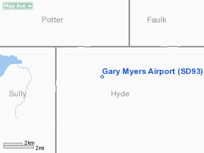
| From nearest city: | 16 nautical miles SE of Gettysburg, SD |
| Location: | Hyde County, SD |
| Magnetic Variation: | 08E (1995) |
Owner & Manager
| Ownership: | Privately owned |
| Owner: | Gary L. Myers |
| Address: | 17365 Holabird Grade
Onida, SD 57564-5001 |
| Phone number: | 605-852-2944 |
| Manager: | Gary L. Myers |
| Address: | 17365 Holabird Grade
Onida, SD 57564 |
| Phone number: | 605-852-2944 |
Airport Operations and Facilities
| Airport Use: | Private |
| Wind indicator: | Yes |
| Segmented Circle: | No |
| Control Tower: | No |
| Sectional chart: | Twin Cities |
| Region: | AGL - Great Lakes |
| Boundary ARTCC: | ZMP - Minneapolis |
| Tie-in FSS: | HON - Huron |
| FSS Toll Free: | 1-800-WX-BRIEF |
Airport Services
Runway Information
Runway 09/27
| Dimension: | 1500 x 45 ft / 457.2 x 13.7 m |
| Surface: | GRVL, |
| |
Runway 09 |
Runway 27 |
| Traffic Pattern: | Left | Right |
| Obstruction: | | 50 ft bldg, 500.0 ft from runway |
|
Runway 13/31
| Dimension: | 4000 x 48 ft / 1219.2 x 14.6 m |
| Surface: | GRVL, |
| |
Runway 13 |
Runway 31 |
| Traffic Pattern: | Left | Right |
| Obstruction: | 50 ft trees, 500.0 ft from runway | |
|
Radio Navigation Aids
| ID |
Type |
Name |
Ch |
Freq |
Var |
Dist |
| PIR | VORTAC | Pierre | 072X | 112.50 | 11E | 37.0 nm |
Remarks
- ALL TRAFFIC PATTERNS REMAIN NE OF ARPT.
- PRVDD YOU ADHERE TO RSTNS IN SD DOT AERONAUTICS COMMISSION DECISION, FINDINGS OF FACT, CONCLUSION OF LAW DATED 10-27-99; CLEAR 20:1 APCH CLEAR OBSTACLE FREE ZONE.
Images and information placed above are from
http://www.airport-data.com/airport/SD93/
We thank them for the data!
| General Info
|
| Country |
United States
|
| State |
SOUTH DAKOTA
|
| FAA ID |
SD93
|
| Latitude |
44-51-51.000N
|
| Longitude |
099-36-23.000W
|
| Elevation |
1930 feet
|
| Near City |
GETTYSBURG
|
We don't guarantee the information is fresh and accurate. The data may
be wrong or outdated.
For more up-to-date information please refer to other sources.
|
|


