 |
|
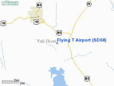
Location & QuickFacts
| FAA Information Effective: | 2008-09-25 |
| Airport Identifier: | SD68 |
| Airport Status: | Operational |
| Longitude/Latitude: | 103-25-51.7090W/43-23-04.9230N
-103.431030/43.384701 (Estimated) |
| Elevation: | 3675 ft / 1120.14 m (Estimated) |
| Land: | 2900 acres |
| From nearest city: | 3 nautical miles SE of Hot Springs, SD |
| Location: | Fall River County, SD |
| Magnetic Variation: | 11E (1985) |
Owner & Manager
| Ownership: | Privately owned |
| Owner: | Dean & Donna Tinaglia
AND MADONNA L TINAGLIA OR DEAN TINAGLIA. |
| Address: | 27622 Brook Dr.
Hot Springs, SD 57747 |
| Phone number: | 605-745-4449 |
| Address: |
|
Airport Operations and Facilities
| Airport Use: | Private |
| Wind indicator: | Yes |
| Segmented Circle: | No |
| Control Tower: | No |
| Beacon Color: | Clear-Green (lighted land airport) |
| Landing fee charge: | No |
| Sectional chart: | Cheyenne |
| Region: | AGL - Great Lakes |
| Boundary ARTCC: | ZDV - Denver |
| Tie-in FSS: | HON - Huron |
| FSS on Airport: | No |
| FSS Toll Free: | 1-800-WX-BRIEF |
Airport Communications
| Unicom: | 122.800
UNICOM ON REQUEST ONLY. |
Runway Information
Runway NW/SE
| Dimension: | 3300 x 80 ft / 1005.8 x 24.4 m |
| Surface: | TURF, |
| |
Runway NW |
Runway SE |
| Traffic Pattern: | Right | Left |
|
Radio Navigation Aids
| ID |
Type |
Name |
Ch |
Freq |
Var |
Dist |
| HIN | NDB | Whitney | | 275.00 | 11E | 36.5 nm |
| RA | NDB | Ranch | | 254.00 | 11E | 39.6 nm |
| RCA | TACAN | Ellsworth | 025X | | 11E | 47.5 nm |
| ECS | VOR | Newcastle | | 108.20 | 11E | 48.4 nm |
| CDR | VOR/DME | Chadron | 081X | 113.40 | 13E | 49.9 nm |
| RAP | VORTAC | Rapid City | 070X | 112.30 | 13E | 39.9 nm |
Remarks
- POLES SW
- INGRESS/EGRESS ROUTES TO/FRM N AND/OR S. TRAFFIC PATTERN NOT TO EXTEND BEYOND 1 MI E OF RWY.
Images and information placed above are from
http://www.airport-data.com/airport/SD68/
We thank them for the data!
| General Info
|
| Country |
United States
|
| State |
SOUTH DAKOTA
|
| FAA ID |
SD68
|
| Latitude |
43-23-04.923N
|
| Longitude |
103-25-51.709W
|
| Elevation |
3675 feet
|
| Near City |
HOT SPRINGS
|
We don't guarantee the information is fresh and accurate. The data may
be wrong or outdated.
For more up-to-date information please refer to other sources.
|
|


