 |
|
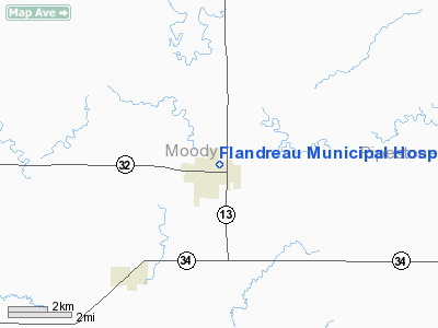
Flandreau Muni Hospital Heliport |
Location & QuickFacts
| FAA Information Effective: | 2008-09-25 |
| Airport Identifier: | SD67 |
| Airport Status: | Operational |
| Longitude/Latitude: | 096-35-31.2000W/44-03-05.9000N
-96.592000/44.051639 (Estimated) |
| Elevation: | 1570 ft / 478.54 m (Estimated) |
| Land: | 0 acres |
| From nearest city: | 0 nautical miles N of Flandreau, SD |
| Location: | Moody County, SD |
| Magnetic Variation: | 06E (1995) |
Owner & Manager
| Ownership: | Privately owned |
| Owner: | Flandreau Medical Center |
| Address: | 214 North Praire
Flandreau, SD 57028 |
| Phone number: | 605-997-2433 |
| Manager: | Flandreau Medical Center
BOB HANDBERG 605-997-3239 |
| Address: | 214 North Praire
Flandreau, SD 57028 |
| Phone number: | 605-997-2433 |
Airport Operations and Facilities
| Airport Use: | Private
MEDICAL USE. |
| Segmented Circle: | No |
| Control Tower: | No |
| Lighting Schedule: | PHONE REQ
FOR CORNER LGTS CALL 605-997-2433. |
| Sectional chart: | Omaha |
| Region: | AGL - Great Lakes |
| Boundary ARTCC: | ZMP - Minneapolis |
| Tie-in FSS: | HON - Huron |
| FSS on Airport: | No |
| FSS Toll Free: | 1-800-WX-BRIEF |
Runway Information
Helipad H1
| Dimension: | 30 x 30 ft / 9.1 x 9.1 m |
| Surface: | CONC, |
| |
Runway H1 |
Runway |
| Traffic Pattern: | Left | Left |
|
Radio Navigation Aids
| ID |
Type |
Name |
Ch |
Freq |
Var |
Dist |
| MDS | NDB | Wentworth | | 400.00 | 05E | 21.6 nm |
| FS | NDB | Rokky | | 245.00 | 06E | 35.0 nm |
| PQN | NDB/DME | Pipestone | 028X | 284.00 | 06E | 13.4 nm |
| BKX | VOR/DME | Brookings | 025X | 108.80 | 06E | 17.9 nm |
| MML | VOR/DME | Marshall | 047X | 111.00 | 05E | 40.7 nm |
| FSD | VORTAC | Sioux Falls | 097X | 115.00 | 09E | 25.5 nm |
Remarks
- ALL APCH/DEP HELI OPNS CONDUCTED IN AN AREA FM 200-100;AREA IS MKD; A WIND INDICATOR I SMAINTAINED & FAR PART 91 126(B)(2) IS COMPLIED WITH IN ARR/DEP HELIPORT.
Images and information placed above are from
http://www.airport-data.com/airport/SD67/
We thank them for the data!
| General Info
|
| Country |
United States
|
| State |
SOUTH DAKOTA
|
| FAA ID |
SD67
|
| Latitude |
44-03-05.900N
|
| Longitude |
096-35-31.200W
|
| Elevation |
1570 feet
|
| Near City |
FLANDREAU
|
We don't guarantee the information is fresh and accurate. The data may
be wrong or outdated.
For more up-to-date information please refer to other sources.
|
|


