 |
|
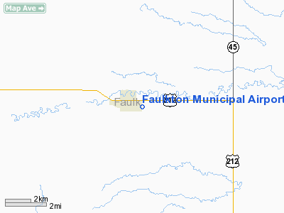
Location & QuickFacts
| FAA Information Effective: | 2008-09-25 |
| Airport Identifier: | 3FU |
| Airport Status: | Operational |
| Longitude/Latitude: | 099-06-45.3850W/45-01-49.2500N
-99.112607/45.030347 (Estimated) |
| Elevation: | 1569 ft / 478.23 m (Surveyed) |
| Land: | 108 acres |
| From nearest city: | 1 nautical miles E of Faulkton, SD |
| Location: | Faulk County, SD |
| Magnetic Variation: | 08E (1985) |
Owner & Manager
| Ownership: | Publicly owned |
| Owner: | City Of Faulkton |
| Address: | P O Box 21
Faulkton, SD 57438 |
| Phone number: | 605-598-6515 |
| Manager: | Jerod Raethz |
| Address: | P O Box 21
Faulkton, SD 57438 |
| Phone number: | (605) 216-6969 |
Airport Operations and Facilities
| Airport Use: | Open to public |
| Wind indicator: | Yes |
| Segmented Circle: | Yes |
| Control Tower: | No |
| Lighting Schedule: | DUSK-DAWN |
| Beacon Color: | Clear-Green (lighted land airport) |
| Landing fee charge: | No |
| Sectional chart: | Twin Cities |
| Region: | AGL - Great Lakes |
| Boundary ARTCC: | ZMP - Minneapolis |
| Tie-in FSS: | HON - Huron |
| FSS on Airport: | No |
| FSS Toll Free: | 1-800-WX-BRIEF |
| NOTAMs Facility: | HON (NOTAM-d service avaliable) |
| Federal Agreements: | NGY |
Airport Communications
Airport Services
| Airframe Repair: | NONE |
| Power Plant Repair: | NONE |
| Bottled Oxygen: | NONE |
| Bulk Oxygen: | NONE |
Runway Information
Runway 13/31
| Dimension: | 3000 x 60 ft / 914.4 x 18.3 m |
| Surface: | ASPH, Good Condition |
| Weight Limit: | Single wheel: 12500 lbs. |
| Edge Lights: | Low |
| |
Runway 13 |
Runway 31 |
| Longitude: | 099-06-59.8900W | 099-06-30.8800W |
| Latitude: | 45-01-59.9000N | 45-01-38.6000N |
| Elevation: | 1567.00 ft | 1570.00 ft |
| Traffic Pattern: | Left | Left |
| Markings: | Basic, Good Condition | Basic, Good Condition |
| Displaced threshold: | 225.00 ft | 0.00 ft |
| Runway End Identifier: | No | No |
| Centerline Lights: | No | No |
| Touchdown Lights: | No | No |
| Obstruction: | 16 ft road, 560.0 ft from runway, 22:1 slope to clear
APCH RATIO 50:1 TO DSPLCD THLD. | 5 ft fence, 350.0 ft from runway, 30:1 slope to clear |
|
Radio Navigation Aids
| ID |
Type |
Name |
Ch |
Freq |
Var |
Dist |
| ABR | VOR/DME | Aberdeen | 077X | 113.00 | 07E | 39.2 nm |
| HON | VORTAC | Huron | 123X | 117.60 | 10E | 49.3 nm |
Remarks
- RY 13 4 FT FENCE 200 FT RIGHT 415 FT FROM THR; TOP OF FENCE BLO RY END ELEVATION.
Images and information placed above are from
http://www.airport-data.com/airport/3FU/
We thank them for the data!
| General Info
|
| Country |
United States
|
| State |
SOUTH DAKOTA
|
| FAA ID |
3FU
|
| Latitude |
45-01-54.907N
|
| Longitude |
099-06-56.391W
|
| Elevation |
1569 feet
|
| Near City |
FAULKTON
|
We don't guarantee the information is fresh and accurate. The data may
be wrong or outdated.
For more up-to-date information please refer to other sources.
|
|


