 |
|
Location & QuickFacts
| FAA Information Effective: | 2008-09-25 |
| Airport Identifier: | D07 |
| Airport Status: | Operational |
| Longitude/Latitude: | 102-01-11.5690W/45-02-09.9390N
-102.019880/45.036094 (Estimated) |
| Elevation: | 2582 ft / 786.99 m (Estimated) |
| Land: | 78 acres |
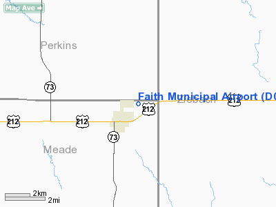
| From nearest city: | 1 nautical miles E of Faith, SD |
| Location: | Meade County, SD |
| Magnetic Variation: | 11E (1985) |
Owner & Manager
| Ownership: | Publicly owned |
| Owner: | City Of Faith |
| Address: | Po Box 368
Faith, SD 57626 |
| Phone number: | 605-967-2261 |
| Manager: | Dave Gebhart |
| Address: | Po Box 494
Faith, SD 57626 |
| Phone number: | 605-967-2261 |
Airport Operations and Facilities
| Airport Use: | Open to public |
| Wind indicator: | Yes |
| Segmented Circle: | Yes |
| Control Tower: | No |
| Lighting Schedule: | DUSK-DAWN
ACTVT MIRL RY 13/31 & PAPI RY 13/31 - CTAF |
| Beacon Color: | Clear-Green (lighted land airport) |
| Landing fee charge: | No |
| Sectional chart: | Billings |
| Region: | AGL - Great Lakes |
| Boundary ARTCC: | ZMP - Minneapolis |
| Tie-in FSS: | HON - Huron |
| FSS on Airport: | No |
| FSS Toll Free: | 1-800-WX-BRIEF |
| NOTAMs Facility: | HON (NOTAM-d service avaliable) |
| Federal Agreements: | NGY |
Airport Communications
Airport Services
| Fuel available: | 100LL
FOR FUEL CALL 605-967-2222. |
| Airframe Repair: | MAJOR |
| Power Plant Repair: | MAJOR |
Runway Information
Runway 13/31
| Dimension: | 4200 x 60 ft / 1280.2 x 18.3 m |
| Surface: | ASPH, Good Condition |
| Weight Limit: | Single wheel: 12500 lbs. |
| Edge Lights: | Medium |
| |
Runway 13 |
Runway 31 |
| Longitude: | 102-01-30.5700W | 102-00-57.1300W |
| Latitude: | 45-02-21.4400N | 45-01-49.8500N |
| Elevation: | 2556.00 ft | 2582.00 ft |
| Traffic Pattern: | Left | Left |
| Markings: | Non-precision instrument, Good Condition | Non-precision instrument, Good Condition |
| VASI: | 2-light PAPI on left side | 2-light PAPI on left side |
| Obstruction: | , 50:1 slope to clear | 22 ft road, 713.0 ft from runway, 23:1 slope to clear |
|
Radio Navigation Aids
| ID |
Type |
Name |
Ch |
Freq |
Var |
Dist |
| DPR | VORTAC | Dupree | 115X | 116.80 | 10E | 13.2 nm |
Remarks
- WILDLIFE ON & INVOF ARPT.
Images and information placed above are from
http://www.airport-data.com/airport/D07/
We thank them for the data!
| General Info
|
| Country |
United States
|
| State |
SOUTH DAKOTA
|
| FAA ID |
D07
|
| Latitude |
45-02-09.939N
|
| Longitude |
102-01-11.569W
|
| Elevation |
2582 feet
|
| Near City |
FAITH
|
We don't guarantee the information is fresh and accurate. The data may
be wrong or outdated.
For more up-to-date information please refer to other sources.
|
|


