 |
|
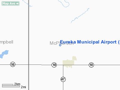
Location & QuickFacts
| FAA Information Effective: | 2008-09-25 |
| Airport Identifier: | 3W8 |
| Airport Status: | Operational |
| Longitude/Latitude: | 099-38-31.4250W/45-47-59.9320N
-99.642062/45.799981 (Estimated) |
| Elevation: | 1935 ft / 589.79 m (Estimated) |
| Land: | 183 acres |
| From nearest city: | 2 nautical miles N of Eureka, SD |
| Location: | Mc Pherson County, SD |
| Magnetic Variation: | 08E (1985) |
Owner & Manager
| Ownership: | Publicly owned |
| Owner: | City Of Eureka |
| Address: | Po Box 655
Eureka, SD 57437 |
| Phone number: | 605-284-2441 |
| Manager: | Lisa Kauk |
| Address: | City Of Eureka, Finance Officer, Po Box 655
Eureka, SD 57437 |
| Phone number: | 605-284-2441 |
Airport Operations and Facilities
| Airport Use: | Open to public |
| Wind indicator: | Yes |
| Segmented Circle: | No |
| Control Tower: | No |
| Lighting Schedule: | DUSK-DAWN
ACTVT LIRL RY 12/30- 122.8. |
| Beacon Color: | Clear-Green (lighted land airport) |
| Landing fee charge: | No |
| Sectional chart: | Twin Cities |
| Region: | AGL - Great Lakes |
| Boundary ARTCC: | ZMP - Minneapolis |
| Tie-in FSS: | HON - Huron |
| FSS on Airport: | No |
| FSS Toll Free: | 1-800-WX-BRIEF |
| NOTAMs Facility: | HON (NOTAM-d service avaliable) |
| Federal Agreements: | NGY |
Airport Communications
Airport Services
| Airframe Repair: | NONE |
| Power Plant Repair: | NONE |
| Bottled Oxygen: | NONE |
| Bulk Oxygen: | NONE |
Runway Information
Runway 07/25
| Dimension: | 2100 x 150 ft / 640.1 x 45.7 m |
| Surface: | TURF, Good Condition |
| |
Runway 07 |
Runway 25 |
| Longitude: | 099-38-42.3500W | 099-38-13.0100W |
| Latitude: | 45-47-54.5100N | 45-47-57.4700N |
| Elevation: | 1930.00 ft | 1924.00 ft |
| Traffic Pattern: | Left | Left |
| Obstruction: | 4 ft fence, 80.0 ft from runway, 20:1 slope to clear | , 50:1 slope to clear |
|
Runway 12/30
| Dimension: | 3100 x 60 ft / 944.9 x 18.3 m |
| Surface: | ASPH-TRTD, Good Condition |
| Surface Treatment: | Aggregate Friction Seal Coat |
| Edge Lights: | Low |
| |
Runway 12 |
Runway 30 |
| Traffic Pattern: | Left | Left |
| Markings: | Basic, Good Condition | Basic, Good Condition |
|
Radio Navigation Aids
| ID |
Type |
Name |
Ch |
Freq |
Var |
Dist |
| RVB | NDB | Riverbend | | 407.00 | 09E | 35.6 nm |
Remarks
- WILDLIFE ON AND INVOF ARPT.
Images and information placed above are from
http://www.airport-data.com/airport/3W8/
We thank them for the data!
| General Info
|
| Country |
United States
|
| State |
SOUTH DAKOTA
|
| FAA ID |
3W8
|
| Latitude |
45-47-59.932N
|
| Longitude |
099-38-31.425W
|
| Elevation |
1935 feet
|
| Near City |
EUREKA
|
We don't guarantee the information is fresh and accurate. The data may
be wrong or outdated.
For more up-to-date information please refer to other sources.
|
|


