 |
|
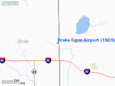
Location & QuickFacts
| FAA Information Effective: | 2008-09-25 |
| Airport Identifier: | 1SD5 |
| Airport Status: | Operational |
| Longitude/Latitude: | 098-47-55.3250W/43-46-06.9870N
-98.798701/43.768608 (Estimated) |
| Elevation: | 1659 ft / 505.66 m (Estimated) |
| Land: | 0 acres |
| From nearest city: | 4 nautical miles NW of White Lake, SD |
| Location: | Brule County, SD |
| Magnetic Variation: | 08E (1985) |
Owner & Manager
| Ownership: | Privately owned |
| Owner: | Don A. Drake |
| Address: |
White Lake, SD 57383 |
| Phone number: | 605-334-2417 |
| Manager: | Don Drake
DON DRAKE IS TO BE CONTACTED BY ANYONE PLANNING TO USE ARPT. |
| Address: | 600 West 37th St
Sioux Falls, SD 57105 |
| Phone number: | 605-335-6665 |
Airport Operations and Facilities
| Airport Use: | Private |
| Wind indicator: | Yes |
| Segmented Circle: | No |
| Control Tower: | No |
| Sectional chart: | Omaha |
| Region: | AGL - Great Lakes |
| Boundary ARTCC: | ZMP - Minneapolis |
| Tie-in FSS: | HON - Huron |
| FSS on Airport: | No |
| FSS Toll Free: | 1-800-WX-BRIEF |
Runway Information
Runway N/S
| Dimension: | 4300 x 90 ft / 1310.6 x 27.4 m |
| Surface: | TURF, |
| |
Runway N |
Runway S |
| Traffic Pattern: | Left | Left |
|
Radio Navigation Aids
| ID |
Type |
Name |
Ch |
Freq |
Var |
Dist |
| AGZ | NDB | Wagner | | 392.00 | 08E | 47.9 nm |
| ISD | VOR | Winner | | 112.80 | 08E | 45.2 nm |
| MHE | VOR/DME | Mitchell | 029X | 109.20 | 07E | 33.0 nm |
| HON | VORTAC | Huron | 123X | 117.60 | 10E | 45.5 nm |
Remarks
- FILED FOR RECORD PURPOSES ONLY.
Images and information placed above are from
http://www.airport-data.com/airport/1SD5/
We thank them for the data!
| General Info
|
| Country |
United States
|
| State |
SOUTH DAKOTA
|
| FAA ID |
1SD5
|
| Latitude |
43-46-06.987N
|
| Longitude |
098-47-55.325W
|
| Elevation |
1659 feet
|
| Near City |
WHITE LAKE
|
We don't guarantee the information is fresh and accurate. The data may
be wrong or outdated.
For more up-to-date information please refer to other sources.
|
|


