 |
|
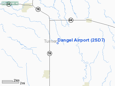
Location & QuickFacts
| FAA Information Effective: | 2008-09-25 |
| Airport Identifier: | 2SD7 |
| Airport Status: | Operational |
| Longitude/Latitude: | 097-03-46.1900W/43-19-59.9400N
-97.062831/43.333317 (Estimated) |
| Elevation: | 1284 ft / 391.36 m (Estimated) |
| Land: | 0 acres |
| From nearest city: | 3 nautical miles NE of Hurley, SD |
| Location: | Turner County, SD |
| Magnetic Variation: | 06E (1995) |
Owner & Manager
| Ownership: | Privately owned |
| Owner: | Russell Dangel |
| Address: | 304 Iowa St
Hurley, SD 57036 |
| Phone number: | 605-238-6553 |
| Manager: | Russell Dangel |
| Address: | 304 Iowa St
Hurley, SD 57036 |
| Phone number: | 605-238-6553 |
Airport Operations and Facilities
| Airport Use: | Private |
| Wind indicator: | Yes |
| Segmented Circle: | No |
| Control Tower: | No |
| Lighting Schedule: | RDO-CTL
ACTVT MIRL RY 18/36 - 122.9 |
| Sectional chart: | Omaha |
| Region: | AGL - Great Lakes |
| Boundary ARTCC: | ZMP - Minneapolis |
| Tie-in FSS: | HON - Huron |
| FSS Toll Free: | 1-800-WX-BRIEF |
Runway Information
Runway 18/36
| Dimension: | 2600 x 75 ft / 792.5 x 22.9 m |
| Surface: | TURF, |
| Edge Lights: | Non-standard lighting system
NSTD LIRL RY 18/36, 5 PAIRS OF RY LGTS - ONE PAIR AT EACH END OF RY - ONE PAIR AT THE MIDDLE OF THE RY - ONE PAIR SPACED EVENLY BTN THE RY END AND THE MIDDLE OF TH RY. |
| |
Runway 18 |
Runway 36 |
| Traffic Pattern: | Left | Left |
| Obstruction: | | 15 ft road, 100.0 ft from runway |
|
Radio Navigation Aids
| ID |
Type |
Name |
Ch |
Freq |
Var |
Dist |
| FS | NDB | Rokky | | 245.00 | 06E | 14.1 nm |
| VMR | NDB | Vermillion | | 375.00 | 06E | 34.7 nm |
| SOY | NDB | Sioux Center | | 368.00 | 06E | 40.1 nm |
| MDS | NDB | Wentworth | | 400.00 | 05E | 40.9 nm |
| ORC | NDB | Orange City | | 521.00 | 05E | 48.5 nm |
| YKN | VOR/DME | Yankton | 051X | 111.40 | 07E | 28.7 nm |
| FSD | VORTAC | Sioux Falls | 097X | 115.00 | 09E | 22.6 nm |
Remarks
- PRVDD CLEAR 20:1 APCH, CLEAR OBSTAC LE FREE ZONE, AND CLEAR RY SAFETY AREA.
Images and information placed above are from
http://www.airport-data.com/airport/2SD7/
We thank them for the data!
| General Info
|
| Country |
United States
|
| State |
SOUTH DAKOTA
|
| FAA ID |
2SD7
|
| Latitude |
43-19-59.940N
|
| Longitude |
097-02-36.190W
|
| Elevation |
1280 feet
|
| Near City |
HURLEY
|
We don't guarantee the information is fresh and accurate. The data may
be wrong or outdated.
For more up-to-date information please refer to other sources.
|
|


