 |
|
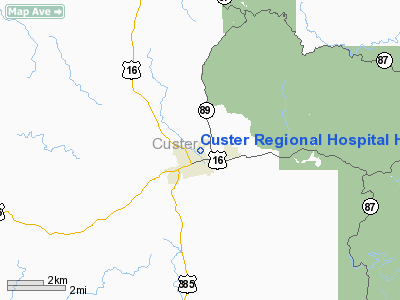
Custer Rgnl Hospital Heliport |
Location & QuickFacts
| FAA Information Effective: | 2008-09-25 |
| Airport Identifier: | SD86 |
| Airport Status: | Operational |
| Longitude/Latitude: | 103-35-37.7000W/43-46-22.9400N
-103.593806/43.773039 (Estimated) |
| Elevation: | 5300 ft / 1615.44 m (Estimated) |
| Land: | 0 acres |
| From nearest city: | 0 nautical miles NE of Custer, SD |
| Location: | Custer County, SD |
| Magnetic Variation: | () |
Owner & Manager
| Ownership: | Privately owned |
| Owner: | Custer Regional Hospital |
| Address: | 1039 Montgomery St
Custer, SD 57730 |
| Phone number: | 605-673-2229 |
| Manager: | Custer Regional Hospital |
| Address: | 1039 Montgomery St
Custer, SD 57730 |
| Phone number: | 605-673-2229
X232. |
Airport Operations and Facilities
| Airport Use: | Private
MEDICAL USE. |
| Wind indicator: | Yes |
| Control Tower: | No |
| Lighting Schedule: | DUSK DAWN |
| Sectional chart: | Cheyenne |
| Region: | AGL - Great Lakes |
| Boundary ARTCC: | ZDV - Denver |
| Tie-in FSS: | HON - Huron |
| FSS Toll Free: | 1-800-WX-BRIEF |
Runway Information
Helipad H1
| Dimension: | 20 x 20 ft / 6.1 x 6.1 m |
| Surface: | CONC, |
| |
Runway H1 |
Runway |
| Traffic Pattern: | Left | Left |
|
Radio Navigation Aids
| ID |
Type |
Name |
Ch |
Freq |
Var |
Dist |
| RA | NDB | Ranch | | 254.00 | 11E | 28.2 nm |
| SPF | NDB | Black Hills | | 300.00 | 11E | 43.5 nm |
| RCA | TACAN | Ellsworth | 025X | | 11E | 30.6 nm |
| ECS | VOR | Newcastle | | 108.20 | 11E | 31.6 nm |
| RAP | VORTAC | Rapid City | 070X | 112.30 | 13E | 28.0 nm |
Remarks
- 45 FT PLINES 1000 FT ESE OF PAD.
- PRVDD ALL APCH/DEP FN 066 TO 170 DEGREES AND FM 205 TO 230 DEGREES; PLINES 1000 FT ESE ARE MARKED; PHONE AND CABLE LINES 60 FT SW ARE REMOVED; NO NIGHT OPS UNLESS UBLESS INSTALL WIND SOCK & ROTG BCN.
Images and information placed above are from
http://www.airport-data.com/airport/SD86/
We thank them for the data!
|
|


