 |
|
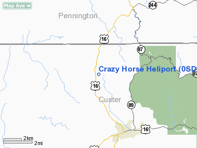
Location & QuickFacts
| FAA Information Effective: | 2008-09-25 |
| Airport Identifier: | 0SD9 |
| Airport Status: | Operational |
| Longitude/Latitude: | 103-38-08.7000W/43-49-29.9000N
-103.635750/43.824972 (Estimated) |
| Elevation: | 5900 ft / 1798.32 m (Estimated) |
| Land: | 0 acres |
| From nearest city: | 4 nautical miles NW of Custer, SD |
| Location: | Custer County, SD |
| Magnetic Variation: | 11E (1995) |
Owner & Manager
| Ownership: | Privately owned |
| Owner: | Rapid Helicopters Inc |
| Address: | 1905 West Main
Rapid City, SD 57702 |
| Phone number: | 605-343-5058 |
| Manager: | Rapid Helicopters Inc |
| Address: | 1905 West Main
Rapid City, SD 57702 |
| Phone number: | 605-343-5058 |
Airport Operations and Facilities
| Airport Use: | Private |
| Wind indicator: | Yes |
| Segmented Circle: | No |
| Control Tower: | No |
| Landing fee charge: | No |
| Sectional chart: | Cheyenne |
| Region: | AGL - Great Lakes |
| Boundary ARTCC: | ZDV - Denver |
| Tie-in FSS: | HON - Huron |
| FSS on Airport: | No |
| FSS Toll Free: | 1-800-WX-BRIEF |
Airport Communications
Airport Services
Runway Information
Helipad H1
| Dimension: | 20 x 20 ft / 6.1 x 6.1 m |
| Surface: | WOOD, |
| |
Runway H1 |
Runway |
| Traffic Pattern: | Left | Left |
|
Radio Navigation Aids
| ID |
Type |
Name |
Ch |
Freq |
Var |
Dist |
| RA | NDB | Ranch | | 254.00 | 11E | 28.8 nm |
| SPF | NDB | Black Hills | | 300.00 | 11E | 40.1 nm |
| RCA | TACAN | Ellsworth | 025X | | 11E | 29.8 nm |
| ECS | VOR | Newcastle | | 108.20 | 11E | 29.3 nm |
| RAP | VORTAC | Rapid City | 070X | 112.30 | 13E | 28.5 nm |
Remarks
- PRVDD APCH/DEP ROUTE CONDUCTED 120-160 AND 300-340 USING TOUCHPAD AS CNTR; TKOF/LANDING AREA MKD; MAINTAINTED WIND INDICATOR ADJACENT TO TKOF/LANDING AREA; COMPLIANCE WITH WITH PART 91.126(B)(2).
Images and information placed above are from
http://www.airport-data.com/airport/0SD9/
We thank them for the data!
| General Info
|
| Country |
United States
|
| State |
SOUTH DAKOTA
|
| FAA ID |
0SD9
|
| Latitude |
43-49-29.900N
|
| Longitude |
103-38-08.700W
|
| Elevation |
5900 feet
|
| Near City |
CUSTER
|
We don't guarantee the information is fresh and accurate. The data may
be wrong or outdated.
For more up-to-date information please refer to other sources.
|
|


