 |
|
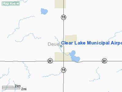
Location & QuickFacts
| FAA Information Effective: | 2008-09-25 |
| Airport Identifier: | 5H3 |
| Airport Status: | Operational |
| Longitude/Latitude: | 096-41-17.2110W/44-46-16.8720N
-96.688114/44.771353 (Estimated) |
| Elevation: | 1801 ft / 548.94 m (Surveyed) |
| Land: | 160 acres |
| From nearest city: | 1 nautical miles N of Clear Lake, SD |
| Location: | Deuel County, SD |
| Magnetic Variation: | 06E (1985) |
Owner & Manager
| Ownership: | Publicly owned |
| Owner: | City Of Clear Lake |
| Address: | P O Box 27
Clear Lake, SD 57226 |
| Phone number: | 605-874-2121 |
| Manager: | Alan Severson |
| Address: | Po Box 27
Clear Lake, SD 57226 |
| Phone number: | 605-874-2121 |
Airport Operations and Facilities
| Airport Use: | Open to public |
| Wind indicator: | Yes |
| Segmented Circle: | No |
| Control Tower: | No |
| Lighting Schedule: | DUSK-DAWN
ACTVT LIRL RY 13/31 - CTAF. |
| Beacon Color: | Clear-Green (lighted land airport) |
| Landing fee charge: | No |
| Sectional chart: | Twin Cities |
| Region: | AGL - Great Lakes |
| Boundary ARTCC: | ZMP - Minneapolis |
| Tie-in FSS: | HON - Huron |
| FSS on Airport: | No |
| FSS Toll Free: | 1-800-WX-BRIEF |
| NOTAMs Facility: | HON (NOTAM-d service avaliable) |
| Federal Agreements: | 1 |
Airport Communications
Airport Services
| Airframe Repair: | NONE |
| Power Plant Repair: | NONE |
| Bottled Oxygen: | NONE |
| Bulk Oxygen: | NONE |
Runway Information
Runway 02/20
| Dimension: | 2130 x 150 ft / 649.2 x 45.7 m |
| Surface: | TURF, |
| |
Runway 02 |
Runway 20 |
| Longitude: | 096-38-57.8400W | 096-38-47.4700W |
| Latitude: | 44-46-09.4400N | 44-46-29.1300N |
| Elevation: | 1790.00 ft | 1793.00 ft |
| Traffic Pattern: | Left | Left |
| Obstruction: | , 50:1 slope to clear | 17 ft road, 375.0 ft from runway, 22:1 slope to clear |
|
Runway 13/31
| Dimension: | 3000 x 150 ft / 914.4 x 45.7 m |
| Surface: | TURF, |
| Edge Lights: | Low |
| |
Runway 13 |
Runway 31 |
| Longitude: | 096-39-00.5200W | 096-38-33.2100W |
| Latitude: | 44-46-29.7100N | 44-46-07.3700N |
| Elevation: | 1798.00 ft | 1792.00 ft |
| Traffic Pattern: | Left | Left |
| Runway End Identifier: | No | No |
| Centerline Lights: | No | No |
| Touchdown Lights: | No | No |
| Obstruction: | 17 ft road, 340.0 ft from runway, 20:1 slope to clear | 21 ft pline, 420.0 ft from runway, 20:1 slope to clear |
|
Radio Navigation Aids
| ID |
Type |
Name |
Ch |
Freq |
Var |
Dist |
| DXX | NDB | Dawson/madison | | 341.00 | 06E | 25.2 nm |
| VVV | NDB | Ortonville | | 332.00 | 05E | 33.8 nm |
| AQP | NDB | Appleton | | 356.00 | 05E | 39.8 nm |
| MDS | NDB | Wentworth | | 400.00 | 05E | 48.7 nm |
| BKX | VOR/DME | Brookings | 025X | 108.80 | 06E | 28.7 nm |
| MML | VOR/DME | Marshall | 047X | 111.00 | 05E | 41.7 nm |
| MVE | VOR/DME | Montevideo | 053X | 111.60 | 05E | 43.3 nm |
| ATY | VORTAC | Watertown | 113X | 116.60 | 09E | 23.0 nm |
Remarks
- RY 31 +4' FENCE 255' FM THR;
- RY 02 +4' FENCE 145' FM THR.
- ARPT CLSD WINTER MONTHS DUE TO SNOW CONDITIONS, CALL 605-874-2121 FOR CONDITIONS .
- PRVDD RY IS PROPERLY MKD AND THE LNDG THRS ARE LCTD TO PROVIDE A CLEAR 20:1 SLOPE OVR OBSTNS.
Images and information placed above are from
http://www.airport-data.com/airport/5H3/
We thank them for the data!
| General Info
|
| Country |
United States
|
| State |
SOUTH DAKOTA
|
| FAA ID |
5H3
|
| Latitude |
44-46-16.872N
|
| Longitude |
096-41-17.211W
|
| Elevation |
1801 feet
|
| Near City |
CLEAR LAKE
|
We don't guarantee the information is fresh and accurate. The data may
be wrong or outdated.
For more up-to-date information please refer to other sources.
|
|


