 |
|
Coordinates: 44°53′42″N 097°42′39″W / 44.895°N 97.71083°W / 44.895; -97.71083
| Clark County Airport |
| IATA: none – ICAO: none – FAA LID: 8D7 |
| Summary |
| Airport type |
Public |
| Owner |
County of Clark |
| Serves |
Clark, South Dakota |
| Elevation AMSL |
1,792 ft / 546 m |
| Runways |
| Direction |
Length |
Surface |
| ft |
m |
| 13/31 |
3,700 |
1,128 |
Asphalt |
| 3/21 |
2,800 |
853 |
Turf |
| Statistics (2006) |
| Aircraft operations |
2,650 |
| Based aircraft |
10 |
| Source: Federal Aviation Administration |
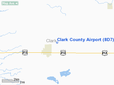
Clark County Airport (FAA LID: 8D7) is a county-owned public-use airport located two miles (3 km) northeast of the central business district of Clark, in Clark County, South Dakota, United States.
Facilities and aircraft
Clark County Airport covers an area of 196 acres (79 ha) which contains two runways: 13/31 with a 3,700 x 60 ft (1,128 x 18 m) asphalt pavement and 3/21 with a 2,800 x 100 ft (853 x 30 m) turf surface. For the 12-month period ending May 1, 2006, the airport had 2,650 aircraft operations: 94% general aviation and 6% air taxi.
The above content comes from Wikipedia and is published under free licenses – click here to read more.
Location & QuickFacts
| FAA Information Effective: | 2008-09-25 |
| Airport Identifier: | 8D7 |
| Airport Status: | Operational |
| Longitude/Latitude: | 097-42-38.8810W/44-53-42.0860N
-97.710800/44.895024 (Estimated) |
| Elevation: | 1792 ft / 546.20 m (Surveyed) |
| Land: | 196 acres |
| From nearest city: | 2 nautical miles NE of Clark, SD |
| Location: | Clark County, SD |
| Magnetic Variation: | 07E (1985) |
Owner & Manager
| Ownership: | Publicly owned |
| Owner: | County Of Clark |
| Address: | P O Box 294
Clark, SD 57225 |
| Phone number: | 605-532-3512 |
| Manager: | C.l. Wagner |
| Address: | Po Box 3
Clark, SD 57225 |
| Phone number: | 605-532-3862 |
Airport Operations and Facilities
| Airport Use: | Open to public |
| Wind indicator: | Yes |
| Segmented Circle: | Yes |
| Control Tower: | No |
| Lighting Schedule: | DUSK-DAWN |
| Beacon Color: | Clear-Green (lighted land airport) |
| Landing fee charge: | No |
| Sectional chart: | Twin Cities |
| Region: | AGL - Great Lakes |
| Boundary ARTCC: | ZMP - Minneapolis |
| Tie-in FSS: | HON - Huron |
| FSS on Airport: | No |
| FSS Toll Free: | 1-800-WX-BRIEF |
| NOTAMs Facility: | HON (NOTAM-d service avaliable) |
| Federal Agreements: | N1 |
Airport Communications
| CTAF: | 122.800 |
| Unicom: | 122.800
UNICOM UNMONITORED. |
Airport Services
| Airframe Repair: | MAJOR |
| Power Plant Repair: | MAJOR |
| Bottled Oxygen: | NONE |
| Bulk Oxygen: | NONE |
Runway Information
Runway 03/21
| Dimension: | 2800 x 100 ft / 853.4 x 30.5 m |
| Surface: | TURF, Fair Condition
SW END OF RY SOFT WHEN WET. |
| |
Runway 03 |
Runway 21 |
| Longitude: | 097-42-55.6850W | 097-42-29.6200W |
| Latitude: | 44-53-34.2600N | 44-53-54.8000N |
| Elevation: | 1788.00 ft | 1784.00 ft |
| Traffic Pattern: | Left | Left |
| Runway End Identifier: | No | No |
| Centerline Lights: | No | No |
| Touchdown Lights: | No | No |
| Obstruction: | 17 ft road, 400.0 ft from runway, 165 ft right of centerline, 23:1 slope to clear | 50 ft trees, 1500.0 ft from runway, 305 ft right of centerline, 30:1 slope to clear |
|
Runway 13/31
| Dimension: | 3700 x 60 ft / 1127.8 x 18.3 m |
| Surface: | ASPH,
SW END OF RY SOFT WHEN WET. |
| Weight Limit: | Single wheel: 13000 lbs. |
| Edge Lights: | Low |
| |
Runway 13 |
Runway 31 |
| Longitude: | 097-42-55.1250W | 097-42-16.9220W |
| Latitude: | 44-53-52.4400N | 44-53-28.0300N |
| Elevation: | 1792.00 ft | 1786.00 ft |
| Traffic Pattern: | Left | Left |
| Markings: | Basic, Good Condition | Basic, Good Condition |
| Runway End Identifier: | No | No |
| Centerline Lights: | No | No |
| Touchdown Lights: | No | No |
| Obstruction: | 19 ft road, 893.0 ft from runway, 36:1 slope to clear | , 50:1 slope to clear |
|
Radio Navigation Aids
| ID |
Type |
Name |
Ch |
Freq |
Var |
Dist |
| ABR | VOR/DME | Aberdeen | 077X | 113.00 | 07E | 42.0 nm |
| ATY | VORTAC | Watertown | 113X | 116.60 | 09E | 24.7 nm |
| HON | VORTAC | Huron | 123X | 117.60 | 10E | 37.5 nm |
Remarks
- RY 21 HAS 3 FT FENCE 215 FT FM THLD.
- WILDLIFE AROUND AND INVOF ARPT.
Images and information placed above are from
http://www.airport-data.com/airport/8D7/
We thank them for the data!
| General Info
|
| Country |
United States
|
| State |
SOUTH DAKOTA
|
| FAA ID |
8D7
|
| Latitude |
44-53-42.086N
|
| Longitude |
097-42-38.881W
|
| Elevation |
1792 feet
|
| Near City |
CLARK
|
We don't guarantee the information is fresh and accurate. The data may
be wrong or outdated.
For more up-to-date information please refer to other sources.
|
|


