 |
|
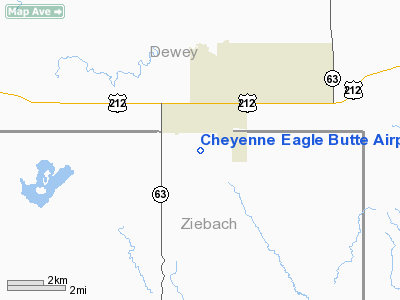
Cheyenne Eagle Butte Airport |
Location & QuickFacts
| FAA Information Effective: | 2008-09-25 |
| Airport Identifier: | 84D |
| Airport Status: | Operational |
| Longitude/Latitude: | 101-15-03.7500W/44-59-03.7500N
-101.251042/44.984375 (Estimated) |
| Elevation: | 2447 ft / 745.85 m (Surveyed) |
| Land: | 142 acres |
| From nearest city: | 1 nautical miles S of Eagle Butte, SD |
| Location: | Ziebach County, SD |
| Magnetic Variation: | 09E (1995) |
Owner & Manager
| Ownership: | Publicly owned |
| Owner: | City Eag Butte&chey Rvr Sioux Tribe |
| Address: | Box 150
Eagle Butte, SD 57625 |
| Phone number: | 605-964-8783 |
| Manager: | Dean Schrempp |
| Address: | Box 62
Lantry, SD 57636-0062 |
| Phone number: | 605-964-6541 |
Airport Operations and Facilities
| Airport Use: | Open to public |
| Wind indicator: | Yes |
| Segmented Circle: | No |
| Control Tower: | No |
| Lighting Schedule: | DUSK-DAWN
ACTVT MIRL RY 13/31 - 122.8. |
| Beacon Color: | Clear-Green (lighted land airport) |
| Landing fee charge: | No |
| Sectional chart: | Billings |
| Region: | AGL - Great Lakes |
| Boundary ARTCC: | ZMP - Minneapolis |
| Tie-in FSS: | HON - Huron |
| FSS on Airport: | No |
| FSS Toll Free: | 1-800-WX-BRIEF |
| NOTAMs Facility: | HON (NOTAM-d service avaliable) |
| Federal Agreements: | NGY |
Airport Communications
Airport Services
Runway Information
Runway 13/31
| Dimension: | 4200 x 60 ft / 1280.2 x 18.3 m |
| Surface: | ASPH, Good Condition |
| Weight Limit: | Single wheel: 12500 lbs. |
| Edge Lights: | Medium |
| |
Runway 13 |
Runway 31 |
| Longitude: | 101-15-24.4420W | 101-14-43.0790W |
| Latitude: | 44-59-18.3990N | 44-58-49.1090N |
| Elevation: | 2430.00 ft | 2447.00 ft |
| Alignment: | 127 | 127 |
| Traffic Pattern: | Left | Left |
| Markings: | Basic, Good Condition | Basic, Good Condition |
| Obstruction: | 7 ft road, 470.0 ft from runway, 38:1 slope to clear | , 50:1 slope to clear |
|
Radio Navigation Aids
| ID |
Type |
Name |
Ch |
Freq |
Var |
Dist |
| RVB | NDB | Riverbend | | 407.00 | 09E | 49.2 nm |
| DPR | VORTAC | Dupree | 115X | 116.80 | 10E | 20.5 nm |
Remarks
- WILDLIFE ON AND INVOF ARPT.
Images and information placed above are from
http://www.airport-data.com/airport/84D/
We thank them for the data!
| General Info
|
| Country |
United States
|
| State |
SOUTH DAKOTA
|
| FAA ID |
84D
|
| Latitude |
44-59-03.750N
|
| Longitude |
101-15-03.750W
|
| Elevation |
2447 feet
|
| Near City |
EAGLE BUTTE
|
We don't guarantee the information is fresh and accurate. The data may
be wrong or outdated.
For more up-to-date information please refer to other sources.
|
|


