 |
|
| Chan Gurney Municipal Airport |
| IATA: YKN – ICAO: KYKN – FAA LID: YKN |
| Summary |
| Airport type |
City of Yankton |
| Operator |
Yankton, South Dakota |
| Location |
1,306 |
| Elevation AMSL |
398.1 ft / m |
| Coordinates |
42°55′00″N 97°23′09″W / 42.9166667°N 97.38583°W / 42.9166667; -97.38583Coordinates: 42°55′00″N 97°23′09″W / 42.9166667°N 97.38583°W / 42.9166667; -97.38583 |
| Runways |
| Direction |
Length |
Surface |
| ft |
m |
| 1/19 |
3,380 |
1,030 |
Asphalt |
| 13/31 |
6,095 |
1,858 |
Concrete |
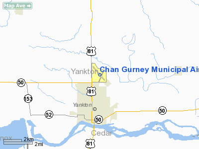
Chan Gurney Municipal Airport (IATA: YKN, ICAO: KYKN, FAA LID: YKN), also referred to as Chan Gurney Airport, is a public airport located three miles (5 km) north of the central business district (CBD) of Yankton, a city in Yankton County, South Dakota, USA. It is named for John Chandler "Chan" Gurney, a native of Yankton who was a sergeant in the U.S. Army during World War I and later became a U.S. Senator. The airport covers 458 acres (185 ha) and has two runways.
Scheduled commercial airline service was previously provided by United Express, with flights to Minneapolis, Minnesota and Denver, Colorado.
The above content comes from Wikipedia and is published under free licenses – click here to read more.
Location & QuickFacts
| FAA Information Effective: | 2008-09-25 |
| Airport Identifier: | YKN |
| Airport Status: | Operational |
| Longitude/Latitude: | 097-23-09.4000W/42-55-00.1000N
-97.385944/42.916694 (Estimated) |
| Elevation: | 1306 ft / 398.07 m (Surveyed) |
| Land: | 458 acres |
| From nearest city: | 3 nautical miles N of Yankton, SD |
| Location: | Yankton County, SD |
| Magnetic Variation: | 07E (1985) |
Owner & Manager
| Ownership: | Publicly owned |
| Owner: | City Of Yankton |
| Address: | P O Box 176
Yankton, SD 57078 |
| Phone number: | 605-668-5221 |
| Manager: | Gary Carlson |
| Address: | 700 East 31st Street
Yankton, SD 57078 |
| Phone number: | 605-665-1460 |
Airport Operations and Facilities
| Airport Use: | Open to public |
| Wind indicator: | Yes |
| Segmented Circle: | Yes |
| Control Tower: | No |
| Lighting Schedule: | DUSK-DAWN
MIRL RY 13/31 PRESET MEDIUM INTST SS-SR, HIRL RY 01/19 PRESET LOW INTST SS-2300 TO INCR INTST & ACTVT MALSR RY 31, PAPI RYS 01 & 19 & TWY LGTS - CTAF. |
| Beacon Color: | Clear-Green (lighted land airport) |
| Landing fee charge: | No |
| Sectional chart: | Omaha |
| Region: | AGL - Great Lakes |
| Boundary ARTCC: | ZMP - Minneapolis |
| Tie-in FSS: | HON - Huron |
| FSS on Airport: | No |
| FSS Toll Free: | 1-800-WX-BRIEF |
| NOTAMs Facility: | YKN (NOTAM-d service avaliable) |
| Federal Agreements: | NGY |
Airport Communications
| CTAF: | 122.800 |
| Unicom: | 122.800 |
Airport Services
| Fuel available: | 100LLA |
| Airframe Repair: | MAJOR |
| Power Plant Repair: | MAJOR |
| Bottled Oxygen: | NONE |
| Bulk Oxygen: | NONE |
Runway Information
Runway 01/19
| Dimension: | 3380 x 75 ft / 1030.2 x 22.9 m |
| Surface: | ASPH, Good Condition |
| Weight Limit: | Single wheel: 12500 lbs. |
| Edge Lights: | High |
| |
Runway 01 |
Runway 19 |
| Longitude: | 097-23-10.7116W | 097-22-54.1119W |
| Latitude: | 42-54-36.4659N | 42-55-07.5402N |
| Elevation: | 1274.00 ft | 1282.00 ft |
| Alignment: | 21 | 127 |
| Traffic Pattern: | Left | Left |
| Markings: | Basic, Good Condition | Basic, Good Condition |
| Crossing Height: | 25.00 ft | 25.00 ft |
| VASI: | 2-light PAPI on left side | 2-light PAPI on left side |
| Visual Glide Angle: | 3.00° | 3.00° |
| Runway End Identifier: | No | No |
| Centerline Lights: | No | No |
| Touchdown Lights: | No | No |
| Obstruction: | 7 ft pline, 385.0 ft from runway, 94 ft right of centerline, 26:1 slope to clear | 6 ft fence, 382.0 ft from runway, 11 ft right of centerline, 30:1 slope to clear |
|
Runway 13/31
| Dimension: | 6095 x 100 ft / 1857.8 x 30.5 m |
| Surface: | CONC, Good Condition |
| Weight Limit: | Single wheel: 30000 lbs.
Dual wheel: 50000 lbs.
Dual tandem wheel: 90000 lbs. |
| Edge Lights: | Medium |
| |
Runway 13 |
Runway 31 |
| Longitude: | 097-23-39.6690W | 097-22-46.7450W |
| Latitude: | 42-55-27.4750N | 42-54-41.5250N |
| Elevation: | 1306.00 ft | 1270.00 ft |
| Alignment: | 127 | 127 |
| ILS Type: | | ILS
|
| Traffic Pattern: | Left | Left |
| Markings: | Precision instrument, Good Condition | Precision instrument, Good Condition |
| Crossing Height: | 40.00 ft | 40.00 ft |
| VASI: | 4-box on left side | 4-box on left side |
| Visual Glide Angle: | 3.00° | 3.00° |
| Approach lights: | | MALSR |
| Runway End Identifier: | Yes | |
| Centerline Lights: | No | No |
| Touchdown Lights: | No | No |
| Obstruction: | 48 ft trees, 840.0 ft from runway, 591 ft right of centerline, 13:1 slope to clear | , 50:1 slope to clear |
|
Radio Navigation Aids
| ID |
Type |
Name |
Ch |
Freq |
Var |
Dist |
| VMR | NDB | Vermillion | | 375.00 | 06E | 21.9 nm |
| AGZ | NDB | Wagner | | 392.00 | 08E | 40.8 nm |
| FS | NDB | Rokky | | 245.00 | 06E | 42.4 nm |
| LCG | NDB | Wayne | | 389.00 | 06E | 44.3 nm |
| OI | NDB | Tommi | | 305.00 | 07E | 49.2 nm |
| YKN | VOR/DME | Yankton | 051X | 111.40 | 07E | 0.1 nm |
Remarks
- MIGRATORY WATERFOWL ON & INVOF ARPT.
- PAEW MOWING SEASONAL.
Images and information placed above are from
http://www.airport-data.com/airport/YKN/
We thank them for the data!
| General Info
|
| Country |
United States
|
| State |
SOUTH DAKOTA
|
| FAA ID |
YKN
|
| Latitude |
42-55-00.100N
|
| Longitude |
097-23-09.400W
|
| Elevation |
1306 feet
|
| Near City |
YANKTON
|
We don't guarantee the information is fresh and accurate. The data may
be wrong or outdated.
For more up-to-date information please refer to other sources.
|
|


