 |
|
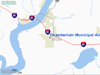
Location & QuickFacts
| FAA Information Effective: | 2008-09-25 |
| Airport Identifier: | 9V9 |
| Airport Status: | Operational |
| Longitude/Latitude: | 099-19-16.8240W/43-45-58.0400N
-99.321340/43.766122 (Estimated) |
| Elevation: | 1695 ft / 516.64 m (Surveyed) |
| Land: | 329 acres |
| From nearest city: | 3 nautical miles S of Chamberlain, SD |
| Location: | Brule County, SD |
| Magnetic Variation: | 08E (1995) |
Owner & Manager
| Ownership: | Publicly owned |
| Owner: | City Of Chamberlain |
| Address: | P O Box 66
Chamberlain, SD 57325 |
| Phone number: | 605-734-4401 |
| Manager: | Dyrk Hrabe |
| Address: | Rr 1 Box 87
Chamberlain, SD 57325 |
| Phone number: | 605-734-4409 |
Airport Operations and Facilities
| Airport Use: | Open to public |
| Wind indicator: | Yes |
| Segmented Circle: | Yes |
| Control Tower: | No |
| Lighting Schedule: | DUSK-DAWN
MIRL RY 13/31 PRESET ON LOW INTST, TO INCR INTST & ACTVT PAPI RYS 13 & 31 - CTAF. |
| Beacon Color: | Clear-Green (lighted land airport) |
| Landing fee charge: | No |
| Sectional chart: | Omaha |
| Region: | AGL - Great Lakes |
| Boundary ARTCC: | ZMP - Minneapolis |
| Tie-in FSS: | HON - Huron |
| FSS on Airport: | No |
| FSS Toll Free: | 1-800-WX-BRIEF |
| NOTAMs Facility: | HON (NOTAM-d service avaliable) |
| Federal Agreements: | NGY |
Airport Communications
| CTAF: | 122.800 |
| Unicom: | 122.800 |
Airport Services
| Fuel available: | 100LLA
FUEL AVBL 24 HRS WITH CREDIT CARD. |
| Airframe Repair: | MAJOR |
| Power Plant Repair: | MAJOR |
Runway Information
Runway 13/31
| Dimension: | 4300 x 75 ft / 1310.6 x 22.9 m |
| Surface: | ASPH, Good Condition |
| Weight Limit: | Single wheel: 12500 lbs. |
| Edge Lights: | Medium |
| |
Runway 13 |
Runway 31 |
| Longitude: | 099-19-35.0910W | 099-18-58.1820W |
| Latitude: | 43-46-13.0300N | 43-45-40.0470N |
| Elevation: | 1688.00 ft | 1677.00 ft |
| Alignment: | 127 | 127 |
| Traffic Pattern: | Left | Left |
| Markings: | Non-precision instrument, Fair Condition | Non-precision instrument, Fair Condition |
| Crossing Height: | 40.00 ft | 40.00 ft |
| VASI: | 2-light PAPI on left side | 2-light PAPI on left side |
| Visual Glide Angle: | 3.00° | 3.00° |
| Runway End Identifier: | No | No |
| Centerline Lights: | No | No |
| Touchdown Lights: | No | No |
| Obstruction: | 64 ft tree, 1539.0 ft from runway, 415 ft left of centerline, 20:1 slope to clear | , 50:1 slope to clear |
|
Runway 18/36
| Dimension: | 3400 x 150 ft / 1036.3 x 45.7 m |
| Surface: | TURF, Good Condition |
| |
Runway 18 |
Runway 36 |
| Longitude: | 099-19-14.3600W | 099-19-19.7600W |
| Latitude: | 43-46-16.6800N | 43-45-43.1800N |
| Traffic Pattern: | Left | Left |
| Obstruction: | 46 ft pole, 1000.0 ft from runway, 21:1 slope to clear | , 50:1 slope to clear |
|
Radio Navigation Aids
| ID |
Type |
Name |
Ch |
Freq |
Var |
Dist |
| ISD | VOR | Winner | | 112.80 | 08E | 25.4 nm |
Remarks
- WATERFOWL ON & INVOF ARPT.
- ULTRALIGHT ACTIVITY ON AND INVOF ARPT.
Images and information placed above are from
http://www.airport-data.com/airport/9V9/
We thank them for the data!
| General Info
|
| Country |
United States
|
| State |
SOUTH DAKOTA
|
| FAA ID |
9V9
|
| Latitude |
43-45-58.040N
|
| Longitude |
099-19-16.824W
|
| Elevation |
1695 feet
|
| Near City |
CHAMBERLAIN
|
We don't guarantee the information is fresh and accurate. The data may
be wrong or outdated.
For more up-to-date information please refer to other sources.
|
|


