 |
|
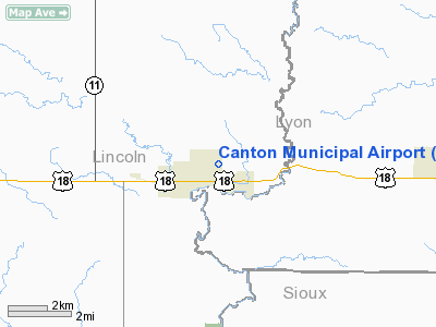
Location & QuickFacts
| FAA Information Effective: | 2008-09-25 |
| Airport Identifier: | 7G9 |
| Airport Status: | Operational |
| Longitude/Latitude: | 096-34-15.6000W/43-18-32.0000N
-96.571000/43.308889 (Estimated) |
| Elevation: | 1290 ft / 393.19 m (Surveyed) |
| Land: | 130 acres |
| From nearest city: | 1 nautical miles NE of Canton, SD |
| Location: | Lincoln County, SD |
| Magnetic Variation: | 06E (1985) |
Owner & Manager
| Ownership: | Publicly owned |
| Owner: | City Of Canton |
| Address: | 1000 Riverview Rd
Canton, SD 57013 |
| Phone number: | 605-987-2881 |
| Manager: | Dean Libra |
| Address: | 210 N. Dakota Ave
Canton, SD 57013 |
| Phone number: | 605-987-9010 |
Airport Operations and Facilities
| Airport Use: | Open to public |
| Wind indicator: | Yes |
| Segmented Circle: | Yes |
| Control Tower: | No |
| Lighting Schedule: | DUSK-DAWN |
| Beacon Color: | Clear-Green (lighted land airport) |
| Landing fee charge: | No |
| Sectional chart: | Omaha |
| Region: | AGL - Great Lakes |
| Boundary ARTCC: | ZMP - Minneapolis |
| Tie-in FSS: | HON - Huron |
| FSS on Airport: | No |
| FSS Toll Free: | 1-800-WX-BRIEF |
| NOTAMs Facility: | HON (NOTAM-d service avaliable) |
| Federal Agreements: | NGY |
Airport Communications
| CTAF: | 122.800 |
| Unicom: | 122.800 |
Airport Services
| Fuel available: | 100LL |
| Airframe Repair: | MINOR |
| Power Plant Repair: | NONE |
| Bottled Oxygen: | NONE |
| Bulk Oxygen: | NONE |
Runway Information
Runway 18/36
| Dimension: | 3600 x 60 ft / 1097.3 x 18.3 m |
| Surface: | ASPH, Fair Condition |
| Weight Limit: | Single wheel: 12500 lbs. |
| Edge Lights: | Low |
| |
Runway 18 |
Runway 36 |
| Longitude: | 096-34-15.6000W | 096-34-15.6000W |
| Latitude: | 43-18-49.8000N | 43-18-14.2000N |
| Elevation: | 1290.00 ft | 1271.00 ft |
| Traffic Pattern: | Left | Left |
| Markings: | Basic, Fair Condition | Basic, Fair Condition |
| Runway End Identifier: | No | No |
| Centerline Lights: | No | No |
| Touchdown Lights: | No | No |
| Obstruction: | 132 ft road, 550.0 ft from runway, 26:1 slope to clear | 52 ft trees, 1300.0 ft from runway, 21:1 slope to clear |
|
Radio Navigation Aids
| ID |
Type |
Name |
Ch |
Freq |
Var |
Dist |
| FS | NDB | Rokky | | 245.00 | 06E | 15.8 nm |
| SOY | NDB | Sioux Center | | 368.00 | 06E | 19.8 nm |
| ORC | NDB | Orange City | | 521.00 | 05E | 29.4 nm |
| SHL | NDB | Sheldon | | 338.00 | 05E | 32.8 nm |
| ISB | NDB | Sibley | | 269.00 | 05E | 36.0 nm |
| VMR | NDB | Vermillion | | 375.00 | 06E | 36.5 nm |
| MDS | NDB | Wentworth | | 400.00 | 05E | 48.0 nm |
| PQN | NDB/DME | Pipestone | 028X | 284.00 | 06E | 42.4 nm |
| DDL | VOR/DME | Sheldon | 023X | 108.60 | 05E | 32.8 nm |
| YKN | VOR/DME | Yankton | 051X | 111.40 | 07E | 42.7 nm |
| OTG | VOR/DME | Worthington | 043X | 110.60 | 08E | 47.7 nm |
| FSD | VORTAC | Sioux Falls | 097X | 115.00 | 09E | 22.4 nm |
Remarks
- DEER & WILDLIFE ON & INVOF OF ARPT.
Images and information placed above are from
http://www.airport-data.com/airport/7G9/
We thank them for the data!
| General Info
|
| Country |
United States
|
| State |
SOUTH DAKOTA
|
| FAA ID |
7G9
|
| Latitude |
43-18-32.000N
|
| Longitude |
096-34-15.600W
|
| Elevation |
1290 feet
|
| Near City |
CANTON
|
We don't guarantee the information is fresh and accurate. The data may
be wrong or outdated.
For more up-to-date information please refer to other sources.
|
|


