 |
|
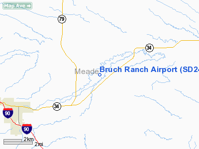
Location & QuickFacts
| FAA Information Effective: | 2008-09-25 |
| Airport Identifier: | SD24 |
| Airport Status: | Operational |
| Longitude/Latitude: | 103-23-43.0000W/44-26-50.0000N
-103.395278/44.447222 (Estimated) |
| Elevation: | 3070 ft / 935.74 m (Estimated) |
| Land: | 0 acres |
| From nearest city: | 5 nautical miles NE of Sturgis, SD |
| Location: | Meade County, SD |
| Magnetic Variation: | 11E (1990) |
Owner & Manager
| Ownership: | Privately owned |
| Owner: | Henry Bruch |
| Address: | Hc 77, Box 30
Sturgis, SD 57785 |
| Phone number: | 605-347-8297 |
| Manager: | Henry Bruch |
| Address: | Hc 77, Box 30
Sturgix, SD 57785 |
| Phone number: | 605-347-8297 |
Airport Operations and Facilities
| Airport Use: | Private |
| Segmented Circle: | No |
| Control Tower: | No |
| Sectional chart: | Billings |
| Region: | AGL - Great Lakes |
| Boundary ARTCC: | ZDV - Denver |
| Tie-in FSS: | HON - Huron |
| FSS Toll Free: | 1-800-WX-BRIEF |
Runway Information
Runway 09/27
| Dimension: | 3150 x 60 ft / 960.1 x 18.3 m |
| Surface: | TURF, |
| |
Runway 09 |
Runway 27 |
| Traffic Pattern: | Left | Left |
| Obstruction: | 70 ft trees, 1400.0 ft from runway | |
|
Runway 10/28
| Dimension: | 3860 x 60 ft / 1176.5 x 18.3 m |
| Surface: | TURF, |
| |
Runway 10 |
Runway 28 |
| Traffic Pattern: | Left | Left |
| Obstruction: | 16 ft pline, 320.0 ft from runway | |
|
Radio Navigation Aids
| ID |
Type |
Name |
Ch |
Freq |
Var |
Dist |
| SPF | NDB | Black Hills | | 300.00 | 11E | 16.8 nm |
| EFC | NDB | Belle Fourche | | 269.00 | 11E | 26.4 nm |
| RA | NDB | Ranch | | 254.00 | 11E | 33.7 nm |
| RCA | TACAN | Ellsworth | 025X | | 11E | 22.4 nm |
| RAP | VORTAC | Rapid City | 070X | 112.30 | 13E | 32.8 nm |
Remarks
- RYS ARE IN TOO CLOSE PROXIMITY & INSUFFIENT AIRSPACE IS AVAILABLE FOR SIMULTANEOUS TRAFFIC OPERATIONS.
Images and information placed above are from
http://www.airport-data.com/airport/SD24/
We thank them for the data!
| General Info
|
| Country |
United States
|
| State |
SOUTH DAKOTA
|
| FAA ID |
SD24
|
| Latitude |
44-26-50.000N
|
| Longitude |
103-23-43.000W
|
| Elevation |
3070 feet
|
| Near City |
STURGIS
|
We don't guarantee the information is fresh and accurate. The data may
be wrong or outdated.
For more up-to-date information please refer to other sources.
|
|


