 |
|
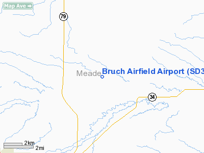
Location & QuickFacts
| FAA Information Effective: | 2008-09-25 |
| Airport Identifier: | SD35 |
| Airport Status: | Operational |
| Longitude/Latitude: | 103-23-40.0000W/44-29-39.0000N
-103.394444/44.494167 (Estimated) |
| Elevation: | 2980 ft / 908.30 m () |
| Land: | 0 acres |
| From nearest city: | 8 nautical miles NE of Sturgis, SD |
| Location: | Meade County, SD |
| Magnetic Variation: | () |
Owner & Manager
| Ownership: | Privately owned |
| Owner: | John H Bruch |
| Address: | 20073 Colony Place
Sturgis, SD 57785 |
| Phone number: | 605-347-5269 |
| Manager: | John H Bruch |
| Address: | 20073 Colony Place
Sturgis, SD 57785 |
| Phone number: | 605-347-5269 |
Airport Operations and Facilities
| Airport Use: | Private |
| Control Tower: | No |
| Region: | AGL - Great Lakes |
| Boundary ARTCC: | ZDV - Denver |
| Tie-in FSS: | HON - Huron |
| FSS Toll Free: | 1-800-WX-BRIEF |
Runway Information
Runway 09/27
| Dimension: | 3000 x 40 ft / 914.4 x 12.2 m |
| Surface: | TURF, |
| |
Runway 09 |
Runway 27 |
| Traffic Pattern: | Left | Left |
|
Radio Navigation Aids
| ID |
Type |
Name |
Ch |
Freq |
Var |
Dist |
| SPF | NDB | Black Hills | | 300.00 | 11E | 16.7 nm |
| EFC | NDB | Belle Fourche | | 269.00 | 11E | 24.6 nm |
| RA | NDB | Ranch | | 254.00 | 11E | 36.1 nm |
| RCA | TACAN | Ellsworth | 025X | | 11E | 24.8 nm |
| RAP | VORTAC | Rapid City | 070X | 112.30 | 13E | 35.2 nm |
Remarks
- PROVIDED COORDINATE OPNS WITH ELLSWORTH APCH CON AT PHONE 605-385-6199. CLEAR 20:1 APCHS; CLEAR OBSTACLE FREE ZONE; CLEAR RY SAFETY AREA.
Images and information placed above are from
http://www.airport-data.com/airport/SD35/
We thank them for the data!
|
|


