 |
|
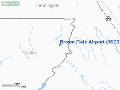
Location & QuickFacts
| FAA Information Effective: | 2008-09-25 |
| Airport Identifier: | 3SD3 |
| Airport Status: | Operational |
| Longitude/Latitude: | 102-43-11.6400W/43-48-42.4500N
-102.719900/43.811792 (Estimated) |
| Elevation: | 2780 ft / 847.34 m (Estimated) |
| Land: | 0 acres |
| From nearest city: | 7 nautical miles WN of Scenic, SD |
| Location: | Custer County, SD |
| Magnetic Variation: | () |
Owner & Manager
| Ownership: | Privately owned |
| Owner: | Pat Brown |
| Address: | 4832 Tanager Court
Rapid City, SD 57702 |
| Phone number: | 605-343-8289 |
| Manager: | Pat Brown |
| Address: | 4832 Tanager Court
Rapid City, SD 57702 |
| Phone number: | 605-343-8289 |
Airport Operations and Facilities
| Airport Use: | Private |
| Segmented Circle: | No |
| Control Tower: | No |
| Sectional chart: | Cheyenne |
| Region: | AGL - Great Lakes |
| Boundary ARTCC: | ZDV - Denver |
| Tie-in FSS: | HON - Huron |
| FSS Toll Free: | 1-800-WX-BRIEF |
Runway Information
Runway 18/36
| Dimension: | 1600 x 45 ft / 487.7 x 13.7 m |
| Surface: | TURF, |
| |
Runway 18 |
Runway 36 |
| Traffic Pattern: | Left | Left |
|
Radio Navigation Aids
| ID |
Type |
Name |
Ch |
Freq |
Var |
Dist |
| RA | NDB | Ranch | | 254.00 | 11E | 15.2 nm |
| RCA | TACAN | Ellsworth | 025X | | 11E | 25.7 nm |
| PHP | VOR/DME | Philip | 021X | 108.40 | 12E | 48.0 nm |
| RAP | VORTAC | Rapid City | 070X | 112.30 | 13E | 16.1 nm |
Remarks
- 25 FT POWERLINE 250 FT W, 50 FT GRAIN BIN 300 FT W. AND 25 FT BLDGS 200 FT NW OF RY.
- OWNER DESIRES ARPT NOT BE CHARTED.
Images and information placed above are from
http://www.airport-data.com/airport/3SD3/
We thank them for the data!
|
|


