 |
|
Location & QuickFacts
| FAA Information Effective: | 2008-09-25 |
| Airport Identifier: | 0SD4 |
| Airport Status: | Operational |
| Longitude/Latitude: | 096-45-53.0000W/44-18-29.0000N
-96.764722/44.308056 (Estimated) |
| Elevation: | 1670 ft / 509.02 m (Estimated) |
| Land: | 0 acres |
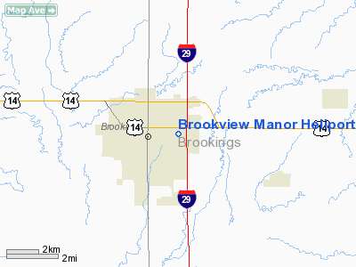
| From nearest city: | 0 nautical miles N of Brookings, SD |
| Location: | Brookings County, SD |
| Magnetic Variation: | 06E (1995) |
Owner & Manager
| Ownership: | Privately owned |
| Owner: | Brookview Manor |
| Address: | 300 22nd Ave
Brookings, SD 57006 |
| Phone number: | 605-692-6351 |
| Manager: | David B Johnson |
| Address: | 300 22nd Ave
Brookings, SD 57006 |
| Phone number: | 605-692-6351 |
Airport Operations and Facilities
| Airport Use: | Private |
| Segmented Circle: | No |
| Control Tower: | No |
| Landing fee charge: | No |
| Sectional chart: | Omaha |
| Region: | AGL - Great Lakes |
| Boundary ARTCC: | ZMP - Minneapolis |
| Tie-in FSS: | HON - Huron |
| FSS on Airport: | No |
| FSS Toll Free: | 1-800-WX-BRIEF |
Runway Information
Helipad H1
| Dimension: | 60 x 60 ft / 18.3 x 18.3 m |
| Surface: | ASPH, |
| |
Runway H1 |
Runway |
| Traffic Pattern: | Left | Left |
|
Radio Navigation Aids
| ID |
Type |
Name |
Ch |
Freq |
Var |
Dist |
| MDS | NDB | Wentworth | | 400.00 | 05E | 22.5 nm |
| DXX | NDB | Dawson/madison | | 341.00 | 06E | 47.7 nm |
| FS | NDB | Rokky | | 245.00 | 06E | 49.0 nm |
| PQN | NDB/DME | Pipestone | 028X | 284.00 | 06E | 28.0 nm |
| BKX | VOR/DME | Brookings | 025X | 108.80 | 06E | 2.2 nm |
| MML | VOR/DME | Marshall | 047X | 111.00 | 05E | 41.3 nm |
| FSD | VORTAC | Sioux Falls | 097X | 115.00 | 09E | 39.6 nm |
| ATY | VORTAC | Watertown | 113X | 116.60 | 09E | 43.5 nm |
Remarks
- PRVDD APCH/DEP ROUTE CONDUCTED 030-200 USING TOUCHDOWN PAD AS CNTR; TKOF/LANDING AREA MKD; WIND INDICTATOR MAINTAINED; COMPLIANCE WITH 14 CFR PART 91.126(B)(2).
Images and information placed above are from
http://www.airport-data.com/airport/0SD4/
We thank them for the data!
| General Info
|
| Country |
United States
|
| State |
SOUTH DAKOTA
|
| FAA ID |
0SD4
|
| Latitude |
44-18-29.000N
|
| Longitude |
096-45-53.000W
|
| Elevation |
1670 feet
|
| Near City |
BROOKINGS
|
We don't guarantee the information is fresh and accurate. The data may
be wrong or outdated.
For more up-to-date information please refer to other sources.
|
|


