 |
|
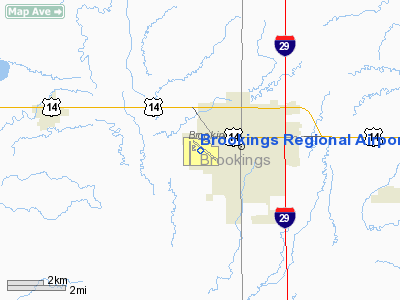
| Brookings Regional Airport |
| IATA: BKX – ICAO: KBKX – FAA LID: BKX |
| Summary |
| Airport type |
Public |
| Owner |
City of Brookings |
| Serves |
Brookings, South Dakota |
| Elevation AMSL |
1,648 ft / 502 m |
| Coordinates |
44°18′17″N 096°49′01″W / 44.30472°N 96.81694°W / 44.30472; -96.81694 |
| Runways |
| Direction |
Length |
Surface |
| ft |
m |
| 12/30 |
5,231 |
1,594 |
Asphalt |
| 17/35 |
3,599 |
1,097 |
Asphalt |
| Statistics (2008) |
| Aircraft operations |
34,915 |
| Based aircraft |
49 |
| Source: Federal Aviation Administration |
Brookings Regional Airport (IATA: BKX, ICAO: KBKX, FAA LID: BKX), formerly known as Brookings Municipal Airport, is a city-owned public-use airport located in the city of Brookings, in Brookings County, South Dakota, United States. As of 2007, it is no longer served by a commercial airline. Airport Manager is currently Michael Wilson (June 2007-Present). Airlines and destinations
| Airlines |
Destinations |
| Great Lakes Airlines |
Minneapolis (startup date unknown) |
Facilities and aircraft
Brookings Regional Airport covers an area of 576 acres (233 ha) at an elevation of 1,648 feet (502 m) above mean sea level. It has two asphalt paved runways: 12/30 is 5,231 by 100 feet (1,594 x 30 m) and 17/35 is 3,599 by 60 feet (1,097 x 18 m).
For the 12-month period ending October 31, 2008, the airport had 34,915 aircraft operations, an average of 95 per day: 92% general aviation, 7% air taxi and 1% military. At that time there were 49 aircraft based at this airport: 78% single-engine, 14% multi-engine, 4% glider and 4% ultralight.
The above content comes from Wikipedia and is published under free licenses – click here to read more.
Location & QuickFacts
| FAA Information Effective: | 2008-09-25 |
| Airport Identifier: | BKX |
| Airport Status: | Operational |
| Longitude/Latitude: | 096-49-01.0000W/44-18-17.4000N
-96.816944/44.304833 (Estimated) |
| Elevation: | 1648 ft / 502.31 m (Surveyed) |
| Land: | 576 acres |
| From nearest city: | 0 nautical miles SW of Brookings, SD |
| Location: | Brookings County, SD |
| Magnetic Variation: | 06E (1990) |
Owner & Manager
| Ownership: | Publicly owned |
| Owner: | City Of Brookings |
| Address: | P. O. Box 270, 311 3rd Ave
Brookings, SD 57006 |
| Phone number: | 605-692-6955 |
| Manager: | Michael Wilson |
| Address: | Box 270, 311 3rd Ave.
Brookings, SD 57006 |
| Phone number: | 605-697-8664 |
Airport Operations and Facilities
| Airport Use: | Open to public |
| Wind indicator: | Yes |
| Segmented Circle: | No |
| Control Tower: | No |
| Lighting Schedule: | DUSK-DAWN
ACTVT HIRL RY 12/30, MIRL RY 17/35, MALSR RY 30, REIL RYS 12, 17, 35, PAPI RYS 12, 30, 17 & 35 - CTAF. |
| Beacon Color: | Clear-Green (lighted land airport) |
| Landing fee charge: | No |
| Sectional chart: | Omaha |
| Region: | AGL - Great Lakes |
| Boundary ARTCC: | ZMP - Minneapolis |
| Tie-in FSS: | HON - Huron |
| FSS on Airport: | No |
| FSS Toll Free: | 1-800-WX-BRIEF |
| NOTAMs Facility: | BKX (NOTAM-d service avaliable) |
| Certification type/date: | II A S 05/197
PPR 48 HRS FOR UNSKED ACR OPNS WITH 31+ PAX SEATS CALL AMGR 605-697-8664. RY 17/35 NOT AVBL SCHED OPNS INVOLV ACR ACFT DESIGNED FOR 10-30 PAX SEATS AND UNSKED ACR OPNS INVOLV ACFT DESIGNED 30+ PAX SEATS. |
| Federal Agreements: | NGY |
Airport Communications
| CTAF: | 123.000 |
| Unicom: | 123.000 |
Airport Services
| Fuel available: | 100LLA |
| Airframe Repair: | MAJOR |
| Power Plant Repair: | MAJOR |
| Bottled Oxygen: | NONE |
| Bulk Oxygen: | NONE |
Runway Information
Runway 12/30
| Dimension: | 5231 x 100 ft / 1594.4 x 30.5 m
RY CHANGE PER NOS SURVEY. |
| Surface: | ASPH, Good Condition |
| Surface Treatment: | Porous Friction Course |
| Weight Limit: | Single wheel: 39000 lbs.
Dual wheel: 54000 lbs.
Dual tandem wheel: 76000 lbs. |
| Edge Lights: | High |
| |
Runway 12 |
Runway 30 |
| Longitude: | 096-49-18.1853W | 096-48-22.2088W |
| Latitude: | 44-18-35.0262N | 44-18-02.5865N |
| Elevation: | 1608.00 ft | 1629.00 ft |
| Alignment: | 127 | 127 |
| ILS Type: | | ILS
|
| Traffic Pattern: | Left | Left |
| Markings: | Precision instrument, Good Condition | Precision instrument, Good Condition |
| Crossing Height: | 49.00 ft | 45.00 ft |
| VASI: | 4-light PAPI on left side | 4-light PAPI on left side |
| Visual Glide Angle: | 3.00° | 3.00° |
| Approach lights: | | MALSR |
| Runway End Identifier: | Yes | |
| Centerline Lights: | No | No |
| Touchdown Lights: | No | No |
| Obstruction: | 19 ft rr, 550.0 ft from runway, 500 ft left of centerline, 18:1 slope to clear | 89 ft tree, 3241.0 ft from runway, 200 ft right of centerline, 34:1 slope to clear |
|
Runway 17/35
| Dimension: | 3599 x 60 ft / 1097.0 x 18.3 m
RY CHANGE PER NOS SURVEY. |
| Surface: | ASPH, Fair Condition |
| Weight Limit: | Single wheel: 12500 lbs. |
| Edge Lights: | Medium |
| |
Runway 17 |
Runway 35 |
| Longitude: | 096-49-18.0377W | 096-49-15.3520W |
| Latitude: | 44-18-33.0538N | 44-17-57.5686N |
| Elevation: | 1607.00 ft | 1648.00 ft |
| Alignment: | 127 | 127 |
| Traffic Pattern: | Left | Left |
| Markings: | Basic, Fair Condition | Basic, Fair Condition |
| Crossing Height: | 27.00 ft | 24.00 ft |
| VASI: | 4-light PAPI on left side | 4-light PAPI on left side |
| Visual Glide Angle: | 3.00° | 3.00° |
| Runway End Identifier: | Yes | Yes |
| Obstruction: | 20 ft rr, 941.0 ft from runway, 75 ft right of centerline, 37:1 slope to clear | 26 ft road, 799.0 ft from runway, 183 ft right of centerline, 23:1 slope to clear |
|
Radio Navigation Aids
| ID |
Type |
Name |
Ch |
Freq |
Var |
Dist |
| MDS | NDB | Wentworth | | 400.00 | 05E | 21.0 nm |
| FS | NDB | Rokky | | 245.00 | 06E | 48.7 nm |
| DXX | NDB | Dawson/madison | | 341.00 | 06E | 49.1 nm |
| PQN | NDB/DME | Pipestone | 028X | 284.00 | 06E | 29.5 nm |
| BKX | VOR/DME | Brookings | 025X | 108.80 | 06E | 0.1 nm |
| MML | VOR/DME | Marshall | 047X | 111.00 | 05E | 43.5 nm |
| FSD | VORTAC | Sioux Falls | 097X | 115.00 | 09E | 39.4 nm |
| ATY | VORTAC | Watertown | 113X | 116.60 | 09E | 42.9 nm |
Remarks
- INTENSIVE STUDENT TRAINING.
- LARGE FLOCKS OF GEESE & GULLS ON & INVOF ARPT APR THRU OCT.
- DURING SUMMER MONTHS MOWING & FARMING OPNS - DALGT HRS ONLY.
- WILDLIFE ON & INVOF ARPT.
- DEER ON AND INVOF ARPT.
- SKED ACR OPNS INVOLVE ACFT DESIGNED FOR 10-30 PAX SEATS AND UNSKED ACR OPNS INVOLVE ACFT DESIGNED FOR 31+ PAX SEATS ARE NOT AUTH UNDER PART 139 TO OPERATE AT BKX IN EXCESS OF 15 MINS BEFORE OR AFTER SKED ARR/DEP TIMES. COORD SKED CHANGES WITH AMGR TO ASSURE ARFF AVBL CALL 605-697-8664.
- RYS 12 & 17 APCH ENDS ARE CLOSELY ALIGNED. VERIFY CORRECT RY AND COMPASS HDG PRIOR TO DEP.
Images and information placed above are from
http://www.airport-data.com/airport/BKX/
We thank them for the data!
| General Info
|
| Country |
United States
|
| State |
SOUTH DAKOTA
|
| FAA ID |
BKX
|
| Latitude |
44-18-17.400N
|
| Longitude |
096-49-01.000W
|
| Elevation |
1648 feet
|
| Near City |
BROOKINGS
|
We don't guarantee the information is fresh and accurate. The data may
be wrong or outdated.
For more up-to-date information please refer to other sources.
|
|


