 |
|
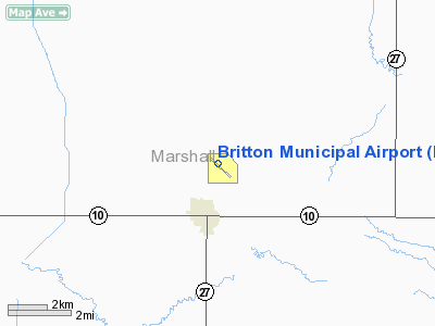
Location & QuickFacts
| FAA Information Effective: | 2008-09-25 |
| Airport Identifier: | BTN |
| Airport Status: | Operational |
| Longitude/Latitude: | 097-44-35.3000W/45-48-54.8000N
-97.743139/45.815222 (Estimated) |
| Elevation: | 1318 ft / 401.73 m (Surveyed) |
| Land: | 192 acres |
| From nearest city: | 2 nautical miles NE of Britton, SD |
| Location: | Marshall County, SD |
| Magnetic Variation: | 06E (1995) |
Owner & Manager
| Ownership: | Publicly owned |
| Owner: | City Of Britton |
| Address: | P O Box 941
Britton, SD 57430 |
| Phone number: | 605-448-5721 |
| Manager: | City Of Britton |
| Address: | Po Box 941
Britton, SD 57430 |
| Phone number: | 605-448-2264 |
Airport Operations and Facilities
| Airport Use: | Open to public |
| Wind indicator: | Yes |
| Segmented Circle: | No |
| Control Tower: | No |
| Lighting Schedule: | DUSK-DAWN |
| Beacon Color: | Clear-Green (lighted land airport) |
| Landing fee charge: | No |
| Sectional chart: | Twin Cities |
| Region: | AGL - Great Lakes |
| Boundary ARTCC: | ZMP - Minneapolis |
| Tie-in FSS: | HON - Huron |
| FSS on Airport: | No |
| FSS Toll Free: | 1-800-WX-BRIEF |
| NOTAMs Facility: | HON (NOTAM-d service avaliable) |
| Federal Agreements: | NGY |
Airport Communications
| CTAF: | 122.800 |
| Unicom: | 122.800 |
Airport Services
| Fuel available: | 100LL |
| Airframe Repair: | MINOR |
| Power Plant Repair: | MINOR |
| Bottled Oxygen: | NONE |
| Bulk Oxygen: | NONE |
Runway Information
Runway 01/19
| Dimension: | 2300 x 120 ft / 701.0 x 36.6 m |
| Surface: | TURF, Good Condition |
| |
Runway 01 |
Runway 19 |
| Longitude: | 097-44-47.7000W | 097-44-33.6000W |
| Latitude: | 45-48-48.8000N | 45-49-09.2000N |
| Alignment: | 26 | 127 |
| Traffic Pattern: | Left | Left |
| Runway End Identifier: | No | No |
| Centerline Lights: | No | No |
| Touchdown Lights: | No | No |
| Obstruction: | 6 ft fence, 125.0 ft from runway, 20:1 slope to clear | 18 ft road, 390.0 ft from runway, 21:1 slope to clear |
|
Runway 13/31
| Dimension: | 4200 x 75 ft / 1280.2 x 22.9 m |
| Surface: | ASPH, Fair Condition |
| Weight Limit: | Single wheel: 12500 lbs. |
| Edge Lights: | Medium |
| |
Runway 13 |
Runway 31 |
| Longitude: | 097-44-53.3590W | 097-44-11.3000W |
| Latitude: | 45-49-07.0910N | 45-48-37.8000N |
| Elevation: | 1314.00 ft | 1318.00 ft |
| Alignment: | 127 | 127 |
| Traffic Pattern: | Left | Left |
| Markings: | Non-precision instrument, Fair Condition | Non-precision instrument, Fair Condition |
| Crossing Height: | 37.00 ft | 37.00 ft |
| VASI: | 4-light PAPI on left side
RY 13/31 PAPI'S OTS INDEFLY. | 4-light PAPI on left side |
| Visual Glide Angle: | 3.00° | 3.20° |
| Runway End Identifier: | No | No |
| Centerline Lights: | No | No |
| Touchdown Lights: | No | No |
| Obstruction: | 15 ft road, 800.0 ft from runway, 40:1 slope to clear | , 50:1 slope to clear |
|
Radio Navigation Aids
| ID |
Type |
Name |
Ch |
Freq |
Var |
Dist |
| BTN | NDB | Britton | | 386.00 | 06E | 0.3 nm |
| GWR | NDB | Gwinner | | 278.00 | 07E | 24.9 nm |
| ABR | VOR/DME | Aberdeen | 077X | 113.00 | 07E | 35.5 nm |
Remarks
- RY 19 +6' FENCE 190' FM THR.
- WATERFOWL AND GULLS ON & INVOF ARPT.
Images and information placed above are from
http://www.airport-data.com/airport/BTN/
We thank them for the data!
| General Info
|
| Country |
United States
|
| State |
SOUTH DAKOTA
|
| FAA ID |
BTN
|
| Latitude |
45-48-54.800N
|
| Longitude |
097-44-35.300W
|
| Elevation |
1318 feet
|
| Near City |
BRITTON
|
We don't guarantee the information is fresh and accurate. The data may
be wrong or outdated.
For more up-to-date information please refer to other sources.
|
|


