 |
|
Location & QuickFacts
| FAA Information Effective: | 2008-09-25 |
| Airport Identifier: | 2SD3 |
| Airport Status: | Operational |
| Longitude/Latitude: | 099-43-30.4200W/44-33-47.9390N
-99.725117/44.563316 (Estimated) |
| Elevation: | 1746 ft / 532.18 m (Estimated) |
| Land: | 0 acres |
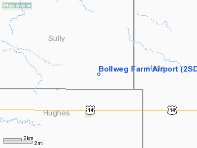
| From nearest city: | 3 nautical miles N of Harrold, SD |
| Location: | Sully County, SD |
| Magnetic Variation: | 09E (1985) |
Owner & Manager
| Ownership: | Privately owned |
| Owner: | Don Bollweg |
| Address: | Star Rt 2, Box 65
Harrold, SD 57536 |
| Phone number: | 605-875-3440 |
| Address: |
|
Airport Operations and Facilities
| Airport Use: | Private |
| Segmented Circle: | No |
| Control Tower: | No |
| Sectional chart: | Twin Cities |
| Region: | AGL - Great Lakes |
| Boundary ARTCC: | ZMP - Minneapolis |
| Tie-in FSS: | HON - Huron |
| FSS Toll Free: | 1-800-WX-BRIEF |
Runway Information
Runway 09/27
| Dimension: | 3000 x 100 ft / 914.4 x 30.5 m |
| Surface: | GRVL, |
| |
Runway 09 |
Runway 27 |
| Traffic Pattern: | Left | Left |
|
Radio Navigation Aids
| ID |
Type |
Name |
Ch |
Freq |
Var |
Dist |
| PIR | VORTAC | Pierre | 072X | 112.50 | 11E | 21.3 nm |
Images and information placed above are from
http://www.airport-data.com/airport/2SD3/
We thank them for the data!
| General Info
|
| Country |
United States
|
| State |
SOUTH DAKOTA
|
| FAA ID |
2SD3
|
| Latitude |
44-33-47.939N
|
| Longitude |
099-43-30.420W
|
| Elevation |
1746 feet
|
| Near City |
HARROLD
|
We don't guarantee the information is fresh and accurate. The data may
be wrong or outdated.
For more up-to-date information please refer to other sources.
|
|


