 |
|
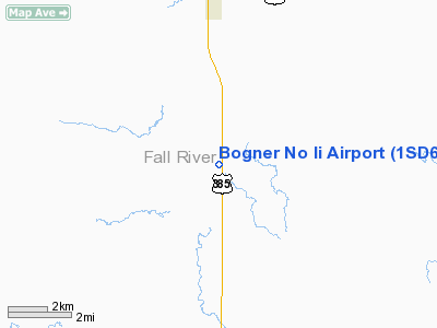
Location & QuickFacts
| FAA Information Effective: | 2008-09-25 |
| Airport Identifier: | 1SD6 |
| Airport Status: | Operational |
| Longitude/Latitude: | 103-13-48.7080W/43-06-36.9080N
-103.230197/43.110252 (Estimated) |
| Elevation: | 3500 ft / 1066.80 m (Estimated) |
| Land: | 0 acres |
| From nearest city: | 5 nautical miles S of Oelrich's, SD |
| Location: | Fall River County, SD |
| Magnetic Variation: | 11E (1990) |
Owner & Manager
| Ownership: | Privately owned |
| Owner: | Bogner Ranch Inc. |
| Address: | 14097 Horsehead Rd
Oelrichs, SD 57763 |
| Phone number: | 605-535-2671 |
| Manager: | Nick And Michael Bogner |
| Address: | Hc46 Box 27
Oelrichs, SD 57763 |
| Phone number: | 605-535-2671 |
Airport Operations and Facilities
| Airport Use: | Private |
| Wind indicator: | Yes |
| Segmented Circle: | No |
| Control Tower: | No |
| Sectional chart: | Cheyenne |
| Region: | AGL - Great Lakes |
| Boundary ARTCC: | ZDV - Denver |
| Tie-in FSS: | HON - Huron |
| FSS Toll Free: | 1-800-WX-BRIEF |
Runway Information
Runway 17/35
| Dimension: | 1800 x 200 ft / 548.6 x 61.0 m |
| Surface: | TURF, |
| |
Runway 17 |
Runway 35 |
| Traffic Pattern: | Left | Left |
| Obstruction: | 20 ft tree | 60 ft hill, 6076.0 ft from runway |
|
Radio Navigation Aids
| ID |
Type |
Name |
Ch |
Freq |
Var |
Dist |
| HIN | NDB | Whitney | | 275.00 | 11E | 18.0 nm |
| GRN | NDB | Gordon | | 414.00 | 09E | 49.8 nm |
| CDR | VOR/DME | Chadron | 081X | 113.40 | 13E | 33.3 nm |
Remarks
- PRVDD AREA 125 FT EITHER SIDE RY CNTRLN & 200 FT EITHER END OF RY BE FREE OF OBSTN; OBSTN IN RY APCH SLOPE SFC LOWERED/REMOVED OR THR DSPLCD & MKD TO PRVD 20:1 APCH CLNC FOR ALL OBSTN.
Images and information placed above are from
http://www.airport-data.com/airport/1SD6/
We thank them for the data!
| General Info
|
| Country |
United States
|
| State |
SOUTH DAKOTA
|
| FAA ID |
1SD6
|
| Latitude |
43-06-36.908N
|
| Longitude |
103-13-48.708W
|
| Elevation |
3500 feet
|
| Near City |
OELRICH'S
|
We don't guarantee the information is fresh and accurate. The data may
be wrong or outdated.
For more up-to-date information please refer to other sources.
|
|


