 |
|
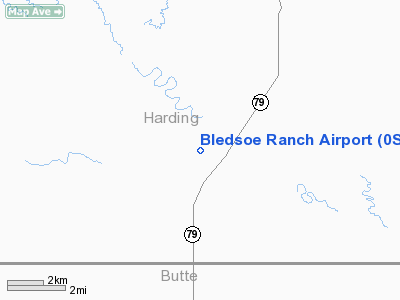
Location & QuickFacts
| FAA Information Effective: | 2008-09-25 |
| Airport Identifier: | 0SD3 |
| Airport Status: | Operational |
| Longitude/Latitude: | 103-13-01.6420W/45-16-09.9640N
-103.217123/45.269434 (Estimated) |
| Elevation: | 2872 ft / 875.39 m (Estimated) |
| Land: | 0 acres |
| From nearest city: | 10 nautical miles NE of Hoover, SD |
| Location: | Harding County, SD |
| Magnetic Variation: | 11E (1985) |
Owner & Manager
| Ownership: | Privately owned |
| Owner: | Robert E. Bledsoe |
| Address: | 555 Franklin, Box Box 406
Wray, CO 80758 |
| Phone number: | 303-332-4480 |
| Address: |
|
Airport Operations and Facilities
| Airport Use: | Private |
| Wind indicator: | Yes |
| Segmented Circle: | No |
| Control Tower: | No |
| Landing fee charge: | No |
| Sectional chart: | Billings |
| Region: | AGL - Great Lakes |
| Boundary ARTCC: | ZLC - Salt Lake City |
| Tie-in FSS: | HON - Huron |
| FSS on Airport: | No |
| FSS Toll Free: | 1-800-WX-BRIEF |
Runway Information
Runway 09/27
| Dimension: | 3700 x 50 ft / 1127.8 x 15.2 m |
| Surface: | GRAVEL, |
| |
Runway 09 |
Runway 27 |
| Traffic Pattern: | Left | Left |
| Obstruction: | 35 ft pline, 1500.0 ft from runway | |
|
Radio Navigation Aids
| ID |
Type |
Name |
Ch |
Freq |
Var |
Dist |
| EFC | NDB | Belle Fourche | | 269.00 | 11E | 42.1 nm |
| BUA | VOR/DME | Buffalo | 031X | 109.40 | 13E | 19.8 nm |
Remarks
- FILED FOR RECORD PURPOSES ONLY.
Images and information placed above are from
http://www.airport-data.com/airport/0SD3/
We thank them for the data!
| General Info
|
| Country |
United States
|
| State |
SOUTH DAKOTA
|
| FAA ID |
0SD3
|
| Latitude |
45-16-09.964N
|
| Longitude |
103-13-01.642W
|
| Elevation |
2872 feet
|
| Near City |
HOOVER
|
We don't guarantee the information is fresh and accurate. The data may
be wrong or outdated.
For more up-to-date information please refer to other sources.
|
|


