 |
|
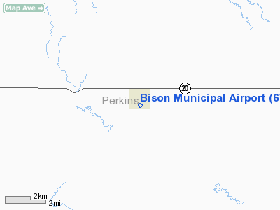
Location & QuickFacts
| FAA Information Effective: | 2008-09-25 |
| Airport Identifier: | 6V5 |
| Airport Status: | Operational |
| Longitude/Latitude: | 102-28-01.5750W/45-31-06.9520N
-102.467104/45.518598 (Estimated) |
| Elevation: | 2785 ft / 848.87 m (Surveyed) |
| Land: | 95 acres |
| From nearest city: | 0 nautical miles SW of Bison, SD |
| Location: | Perkins County, SD |
| Magnetic Variation: | 11E (1985) |
Owner & Manager
| Ownership: | Publicly owned |
| Owner: | Bison City |
| Address: | P O Box 237
Bison, SD 57620 |
| Phone number: | 605-244-5677 |
| Manager: | Beth Hulm |
| Address: | Po Box 237
Bison, SD 57620 |
| Phone number: | 605-244-5677 |
Airport Operations and Facilities
| Airport Use: | Open to public |
| Wind indicator: | Yes |
| Segmented Circle: | Yes |
| Control Tower: | No |
| Lighting Schedule: | DUSK-DAWN
FOR LIRL RY 11/29 - 122.9 3 TIMES. |
| Beacon Color: | Clear-Green (lighted land airport) |
| Landing fee charge: | No |
| Sectional chart: | Billings |
| Region: | AGL - Great Lakes |
| Boundary ARTCC: | ZMP - Minneapolis |
| Tie-in FSS: | HON - Huron |
| FSS on Airport: | No |
| FSS Toll Free: | 1-800-WX-BRIEF |
| NOTAMs Facility: | HON (NOTAM-d service avaliable) |
| Federal Agreements: | NGY |
Airport Communications
Airport Services
| Fuel available: | 100LL
FOR FUEL CALL 605-244-5677/7143/5423. |
| Airframe Repair: | NONE |
| Power Plant Repair: | NONE |
| Bottled Oxygen: | NONE |
| Bulk Oxygen: | NONE |
Runway Information
Runway 11/29
| Dimension: | 3500 x 60 ft / 1066.8 x 18.3 m |
| Surface: | ASPH, |
| Weight Limit: | Single wheel: 12500 lbs. |
| Edge Lights: | Low |
| |
Runway 11 |
Runway 29 |
| Traffic Pattern: | Left | Left |
| Markings: | Basic, Good Condition | Basic, Good Condition |
| Runway End Identifier: | No | No |
| Centerline Lights: | No | No |
| Touchdown Lights: | No | No |
| Obstruction: | , 50:1 slope to clear | 20 ft trees, 670.0 ft from runway, 23:1 slope to clear |
|
Radio Navigation Aids
| ID |
Type |
Name |
Ch |
Freq |
Var |
Dist |
| HEI | NDB | Hettinger | | 392.00 | 12E | 30.9 nm |
| LEM | VOR | Lemmon | | 111.40 | 13E | 28.5 nm |
| BUA | VOR/DME | Buffalo | 031X | 109.40 | 13E | 41.7 nm |
| DPR | VORTAC | Dupree | 115X | 116.80 | 10E | 41.4 nm |
Remarks
- WILDLIFE ON AND INVOF ARPT.
Images and information placed above are from
http://www.airport-data.com/airport/6V5/
We thank them for the data!
| General Info
|
| Country |
United States
|
| State |
SOUTH DAKOTA
|
| FAA ID |
6V5
|
| Latitude |
45-31-06.952N
|
| Longitude |
102-28-01.575W
|
| Elevation |
2785 feet
|
| Near City |
BISON
|
We don't guarantee the information is fresh and accurate. The data may
be wrong or outdated.
For more up-to-date information please refer to other sources.
|
|


