 |
|
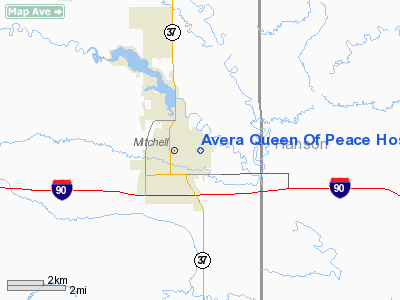
Avera Queen Of Peace Hospital Heliport |
Location & QuickFacts
| FAA Information Effective: | 2008-09-25 |
| Airport Identifier: | SD52 |
| Airport Status: | Operational |
| Longitude/Latitude: | 098-00-31.2800W/43-42-50.9400N
-98.008689/43.714150 (Estimated) |
| Elevation: | 1386 ft / 422.45 m (Estimated) |
| Land: | 1 acres |
| From nearest city: | 0 nautical miles N of Mitchell, SD |
| Location: | Davison County, SD |
| Magnetic Variation: | 08E (1985) |
Owner & Manager
| Ownership: | Privately owned |
| Owner: | Avera Queen Of Peace Hospital |
| Address: | 525 N Foster St.
Mitchell, SD 57301 |
| Phone number: | 605-995-2000 |
| Manager: | Pat Clark
OTHER: JIM BUCK, 605-995-2243 |
| Address: | 525 N Foster St.
Mitchell, SD 57301 |
| Phone number: | 605-995-2000 |
Airport Operations and Facilities
| Airport Use: | Private
MEDICAL USE |
| Wind indicator: | Yes |
| Segmented Circle: | No |
| Control Tower: | No |
| Lighting Schedule: | DUSK-DAWN |
| Sectional chart: | Omaha |
| Region: | AGL - Great Lakes |
| Boundary ARTCC: | ZMP - Minneapolis |
| Tie-in FSS: | HON - Huron |
| FSS on Airport: | No |
| FSS Toll Free: | 1-800-WX-BRIEF |
Runway Information
Helipad H1
| Dimension: | 40 x 50 ft / 12.2 x 15.2 m |
| Surface: | MATS, |
| |
Runway H1 |
Runway |
| Traffic Pattern: | Left | Left |
|
Radio Navigation Aids
| ID |
Type |
Name |
Ch |
Freq |
Var |
Dist |
| AGZ | NDB | Wagner | | 392.00 | 08E | 41.1 nm |
| MDS | NDB | Wentworth | | 400.00 | 05E | 43.8 nm |
| MHE | VOR/DME | Mitchell | 029X | 109.20 | 07E | 4.0 nm |
| HON | VORTAC | Huron | 123X | 117.60 | 10E | 45.5 nm |
Remarks
- APCH/DEP OPNS 010-190 DEGREES, TKOF/LDG AREA APPROPRIATELY MKD, MAINTAIN NON-OBSTRUCTING WIND INDICATOR ADJACENT TO TKOF/LDG AREA, 14 CFR PART 126 & COMPLIED WITH, NO NGT OPNS WITHOUT LGTS, WIND INDICATOR & BCN, UNAUTHORIZED PERSONS RESTRAIN ACCESS.
Images and information placed above are from
http://www.airport-data.com/airport/SD52/
We thank them for the data!
| General Info
|
| Country |
United States
|
| State |
SOUTH DAKOTA
|
| FAA ID |
SD52
|
| Latitude |
43-42-50.940N
|
| Longitude |
098-00-31.280W
|
| Elevation |
1386 feet
|
| Near City |
MITCHELL
|
We don't guarantee the information is fresh and accurate. The data may
be wrong or outdated.
For more up-to-date information please refer to other sources.
|
|


