 |
|
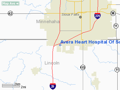
Avera Heart Hospital Of South Dakota Heliport |
Location & QuickFacts
| FAA Information Effective: | 2008-09-25 |
| Airport Identifier: | 2SD6 |
| Airport Status: | Operational |
| Longitude/Latitude: | 096-46-47.0000W/43-29-27.0000N
-96.779722/43.490833 (Estimated) |
| Elevation: | 1477 ft / 450.19 m (Estimated) |
| Land: | 0 acres |
| From nearest city: | 0 nautical miles SE of Sioux Falls, SD |
| Location: | Lincoln County, SD |
| Magnetic Variation: | 05E (2000) |
Owner & Manager
| Ownership: | Privately owned |
| Owner: | Heart Hospital Of South Dakota |
| Address: | 4500 West 69th St
Sioux Falls, SD 57108 |
| Phone number: | 605-977-7000 |
| Manager: | John Soderholm |
| Address: | Heart Hospital Of South Dakota, 4500 West 69th St
Sioux Falls, SD 57108 |
| Phone number: | 605-977-7000 |
Airport Operations and Facilities
| Airport Use: | Private |
| Wind indicator: | Yes |
| Segmented Circle: | No |
| Control Tower: | No |
| Lighting Schedule: | PHONE REQ
FOR PERIMETER LGTS CALL 605-977-7000. |
| Sectional chart: | Omaha |
| Region: | AGL - Great Lakes |
| Boundary ARTCC: | ZMP - Minneapolis |
| Tie-in FSS: | HON - Huron |
| FSS Toll Free: | 1-800-WX-BRIEF |
Runway Information
Helipad H1
| Dimension: | 40 x 40 ft / 12.2 x 12.2 m |
| Surface: | CONC, |
| |
Runway H1 |
Runway |
| Traffic Pattern: | Left | Left |
|
Radio Navigation Aids
| ID |
Type |
Name |
Ch |
Freq |
Var |
Dist |
| FS | NDB | Rokky | | 245.00 | 06E | 2.1 nm |
| SOY | NDB | Sioux Center | | 368.00 | 06E | 33.6 nm |
| MDS | NDB | Wentworth | | 400.00 | 05E | 34.2 nm |
| ORC | NDB | Orange City | | 521.00 | 05E | 43.5 nm |
| VMR | NDB | Vermillion | | 375.00 | 06E | 44.3 nm |
| SHL | NDB | Sheldon | | 338.00 | 05E | 44.6 nm |
| ISB | NDB | Sibley | | 269.00 | 05E | 45.4 nm |
| PQN | NDB/DME | Pipestone | 028X | 284.00 | 06E | 36.4 nm |
| YKN | VOR/DME | Yankton | 051X | 111.40 | 07E | 43.4 nm |
| DDL | VOR/DME | Sheldon | 023X | 108.60 | 05E | 44.6 nm |
| BKX | VOR/DME | Brookings | 025X | 108.80 | 06E | 48.9 nm |
| FSD | VORTAC | Sioux Falls | 097X | 115.00 | 09E | 9.5 nm |
Remarks
- PRVDD ALL APCH/DEP FM 280-090, AREA MKD, WIND INDICATOR MAINTAINED, AND COMPLY WITH 14 CFR, FAR PART 91.126(B)(2).
Images and information placed above are from
http://www.airport-data.com/airport/2SD6/
We thank them for the data!
| General Info
|
| Country |
United States
|
| State |
SOUTH DAKOTA
|
| FAA ID |
2SD6
|
| Latitude |
43-29-27.000N
|
| Longitude |
096-46-47.000W
|
| Elevation |
1477 feet
|
| Near City |
SIOUX FALLS
|
We don't guarantee the information is fresh and accurate. The data may
be wrong or outdated.
For more up-to-date information please refer to other sources.
|
|


