 |
|
Location & QuickFacts
| FAA Information Effective: | 2008-09-25 |
| Airport Identifier: | 3A9 |
| Airport Status: | Operational |
| Longitude/Latitude: | 097-07-23.2360W/44-23-39.8860N
-97.123121/44.394413 (Estimated) |
| Elevation: | 1818 ft / 554.13 m (Estimated) |
| Land: | 175 acres |
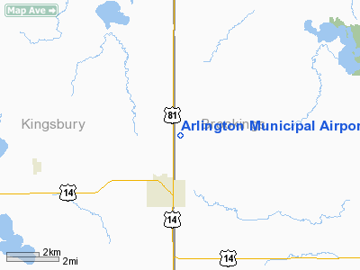
| From nearest city: | 2 nautical miles N of Arlington, SD |
| Location: | Brookings County, SD |
| Magnetic Variation: | 06E (1985) |
Owner & Manager
| Ownership: | Publicly owned |
| Owner: | City Of Arlington |
| Address: | Po Box 379
Arlington, SD 57212 |
| Phone number: | 605-983-5251 |
| Manager: | Amiel Redfish-mayor |
| Address: | City Of Arlington, Po Box 379
Arlington, SD 57212 |
| Phone number: | 605-983-5251 |
Airport Operations and Facilities
| Airport Use: | Open to public |
| Wind indicator: | Yes |
| Segmented Circle: | No |
| Control Tower: | No |
| Lighting Schedule: | DUSK-DAWN |
| Beacon Color: | Clear-Green (lighted land airport) |
| Landing fee charge: | No |
| Sectional chart: | Omaha |
| Region: | AGL - Great Lakes |
| Traffic Pattern Alt: | 800 ft |
| Boundary ARTCC: | ZMP - Minneapolis |
| Tie-in FSS: | HON - Huron |
| FSS on Airport: | No |
| FSS Toll Free: | 1-800-WX-BRIEF |
| NOTAMs Facility: | HON (NOTAM-d service avaliable) |
| Federal Agreements: | Y1 |
Airport Communications
Airport Services
| Airframe Repair: | NONE |
| Power Plant Repair: | NONE |
| Bottled Oxygen: | NONE |
| Bulk Oxygen: | NONE |
Runway Information
Runway 04/22
| Dimension: | 2400 x 250 ft / 731.5 x 76.2 m |
| Surface: | TURF, Good Condition |
| |
Runway 04 |
Runway 22 |
| Longitude: | 097-07-30.7300W | 097-07-07.7700W |
| Latitude: | 44-23-28.8700N | 44-23-45.9200N |
| Elevation: | 1803.00 ft | 1818.00 ft |
| Traffic Pattern: | Left | Left |
| Runway End Identifier: | No | No |
| Centerline Lights: | No | No |
| Touchdown Lights: | No | No |
| Obstruction: | 78 ft trees, 2600.0 ft from runway, 120 ft right of centerline, 33:1 slope to clear | 40 ft trees, 900.0 ft from runway, 200 ft right of centerline, 22:1 slope to clear |
|
Runway 14/32
| Dimension: | 3000 x 250 ft / 914.4 x 76.2 m |
| Surface: | TURF, Good Condition |
| Edge Lights: | Low |
| |
Runway 14 |
Runway 32 |
| Longitude: | 097-07-34.7400W | 097-07-13.3100W |
| Latitude: | 44-23-48.8900N | 44-23-23.5600N |
| Elevation: | 1801.00 ft | 1810.00 ft |
| Traffic Pattern: | Left | Left |
| Runway End Identifier: | No | No |
| Centerline Lights: | No | No |
| Touchdown Lights: | No | No |
| Obstruction: | 40 ft trees, 1000.0 ft from runway, 25:1 slope to clear | 45 ft trees, 1500.0 ft from runway, 33:1 slope to clear |
|
Radio Navigation Aids
| ID |
Type |
Name |
Ch |
Freq |
Var |
Dist |
| MDS | NDB | Wentworth | | 400.00 | 05E | 22.9 nm |
| PQN | NDB/DME | Pipestone | 028X | 284.00 | 06E | 43.3 nm |
| BKX | VOR/DME | Brookings | 025X | 108.80 | 06E | 14.3 nm |
| ATY | VORTAC | Watertown | 113X | 116.60 | 09E | 35.2 nm |
| FSD | VORTAC | Sioux Falls | 097X | 115.00 | 09E | 47.1 nm |
Remarks
- CULTIVATED FIELDS ALL QUADRANTS AT VARIOUS DSTCS FM RYS.
- ARPT CLSD 1 NOV TO 1 APR.
- WATERFOWL ON AND INVOF ARPT.
Images and information placed above are from
http://www.airport-data.com/airport/3A9/
We thank them for the data!
| General Info
|
| Country |
United States
|
| State |
SOUTH DAKOTA
|
| FAA ID |
3A9
|
| Latitude |
44-23-39.886N
|
| Longitude |
097-07-23.236W
|
| Elevation |
1818 feet
|
| Near City |
ARLINGTON
|
We don't guarantee the information is fresh and accurate. The data may
be wrong or outdated.
For more up-to-date information please refer to other sources.
|
|


