 |
|
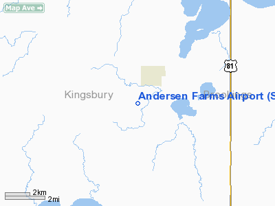
Location & QuickFacts
| FAA Information Effective: | 2008-09-25 |
| Airport Identifier: | SD19 |
| Airport Status: | Operational |
| Longitude/Latitude: | 097-13-21.0000W/44-27-55.0000N
-97.222500/44.465278 (Estimated) |
| Elevation: | 1750 ft / 533.40 m (Estimated) |
| Land: | 0 acres |
| From nearest city: | 1 nautical miles SW of Badger, SD |
| Location: | Kingsbury County, SD |
| Magnetic Variation: | 06E (1995) |
Owner & Manager
| Ownership: | Privately owned |
| Owner: | Art Andersen |
| Address: | Po Box 143, 44923 201st St
Badger, SD 57214 |
| Phone number: | 605-983-5087 |
| Manager: | Art Andersen |
| Address: | Po Box 143, 44923 201st St
Badger, SD 57214 |
| Phone number: | 605-983-5087 |
Airport Operations and Facilities
| Airport Use: | Private |
| Segmented Circle: | No |
| Control Tower: | No |
| Sectional chart: | Omaha |
| Region: | AGL - Great Lakes |
| Boundary ARTCC: | ZMP - Minneapolis |
| Tie-in FSS: | HON - Huron |
| FSS on Airport: | No |
| FSS Toll Free: | 1-800-WX-BRIEF |
Runway Information
Runway 18/36
| Dimension: | 3100 x 75 ft / 944.9 x 22.9 m |
| Surface: | TURF, |
| |
Runway 18 |
Runway 36 |
| Traffic Pattern: | Left | Left |
| Obstruction: | | 100 ft bldg, 300.0 ft from runway |
|
Radio Navigation Aids
| ID |
Type |
Name |
Ch |
Freq |
Var |
Dist |
| MDS | NDB | Wentworth | | 400.00 | 05E | 27.7 nm |
| PQN | NDB/DME | Pipestone | 028X | 284.00 | 06E | 49.2 nm |
| BKX | VOR/DME | Brookings | 025X | 108.80 | 06E | 20.0 nm |
| ATY | VORTAC | Watertown | 113X | 116.60 | 09E | 31.1 nm |
| HON | VORTAC | Huron | 123X | 117.60 | 10E | 46.7 nm |
Remarks
- PRVDD RY THLD LCTD FOR 20:1 APCH; RY ENDS CLEAR OF OBSTNS FOR 200 FT; 125 FT CLNC 125 FT EITHER SIDE OF RY CNTRLN; 60 FT EITHER SIDE OF RY CNTRLN & 240 FT OFF RY ENDS CLEAR & GRADED.
Images and information placed above are from
http://www.airport-data.com/airport/SD19/
We thank them for the data!
| General Info
|
| Country |
United States
|
| State |
SOUTH DAKOTA
|
| FAA ID |
SD19
|
| Latitude |
44-27-55.000N
|
| Longitude |
097-13-21.000W
|
| Elevation |
1750 feet
|
| Near City |
BADGER
|
We don't guarantee the information is fresh and accurate. The data may
be wrong or outdated.
For more up-to-date information please refer to other sources.
|
|


