 |
|
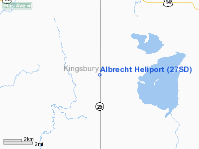
Location & QuickFacts
| FAA Information Effective: | 2008-09-25 |
| Airport Identifier: | 27SD |
| Airport Status: | Operational |
| Longitude/Latitude: | 097-33-09.3600W/44-17-43.8000N
-97.552600/44.295500 (Estimated) |
| Elevation: | 1722 ft / 524.87 m (Estimated) |
| Land: | 0 acres |
| From nearest city: | 8 nautical miles S of De Smet, SD |
| Location: | Kingsbury County, SD |
| Magnetic Variation: | () |
Owner & Manager
| Ownership: | Privately owned |
| Owner: | William W. Albrecht |
| Address: | 21305 Sd Hwy 25
De Smet, SD 57231 |
| Phone number: | 605-854-3653 |
| Manager: | William W. Albrecht |
| Address: | 21305 Sd Hwy 25
De Smet, SD 57231 |
| Phone number: | 605-854-3653 |
Airport Operations and Facilities
| Airport Use: | Private |
| Wind indicator: | Yes |
| Control Tower: | No |
| Sectional chart: | Omaha |
| Region: | AGL - Great Lakes |
| Boundary ARTCC: | ZMP - Minneapolis |
| Tie-in FSS: | HON - Huron |
| FSS Toll Free: | 1-800-WX-BRIEF |
Airport Services
Runway Information
Helipad H1
| Dimension: | 35 x 35 ft / 10.7 x 10.7 m |
| Surface: | CONC, |
| |
Runway H1 |
Runway |
| Traffic Pattern: | Left | Left |
|
Radio Navigation Aids
| ID |
Type |
Name |
Ch |
Freq |
Var |
Dist |
| MDS | NDB | Wentworth | | 400.00 | 05E | 26.2 nm |
| BKX | VOR/DME | Brookings | 025X | 108.80 | 06E | 31.7 nm |
| MHE | VOR/DME | Mitchell | 029X | 109.20 | 07E | 37.6 nm |
| HON | VORTAC | Huron | 123X | 117.60 | 10E | 33.7 nm |
| ATY | VORTAC | Watertown | 113X | 116.60 | 09E | 44.7 nm |
Remarks
- PRVDD ALL APCH/DEP 050-210, AREA IS MARKED, AND COMPLY WITH FAR PART 91.126(B)(2)
Images and information placed above are from
http://www.airport-data.com/airport/27SD/
We thank them for the data!
|
|


