 |
|
| Aberdeen Regional Airport |
 |
| IATA: ABR – ICAO: KABR – FAA LID: ABR |
| Summary |
| Airport type |
Public |
| Owner |
City of Aberdeen |
| Serves |
Aberdeen, South Dakota |
| Elevation AMSL |
1,302 ft / 397 m |
| Coordinates |
45°26′57″N 098°25′19″W / 45.44917°N 98.42194°W / 45.44917; -98.42194 |
| Website |
www.aberdeen.sd.us/... |
| Runways |
| Direction |
Length |
Surface |
| ft |
m |
| 13/31 |
6,901 |
2,103 |
Concrete |
| 17/35 |
5,500 |
1,676 |
Asphalt |
| Statistics (2007) |
| Aircraft operations |
52,421 |
| Based aircraft |
50 |
| Source: Federal Aviation Administration |
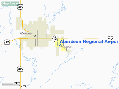
Aberdeen Regional Airport (IATA: ABR, ICAO: KABR, FAA LID: ABR) is a city-owned, public-use airport located two nautical miles (3.7 km) east of the central business district of Aberdeen, a city in Brown County, South Dakota, United States. It is mostly used for general aviation, but is also served by one commercial airline. Airlines and destinations
| Airlines |
Destinations |
| Delta Connection operated by Mesaba Airlines |
Minneapolis/St. Paul |
Facilities and aircraft
Aberdeen Regional Airport covers an area of 1,284 acres (520 ha) at an elevation of 1,302 feet (397 m) above mean sea level. It has two runways: 13/31 is 6,901 by 100 feet (2,103 x 30 m) with a concrete surface; 17/35 is 5,500 by 100 feet (1,676 x 30 m) with an asphalt surface.
For the 12-month period ending December 31, 2007, the airport had 52,421 aircraft operations, an average of 143 per day: 81% general aviation, 13% scheduled commercial, 6% air taxi and <1% military. At that time there were 50 aircraft based at this airport: 62% single-engine, 30% multi-engine, 6% jet and 2% helicopter.
Remarks:
- 605-626-7031.
- For services after hours call (605) 225-1384/8008.
- Prior Permission Required for unscheduled air carrier operations with more than 30 passenger seats call airport manager 605-626-7020. After hours call 605-626-7068.
- MIRL runway 17/35 & HIRL runway 13/31 preset on low intensity sunset - 00:00; to increase intensity & activate REIL runways 13; 17; 35 & MALSR runway 31 - CTAF.
- Gulls & geese on and in the vicinity of airport March thru December.
- Runway 13 & runway 17 approach ends are closely aligned. Verify correct runway and compass heading prior to departure.
- This airport has been surveyed by the National Geodetic Survey.
History
In 1923, Aberdeen hosted the first fly-in event in South Dakota. During World War II the airfield was used by the United States Army Air Force as a contract glider training airfield owned by Anderson & Brennan Flying Service, beginning on 25 May 1942. The mission of the school was to train glider pilot students in proficiency in operation of gliders in various types of towed and soaring flight, both day and night, and in servicing of gliders in the field. Used primarily C-47 Skytrains and Waco CG-4 unpowered Gliders.
Originally named Aberdeen Municipal Airport, the name was changed to Saunders Field in 1946. President George W. Bush landed here in the early 2000s to speak at a rally at NSU.
The above content comes from Wikipedia and is published under free licenses – click here to read more.
Location & QuickFacts
| FAA Information Effective: | 2008-09-25 |
| Airport Identifier: | ABR |
| Airport Status: | Operational |
| Longitude/Latitude: | 098-25-18.6000W/45-26-56.6000N
-98.421833/45.449056 (Estimated) |
| Elevation: | 1302 ft / 396.85 m (Surveyed) |
| Land: | 1284 acres |
| From nearest city: | 2 nautical miles E of Aberdeen, SD |
| Location: | Brown County, SD |
| Magnetic Variation: | 07E (2000) |
Owner & Manager
| Ownership: | Publicly owned |
| Owner: | City Of Aberdeen |
| Address: | 123 S Lincoln St
Aberdeen, SD 57402-1420 |
| Phone number: | 605-626-7020 |
| Manager: | David Osborn |
| Address: | 123 South Lincoln St
Aberdeen, SD 57401-4215 |
| Phone number: | 605-626-7020
605-626-7031. |
Airport Operations and Facilities
| Airport Use: | Open to public |
| Wind indicator: | Yes |
| Segmented Circle: | Yes |
| Control Tower: | No |
| Lighting Schedule: | DUSK-DAWN
MIRL RY 17/35 & HIRL RY 13/31 PRESET ON LOW INTST SS-0000; TO INCR INTST & ACTVT REIL RYS 13; 17; 35 & MALSR RY 31 - CTAF. |
| Beacon Color: | Clear-Green (lighted land airport) |
| Landing fee charge: | No |
| Sectional chart: | Twin Cities |
| Region: | AGL - Great Lakes |
| Boundary ARTCC: | ZMP - Minneapolis |
| Tie-in FSS: | HON - Huron |
| FSS on Airport: | No |
| FSS Toll Free: | 1-800-WX-BRIEF |
| NOTAMs Facility: | ABR (NOTAM-d service avaliable) |
| Certification type/date: | I A S 05/1973
PPR FOR UNSKED ACR OPNS WITH MORE THAN 30 PSGR SEATS CALL AMGR 605-626-7020. AFT HRS CALL 605-626-7068. |
| Federal Agreements: | NGY |
Airport Communications
| CTAF: | 122.700 |
| Unicom: | 122.950 |
Airport Services
| Fuel available: | 100LLA MOGAS |
| Airframe Repair: | MAJOR |
| Power Plant Repair: | MAJOR |
| Bottled Oxygen: | NONE |
| Bulk Oxygen: | HIGH |
Runway Information
Runway 13/31
| Dimension: | 6901 x 100 ft / 2103.4 x 30.5 m |
| Surface: | CONC, Good Condition |
| Surface Treatment: | Saw-cut or plastic Grooved |
| Weight Limit: | Single wheel: 99000 lbs.
Dual wheel: 150000 lbs.
Dual tandem wheel: 250000 lbs. |
| Edge Lights: | High |
| |
Runway 13 |
Runway 31 |
| Longitude: | 098-25-40.9344W | 098-24-32.5663W |
| Latitude: | 45-27-18.8482N | 45-26-30.6269N |
| Elevation: | 1302.00 ft | 1301.00 ft |
| Alignment: | 127 | 127 |
| ILS Type: | | ILS/DME
|
| Traffic Pattern: | Left | Left |
| Markings: | Precision instrument, Good Condition | Precision instrument, Good Condition |
| Crossing Height: | 52.00 ft | 68.00 ft |
| VASI: | 4-box on left side | 4-light PAPI on left side |
| Visual Glide Angle: | 3.00° | 3.00° |
| Approach lights: | | MALSR |
| Runway End Identifier: | Yes | |
|
Runway 17/35
| Dimension: | 5500 x 100 ft / 1676.4 x 30.5 m |
| Surface: | ASPH, Fair Condition |
| Surface Treatment: | Porous Friction Course |
| Weight Limit: | Single wheel: 60000 lbs.
Dual wheel: 75000 lbs.
Dual tandem wheel: 140000 lbs. |
| Edge Lights: | Medium |
| |
Runway 17 |
Runway 35 |
| Longitude: | 098-25-38.4700W | 098-25-38.3700W |
| Latitude: | 45-27-19.9900N | 45-26-25.6900N |
| Elevation: | 1302.00 ft | 1298.00 ft |
| Alignment: | 127 | 127 |
| Traffic Pattern: | Left | Left |
| Markings: | Precision instrument, Fair Condition | Precision instrument, Fair Condition |
| Crossing Height: | 37.00 ft | 38.00 ft |
| VASI: | 4-light PAPI on right side | 4-light PAPI on left side |
| Visual Glide Angle: | 3.00° | 3.00° |
| Runway End Identifier: | Yes | Yes |
|
Radio Navigation Aids
| ID |
Type |
Name |
Ch |
Freq |
Var |
Dist |
| BTN | NDB | Britton | | 386.00 | 06E | 36.1 nm |
| ABR | VOR/DME | Aberdeen | 077X | 113.00 | 07E | 2.9 nm |
Remarks
- GULLS & GEESE ON & INVOF ARPT MAR THRU DEC.
- RY 13 & RY 17 APCH ENDS ARE CLOSELY ALIGNED. VERIFY CORRECT RY AND COMPASS HEADING PRIOR TO DEP.
Images and information placed above are from
http://www.airport-data.com/airport/ABR/
We thank them for the data!
| General Info
|
| Country |
United States
|
| State |
SOUTH DAKOTA
|
| FAA ID |
ABR
|
| Latitude |
45-26-56.600N
|
| Longitude |
098-25-18.600W
|
| Elevation |
1302 feet
|
| Near City |
ABERDEEN
|
We don't guarantee the information is fresh and accurate. The data may
be wrong or outdated.
For more up-to-date information please refer to other sources.
|
|


