 |
|
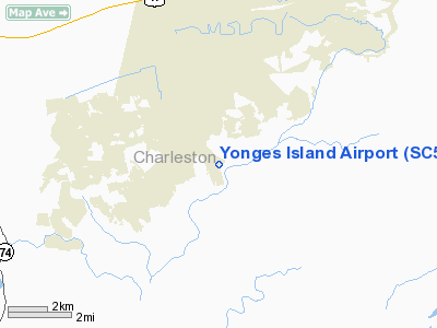
Location & QuickFacts
| FAA Information Effective: | 2008-09-25 |
| Airport Identifier: | SC50 |
| Airport Status: | Operational |
| Longitude/Latitude: | 080-13-33.3520W/32-41-50.6440N
-80.225931/32.697401 (Estimated) |
| Elevation: | 10 ft / 3.05 m (Estimated) |
| Land: | 0 acres |
| From nearest city: | 26 nautical miles S of Charleston, SC |
| Location: | Charleston County, SC |
| Magnetic Variation: | 05W (1985) |
Owner & Manager
| Ownership: | Privately owned |
| Owner: | Russell B. Corbin |
| Address: | 6364 Simmons Bluff Road
Yonges Island, SC 29449 |
| Phone number: | 843-889-3919 |
| Address: |
|
Airport Operations and Facilities
| Airport Use: | Private |
| Wind indicator: | Yes |
| Segmented Circle: | No |
| Control Tower: | No |
| Landing fee charge: | No |
| Sectional chart: | Charlotte |
| Region: | ASO - Southern |
| Boundary ARTCC: | ZJX - Jacksonville |
| Tie-in FSS: | AND - Anderson |
| FSS on Airport: | No |
| FSS Toll Free: | 1-800-WX-BRIEF |
Runway Information
Runway 18/36
| Dimension: | 2300 x 75 ft / 701.0 x 22.9 m |
| Surface: | TURF, |
| |
Runway 18 |
Runway 36 |
| Traffic Pattern: | Left | Right |
| Obstruction: | | 50 ft pline, 500.0 ft from runway |
|
Radio Navigation Aids
| ID |
Type |
Name |
Ch |
Freq |
Var |
Dist |
| JZI | NDB | Johns Island | | 283.00 | 05W | 11.1 nm |
| CH | NDB | Ashly | | 329.00 | 05W | 18.0 nm |
| DYB | NDB | Dorchester County | | 365.00 | 05W | 22.0 nm |
| RBW | NDB | Walterboro | | 221.00 | 05W | 25.0 nm |
| MKS | NDB | Moncks Corner | | 354.00 | 05W | 31.2 nm |
| NBC | TACAN | Beaufort | 042X | | 05W | 28.1 nm |
| CHS | VORTAC | Charleston | 082X | 113.50 | 05W | 15.2 nm |
| VAN | VORTAC | Vance | 041X | 110.40 | 06W | 48.1 nm |
| CHS | VOT | Charleston | | 111.00 | | 15.6 nm |
Remarks
- VFR; PVT USE ONLY. ESTAB & MAINTAIN COMPATIBLE TFC PATS WITH OPERATOR OF TOO GOO DOO AIRPORT.
Images and information placed above are from
http://www.airport-data.com/airport/SC50/
We thank them for the data!
| General Info
|
| Country |
United States
|
| State |
SOUTH CAROLINA
|
| FAA ID |
SC50
|
| Latitude |
32-41-50.644N
|
| Longitude |
080-13-33.352W
|
| Elevation |
10 feet
|
| Near City |
CHARLESTON
|
We don't guarantee the information is fresh and accurate. The data may
be wrong or outdated.
For more up-to-date information please refer to other sources.
|
|


