 |
|
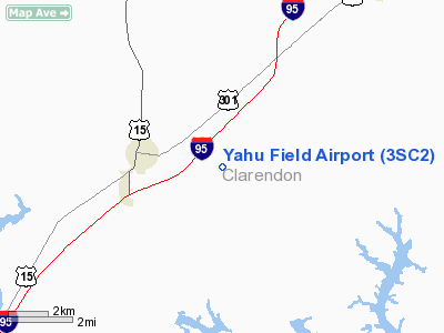
Location & QuickFacts
| FAA Information Effective: | 2008-09-25 |
| Airport Identifier: | 3SC2 |
| Airport Status: | Operational |
| Longitude/Latitude: | 080-18-22.0000W/33-36-07.0000N
-80.306111/33.601944 (Estimated) |
| Elevation: | 140 ft / 42.67 m (Estimated) |
| Land: | 0 acres |
| From nearest city: | 3 nautical miles E of Summerton, SC |
| Location: | Clarendon County, SC |
| Magnetic Variation: | () |
Owner & Manager
| Ownership: | Privately owned |
| Owner: | Yahu Inc. |
| Address: | 8608 Hwy 260
Manning, SC 29012 |
| Phone number: | 803-460-6767 |
| Manager: | Mike Huizenga |
| Address: | 2811 Furman Rd
Summerton, SC 29148 |
| Phone number: | 803-460-6767 |
Airport Operations and Facilities
| Airport Use: | Private |
| Wind indicator: | Yes |
| Control Tower: | No |
| Sectional chart: | Charlotte |
| Region: | ASO - Southern |
| Boundary ARTCC: | ZJX - Jacksonville |
| Tie-in FSS: | ANB - Anniston |
| FSS Toll Free: | 1-800-WX-BRIEF |
Airport Communications
Runway Information
Runway 01/19
| Dimension: | 4400 x 80 ft / 1341.1 x 24.4 m |
| Surface: | TURF, |
| |
Runway 01 |
Runway 19 |
| Traffic Pattern: | Left | Left |
| Obstruction: | 50 ft trees, 300.0 ft from runway | 30 ft pline, 75.0 ft from runway |
|
Radio Navigation Aids
| ID |
Type |
Name |
Ch |
Freq |
Var |
Dist |
| MNI | NDB | Manning | | 381.00 | 06W | 5.1 nm |
| SMS | NDB | Sumter | | 252.00 | 04W | 23.5 nm |
| CKI | NDB | Kingstree | | 404.00 | 06W | 23.6 nm |
| MKS | NDB | Moncks Corner | | 354.00 | 05W | 28.2 nm |
| CFY | NDB | Evans | | 420.00 | 06W | 31.0 nm |
| MMT | NDB | Mc Entire | | 427.00 | 05W | 31.8 nm |
| OYI | NDB | Orangeburg | | 226.00 | 05W | 32.0 nm |
| DYB | NDB | Dorchester County | | 365.00 | 05W | 32.5 nm |
| CH | NDB | Ashly | | 329.00 | 05W | 39.0 nm |
| HEK | NDB | Stuckey | | 236.00 | 06W | 39.8 nm |
| PHH | NDB | Andrews | | 255.00 | 06W | 40.1 nm |
| CDN | NDB | Camden | | 263.00 | 05W | 42.9 nm |
| RBW | NDB | Walterboro | | 221.00 | 05W | 44.0 nm |
| HVS | NDB | Hartsville | | 341.00 | 07W | 49.2 nm |
| SSC | TACAN | Shaw | 038X | | 05W | 24.0 nm |
| EDS | VOR/DME | Edisto | 051X | 111.40 | 05W | 29.0 nm |
| VAN | VORTAC | Vance | 041X | 110.40 | 06W | 10.5 nm |
| MMT | VORTAC | Mc Entire | 079X | 113.20 | 05W | 31.5 nm |
| CAE | VORTAC | Columbia | 094X | 114.70 | 02W | 40.4 nm |
| CHS | VORTAC | Charleston | 082X | 113.50 | 05W | 44.6 nm |
| FLO | VORTAC | Florence | 099X | 115.20 | 03W | 49.9 nm |
| CHS | VOT | Charleston | | 111.00 | | 43.9 nm |
Remarks
- 324 FT ANTENNA 1.2 NM NORTH & 322 FT ANTENNA 1.4 NM NORTHWEST OF ARPT.
- PRVDD VFR OPNS & PVT USE.
Images and information placed above are from
http://www.airport-data.com/airport/3SC2/
We thank them for the data!
|
|


