 |
|
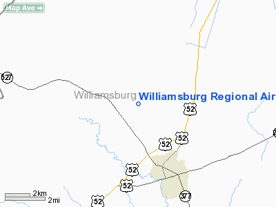
Williamsburg Rgnl Airport |
Location & QuickFacts
| FAA Information Effective: | 2008-09-25 |
| Airport Identifier: | CKI |
| Airport Status: | Operational |
| Longitude/Latitude: | 079-51-25.1000W/33-43-02.0000N
-79.856972/33.717222 (Estimated) |
| Elevation: | 67 ft / 20.42 m (Surveyed) |
| Land: | 396 acres |
| From nearest city: | 3 nautical miles W of Kingstree, SC |
| Location: | Williamsburg County, SC |
| Magnetic Variation: | 06W (1985) |
Owner & Manager
| Ownership: | Publicly owned |
| Owner: | Williamsburg County |
| Address: | Po Box 330
Kingstree, SC 29556 |
| Phone number: | 843-355-9321 |
| Manager: | Jack Whiteside |
| Address: | Po Box 1124
Kingstree, SC 29556 |
| Phone number: | 843-355-9321 |
Airport Operations and Facilities
| Airport Use: | Open to public |
| Wind indicator: | Yes |
| Segmented Circle: | Yes |
| Control Tower: | No |
| Lighting Schedule: | DUSK-DAWN
ARPT BCN OTS INDEFLY. |
| Beacon Color: | Clear-Green (lighted land airport) |
| Landing fee charge: | No |
| Sectional chart: | Charlotte |
| Region: | ASO - Southern |
| Boundary ARTCC: | ZJX - Jacksonville |
| Tie-in FSS: | AND - Anderson |
| FSS on Airport: | No |
| FSS Toll Free: | 1-800-WX-BRIEF |
| NOTAMs Facility: | AND (NOTAM-d service avaliable) |
| Federal Agreements: | NGY |
Airport Communications
| CTAF: | 122.700 |
| Unicom: | 122.700 |
Airport Services
| Fuel available: | 100LL
FUEL AVBL BY PRIOR REQUEST. CALL 843-382-9393 PRIOR TO 1700. |
| Airframe Repair: | NONE |
| Power Plant Repair: | NONE |
| Bottled Oxygen: | NONE |
| Bulk Oxygen: | NONE |
Runway Information
Runway 14/32
| Dimension: | 5000 x 75 ft / 1524.0 x 22.9 m |
| Surface: | ASPH, Good Condition |
| Weight Limit: | Single wheel: 30000 lbs.
Dual wheel: 45000 lbs. |
| Edge Lights: | Medium |
| |
Runway 14 |
Runway 32 |
| Longitude: | 079-51-47.0540W | 079-51-03.2080W |
| Latitude: | 33-43-18.6300N | 33-42-45.3980N |
| Elevation: | 66.00 ft | 65.00 ft |
| Alignment: | 127 | 127 |
| Traffic Pattern: | Left | Left |
| Markings: | Non-precision instrument, Good Condition | Non-precision instrument, Good Condition |
| Crossing Height: | 40.00 ft | 40.00 ft |
| VASI: | 2-light PAPI on left side | 2-light PAPI on left side |
| Visual Glide Angle: | 3.00° | 3.00° |
| Runway End Identifier: | No | No |
| Centerline Lights: | No | No |
| Touchdown Lights: | No | No |
| Obstruction: | 88 ft tree, 1950.0 ft from runway, 73 ft left of centerline, 19:1 slope to clear | 77 ft tree, 1737.0 ft from runway, 305 ft right of centerline, 20:1 slope to clear |
|
Radio Navigation Aids
| ID |
Type |
Name |
Ch |
Freq |
Var |
Dist |
| CKI | NDB | Kingstree | | 404.00 | 06W | 0.1 nm |
| CFY | NDB | Evans | | 420.00 | 06W | 9.5 nm |
| HEK | NDB | Stuckey | | 236.00 | 06W | 16.6 nm |
| MNI | NDB | Manning | | 381.00 | 06W | 19.1 nm |
| PHH | NDB | Andrews | | 255.00 | 06W | 23.0 nm |
| SMS | NDB | Sumter | | 252.00 | 04W | 30.0 nm |
| MKS | NDB | Moncks Corner | | 354.00 | 05W | 32.8 nm |
| GGE | NDB | Georgetown | | 242.00 | 06W | 36.0 nm |
| HYW | NDB | Horry | | 370.00 | 08W | 37.0 nm |
| MAO | NDB | Marion | | 388.00 | 06W | 38.4 nm |
| HVS | NDB | Hartsville | | 341.00 | 07W | 43.5 nm |
| UDG | NDB | Darlington | | 245.00 | 06W | 43.7 nm |
| DYB | NDB | Dorchester County | | 365.00 | 05W | 44.7 nm |
| CH | NDB | Ashly | | 329.00 | 05W | 46.1 nm |
| MMT | NDB | Mc Entire | | 427.00 | 05W | 48.8 nm |
| CDN | NDB | Camden | | 263.00 | 05W | 48.9 nm |
| SSC | TACAN | Shaw | 038X | | 05W | 34.2 nm |
| FLO | VORTAC | Florence | 099X | 115.20 | 03W | 32.6 nm |
| VAN | VORTAC | Vance | 041X | 110.40 | 06W | 33.0 nm |
| MMT | VORTAC | Mc Entire | 079X | 113.20 | 05W | 48.8 nm |
| CHS | VOT | Charleston | | 111.00 | | 49.7 nm |
Images and information placed above are from
http://www.airport-data.com/airport/CKI/
We thank them for the data!
| General Info
|
| Country |
United States
|
| State |
SOUTH CAROLINA
|
| FAA ID |
CKI
|
| Latitude |
33-43-02.000N
|
| Longitude |
079-51-25.100W
|
| Elevation |
67 feet
|
| Near City |
KINGSTREE
|
We don't guarantee the information is fresh and accurate. The data may
be wrong or outdated.
For more up-to-date information please refer to other sources.
|
|


