 |
|
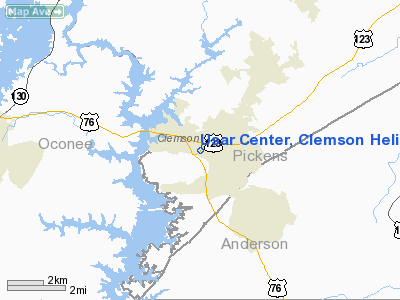
Usar Center, Clemson Heliport |
Location & QuickFacts
| FAA Information Effective: | 2008-09-25 |
| Airport Identifier: | SC53 |
| Airport Status: | Operational |
| Longitude/Latitude: | 082-49-04.5120W/34-41-00.3800N
-82.817920/34.683439 (Estimated) |
| Elevation: | 750 ft / 228.60 m (Estimated) |
| Land: | 0 acres |
| From nearest city: | 1 nautical miles SE of Clemson, SC |
| Location: | Oconee County, SC |
| Magnetic Variation: | 03W (1985) |
Owner & Manager
| Ownership: | Publicly owned |
| Owner: | Us Army Reserves |
| Address: | P O Box 232
Clemson, SC 29631 |
| Manager: | John Archer |
| Address: | 120th Arcom
West Columbia, SC 29169
AVIATION SUPPORT FACILITY |
| Phone number: | 803-796-7140 |
Airport Operations and Facilities
| Airport Use: | Private |
| Wind indicator: | No |
| Segmented Circle: | No |
| Control Tower: | No |
| Landing fee charge: | No |
| Sectional chart: | Atlanta |
| Region: | ASO - Southern |
| Boundary ARTCC: | ZTL - Atlanta |
| Tie-in FSS: | AND - Anderson |
| FSS on Airport: | No |
| FSS Toll Free: | 1-800-WX-BRIEF |
Runway Information
Helipad H1
| Dimension: | 500 x 250 ft / 152.4 x 76.2 m |
| Surface: | TURF, |
| |
Runway H1 |
Runway |
| Traffic Pattern: | Left | Left |
|
Radio Navigation Aids
| ID |
Type |
Name |
Ch |
Freq |
Var |
Dist |
| CEU | NDB | Clemson | | 257.00 | 05W | 3.5 nm |
| LQK | NDB | Lake Keowee | | 408.00 | 04W | 9.5 nm |
| AND | NDB | Anderson County | | 230.00 | 04W | 12.4 nm |
| GY | NDB | Dyana | | 338.00 | 03W | 18.5 nm |
| AJR | NDB | Habersham | | 347.00 | 03W | 37.8 nm |
| BRA | NDB | Broad River | | 379.00 | 04W | 39.3 nm |
| FRT | NDB | Fairmont | | 248.00 | 05W | 43.2 nm |
| LUX | NDB | Laurens | | 307.00 | 04W | 44.2 nm |
| GIW | NDB | Coronaca | | 239.00 | 04W | 44.5 nm |
| BJT | NDB | Bulldog | | 221.00 | 03W | 48.3 nm |
| ELW | VORTAC | Electric City | 023X | 108.60 | 00E | 16.0 nm |
| ODF | VORTAC | Foothills | 081X | 113.40 | 00E | 23.7 nm |
| GRD | VORTAC | Greenwood | 102X | 115.50 | 01W | 41.9 nm |
| SPA | VORTAC | Spartanburg | 104X | 115.70 | 02W | 48.7 nm |
Remarks
Images and information placed above are from
http://www.airport-data.com/airport/SC53/
We thank them for the data!
| General Info
|
| Country |
United States
|
| State |
SOUTH CAROLINA
|
| FAA ID |
SC53
|
| Latitude |
34-41-00.380N
|
| Longitude |
082-49-04.512W
|
| Elevation |
750 feet
|
| Near City |
CLEMSON
|
We don't guarantee the information is fresh and accurate. The data may
be wrong or outdated.
For more up-to-date information please refer to other sources.
|
|


